- Route
- Kongsberg – the silver mines at Saggrenda – Flesberg – Rollag and Veggli – Nore – Rødberg and Uvdal – Dagalifjellet – Dagali – Geilo (Fv 40, with a trip on the E134 to Saggrenda and short detours to the churches)
- Length
- about 190 km. The Fv 40 itself, from Kongsberg to Geilo, is around 160 km. The trip to Saggrenda and back is around 19 km, and the rest is short detours to the churches.
- Driving time
- Around 3.5 hours without stops
- Recommended number of days
- 2–3
- Best season
- June–August. From late June to early August the stave churches in Rollag, Nore and Uvdal are all open, and the mine train at the silver mines runs every day all summer. We have found nothing to say the Fv 40 is closed in winter, but over Dagalifjellet there can be convoy driving, so check the road reports in winter.
- Difficulty
- Easy. The Fv 40 is wide enough for large motorhomes all the way, with no ferries and no toll stations, but on two narrow bridges you have to wait for oncoming traffic. The mountain stretch comes between Uvdal and Geilo: over Dagalifjellet, up to almost 1,100 metres above sea level, and over two lower ridges after Dagali.
- Last checked
- October 2026
Why this route?
Many people drive the Fv 40 simply to get from Kongsberg to Geilo. It is a good road, and the valley looks lovely from the car window. But it is the stops that make the trip. In the silver town you first step into the great church and then go into the mountain, into the mines that yielded silver for more than 300 years. Then you follow the Numedalslågen river north, past four stave churches. Two of them have timber from the 1160s: in Nore and Uvdal it was felled in the winters of 1166–1168. Fortidsminneforeningen, the heritage society that owns both, calls Numedal «Middelalderdalen», the Medieval Valley.
After Uvdal the road climbs onto the bare mountain before letting you down into Geilo. That is where Across Hardangervidda begins. Take two days if you want to see everything, three if you want to hike in the mountains or spend an evening by Norefjorden.
Stops along the route
1. Kongsberg — the silver town's church
Silver was found here in 1623, and the following year Christian IV founded the town. The silver works kept going right up to 1958. In the middle of town stands Kongsberg kirke, built of red brick from 1740 and consecrated in 1761. From outside it is restrained. Inside wait 2,400 seats and rococo on a scale no other Norwegian church can match. The seating shows who was who in the silver town: the miners got the top gallery and the burghers the lower one, while the management of the silver works sat below the royal box, which faces the pulpit.
Don't miss: The altar wall. Altar, pulpit and a large baroque organ from the 1760s stand in a single wall, and this was the first time in Norway that the pulpit took the place where the altarpiece usually stands.
Motorhome tip: During the summer holidays the church is usually open Tuesday–Thursday from 11 am to 3 pm, and it is free to go in without a guided tour. Tours are booked separately, see kirken.no/kongsbergkirke. Norsk Bergverksmuseum in Smeltehytta is closed until June 2027 while the museum builds a new main exhibition, but the mines at Saggrenda are open as usual. We have found no dedicated motorhome spaces or special motorhome rules in the centre, so follow the signs.
2. The silver mines — by mine train into the mountain
Eight kilometres outside the centre, at Saggrenda, Norsk Bergverksmuseum has its visitor mine. The mine train takes you 2.3 kilometres into the mountain, to Kongens gruve, the King's Mine, 342 metres below ground. The whole tour takes around an hour and a half, and down there it is around 6 degrees. Bring warm clothes, in July too. The museum advises against the tour for anyone with claustrophobia or poor health, and it is not suitable for wheelchair users or visually impaired visitors. In the mine you climb stairs equal to five storeys, and if the mine has to be evacuated, everyone must be able to walk out through the adit, the 2.3-kilometre tunnel the train runs in.
Don't miss: The train ride into the dark. If you want more, the museum also offers a gallery walk and a mine safari, booked separately.
Motorhome tip: The mine train usually runs several times a day from mid-May to late August, at weekends in September and every day during the autumn school holiday. Book tickets at norskbergverksmuseum.no, where the departures are listed. From Kongsberg you take the E134 west to Saggrenda. The toll stations on the E134 are east of town at Damåsen and at the border with Notodden, so the trip to the mines and back is toll-free.
3. Flesberg stave church — lions in the portal
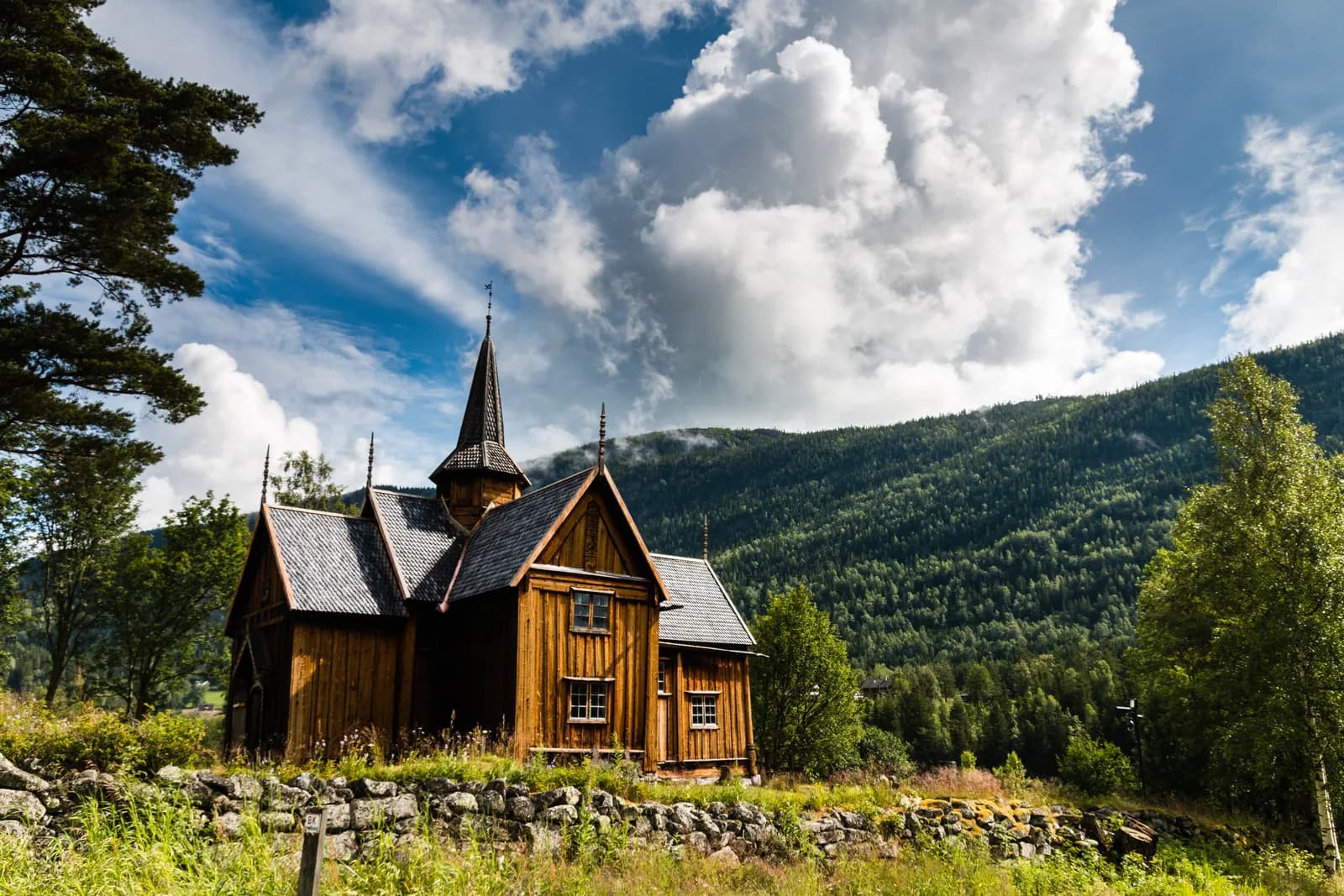
The Fv 40 follows the Lågen north through Lampeland, the centre of Flesberg. Some way further up lies Flesberg stave church, a short way off the main road. It was built some time between 1150 and 1250, and it is first mentioned in writing in 1359. In 1735 it was given log-built transepts and became a cruciform church. Look out for the ridge turret: it sits on the ridge above the nave, some way west of where the arms meet. The church is still in use as a parish church.
Don't miss: The west portal, with tendrils and dragons carved into the wood and lions on the capitals, each with a human head in its jaws.
Motorhome tip: We have found no fixed visiting hours from Flesberg kirkelige fellesråd, the parish council. If the door is locked, you can still see the portal and walk round the churchyard. A kilometre and a half past the turn to the church, the Fv 40 crosses Aslefet bridge, signed «road narrows» with a clear width of 4.2 metres. A motorhome gets across easily, but two large vehicles cannot pass each other on it, so wait for oncoming traffic.
4. Rollag and Veggli — a guided tour of the stave church
Rollag stave church stands on the other side of the Lågen from the Fv 40, by the Fv 2792. After many rebuilds you have to look hard to find the stave church: the sills and corner posts are still there, but the medieval roof is gone. Tree-ring samples suggest that the timber in the eastern corner posts was felled in the 1460s. The transepts were added in the 1690s, the sacristy in 1739. The arches, flowers and fruit in the choir look old, but they are mostly recreated: the original decoration from 1683 was painted over, and most of what you see is reconstruction. Set into the altarpiece from the 1670s is a relief of the Virgin and Child. It is older than the rest, from the late Middle Ages, and probably made in northern Germany.
Ten minutes further up lies Veggli, where the Fv 40 crosses Mykstu bridge, signed with a clear width of 4.6 metres: here too, wait for oncoming traffic. The village has an inn and a petrol station. From here a summer road heads west over Vegglifjell towards Tinn. Over the mountain it is registered as a forest road, and we have not been able to check its surface, barriers or restrictions there, so we do not recommend it in a motorhome. If you are heading for Rjukan, take the E134 from Kongsberg to Notodden instead.
Don't miss: The guided tour. The church usually has guided tours every day from 11 am to 5 pm from mid-June to mid-August. The rest of the year you can arrange a tour with the church office.
Motorhome tip: Coming from Flesberg, do not turn off at Stærnes, where the Fv 2792 (Rollagsvegen) leaves the Fv 40 south of Rollag. Around 800 metres before the church that road passes under the old railway bridge at Tråen, signed with a height limit of 3.8 metres and a width limit of 3.1 metres, and a satnav may well choose exactly that way. Instead, carry on along the Fv 40 to Bruhaug, cross the Lågen there and drive around three kilometres south to the church, with no height restriction. Just after the turn you will see signs with the same limits and «3.7 km»: they refer to the bridge at Tråen, beyond the church, not to the road there. At the church the road is signed «road narrows». Go back the same way. The Fv 2792 is open to vehicles up to 19.5 metres long, but narrow: around 5–6 metres from Bruhaug to the church, so passing oncoming traffic is tight. Holman Camping lies by the Fv 40 on the west side of the Lågen, just under two kilometres south of Bruhaug, with pitches for caravans, and is usually open from mid-May to late September.
5. Nore stave church — the central mast from 1167
From the bridge over Norefjorden at Nore it is just under a kilometre south to Nore stave church, down at the end of the lake. The central mast and one of the corner posts were felled in the winter of 1166–1167. It is a central-mast church: a single tall post stands in the middle of the room and rises all the way to the ridge. Only two medieval stave churches have such a mast preserved, and the other one is in Uvdal. Nore was probably cruciform from the very start, with arms of almost equal length. Most of the decoration dates from the 1650s and 1730s: painted arches, Bible verses and rebuses on the walls.
Don't miss: The altarpiece with the Last Supper, probably painted in 1704, modelled on the altarpiece in Lyngdal kirke in Numedal.
Motorhome tip: The church is usually open every day from 10 am to 6 pm from late June to early August. Turn off the Fv 40 onto the Fv 2798 at Nore (the northern turn-off). The other end of the Fv 2798 meets the Fv 40 further south over Kravikfjord bridge, a suspension bridge from 1963 that is 5.4 metres wide and approved for 25 tonnes and vehicles up to 15 metres long. It is no obstacle for a motorhome, but that way round is much longer. Between Nore and Rødberg you drive through the Rustand tunnel, 53 metres long and signed at 4.3 metres. That is the lowest signed height on the route as we describe it (see stop 4 on the bridge at Tråen). At Nore, Norefjord Camping lies between the Fv 40 and the lake. Its website says it is open all year, but the site is being reworked, so phone before a winter visit. Fjordgløtt Camping lies by Norefjorden six kilometres south of Rødberg. It is self-service and takes no reservations, and you pay by card or Vipps on arrival. Its website gives no season.
6. Rødberg and Uvdal — the stave church above the valley floor
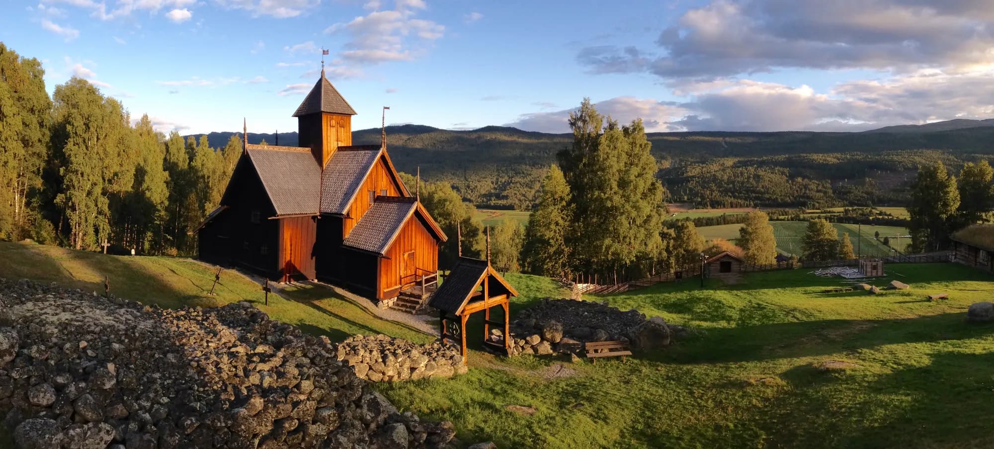
Rødberg is the centre of Nore og Uvdal municipality and was the terminus of the Numedal railway. From here the Fv 40 swings west up Uvdal. After seven kilometres you see Uvdal stave church on the hillside to your right, along the old village road above the valley floor. Timber in the church was felled in the winter of 1167–1168, a year after Nore, and here too the central mast is preserved. The church was enlarged several times, and in 1723 it gained transepts, a porch and a ridge turret. After the parish got a new church in 1893, the old one was taken over by Fortidsminneforeningen, which has owned it since around 1900. The walls and ceiling are covered in paintwork from the mid-17th century onwards.
Don't miss: Nore og Uvdal bygdetun, the open-air museum right next to the church. The ticket covers both, and the church is usually open every day from 10 am to 6 pm from early June to late August.
Motorhome tip: Turn off the Fv 40 onto the Fv 2810 towards Kirkebygda. The road is open to vehicles up to 19.5 metres long, but only around 5.5–6 metres wide. Camp Uvdal lies by the Fv 40 further up the valley, with room for motorhomes and 36 electric hook-ups, and for an extra charge you can get a pitch with a view of the Uvdalselva river. Its website gives no season, so check before you come outside the summer.
7. Dagalifjellet — above the tree line
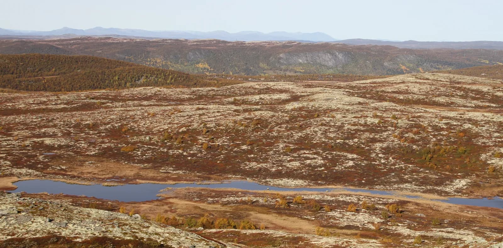
From Uvdal the Fv 40 runs almost flat for the first 15 kilometres up the valley. Then it climbs steeply: over seven to eight kilometres it rises from around 620 to 1,100 metres above sea level, and the forest thins out into heather, bog and glinting tarns. This is the highest point of the drive. After the mountain the road drops to Dagali, at around 830 metres. Then it climbs again, to around 1,050 metres a few kilometres north-west of Dagali, before dropping into Skurdalen and crossing a last ridge at Kikut, around 1,000 metres, and descending towards Geilo.
Don't miss: A break on the mountain on a clear day, with views north towards Dagali and the mountains behind.
Motorhome tip: At the foot of the climb the signs warn of steep hills all the way from Uvdal to Geilo, with 7–10 % on the climb up to Dagalifjellet, and there is a place to fit snow chains. Use a low gear and engine braking on the way down. Up here the wind picks up quickly, and the weather changes faster than down in the valley. yr.no has its own weather station for «Fv40 Dagalifjell». In the road database of Statens vegvesen, the Norwegian Public Roads Administration, around 8 kilometres over Dagalifjellet are registered as a convoy stretch. At both ends, signs say the road is closed in bad weather and tell you to wait for the snowplough when traffic runs in convoy. The road from Dagali to Geilo also climbs above 1,000 metres. In winter: check vegvesen.no or call 175 before you set off.
8. Geilo — on across the plateau
The Fv 40 ends in Geilo, where it meets the Rv 7. This is where Across Hardangervidda begins, covering Geilo, its campsites and the road on towards Eidfjord.
Motorhome tip: Fill up in Geilo before the plateau. The route on across Hardangervidda has no filling station between Haugastøl and Eidfjord.
Practical info for motorhomes
Roads: The whole of the Fv 40 from Kongsberg to Geilo is open to vehicles up to 19.5 metres long and 50 tonnes (Statens vegvesen's road database). Where the database has measurements, the asphalt is mostly 6–7.5 metres wide, at its narrowest around 5.5 metres on short stretches between Uvdal and Dagali. Two older bridges are signed «road narrows» with a clear width: Aslefet bridge north of Flesberg church, 4.2 metres, and Mykstu bridge in Veggli, 4.6 metres. A motorhome gets across easily, but two large vehicles cannot pass each other there, so wait for oncoming traffic. At Lampeland the Fv 40 used to cross the old Grettefoss bridge, with a clear width of 3.7 metres. Since October 2026 traffic has used a new bridge, and the old one is to become a footbridge and cycle bridge. The whole stretch from Uvdal to Geilo is signed «steep hills», with 7–10 % on the climb up to Dagalifjellet. On the route as described, the Rustand tunnel between Nore and Rødberg is the only signed height restriction, at 4.3 metres. If you turn off at Stærnes towards Rollag church, you pass under the railway bridge at Tråen, signed with a height limit of 3.8 metres and a width limit of 3.1 metres: approach from Bruhaug instead (see stop 4). The detours to the churches in Rollag, Nore and Uvdal follow narrower county roads, around 5–6.5 metres. We have found nothing to say the Fv 40 is closed in winter, but around 8 km over Dagalifjellet is a convoy stretch, and both Dagalifjellet and the road from Dagali to Geilo go above 1,000 metres. Check vegvesen.no or call 175 before you drive in winter.
Tolls: No toll stations on the Fv 40 between Kongsberg and Geilo. If you come along the E134 from Drammen, you pass the AutoPASS toll station at Damåsen east of Kongsberg. It is run by Vegfinans, where the prices are listed.
Parking: We have found no dedicated motorhome spaces in central Kongsberg. There is room for cars at the churches, but we have not been able to confirm that they have dedicated spaces for large vehicles. Never park in passing places or bus bays.
Overnight stays: The outdoor recreation act's rule for camping in a tent — at least 150 metres from inhabited houses, no more than two nights in the same place — is a sensible guide for motorhomes too. The motorhome must stand in a legal parking place, not out in the terrain. We have found no municipal bans on sleeping in a motorhome along the Fv 40, but follow any signs where they stand.
Campsites:
- Holman Camping — by the Fv 40 just under 2 km south of Bruhaug in Rollag, pitches for caravans, usually mid-May–September
- Norefjord Camping — Nore, between the Fv 40 and Norefjorden, around 45 pitches with electricity, open all year according to its website (phone before a winter visit)
- Fjordgløtt Camping — by Norefjorden, 6 km south of Rødberg, 50 pitches for motorhomes, caravans and tents, electricity included in the price, no reservations, no season given
- Camp Uvdal — by the Fv 40 in Uvdal, room for motorhomes and 36 electric hook-ups, no season given
- Geilo Hytter & Camping and Øen Turistsenter — in Geilo, see Across Hardangervidda
Fuel: Kongsberg has plenty of stations. According to map data (OpenStreetMap) there are stations up the valley in Lampeland, Flesberg, Veggli, Nore, Rødberg and Uvdal. According to the same map data, only the stations in Lampeland and one of the two in Veggli are staffed; the others are unmanned. We have not checked the stations' own pages. Over the mountain between Uvdal and Dagali the map data shows none, so fill up in Uvdal at the latest. Geilo has several stations.
Waste disposal: We have not found a disposal point along the Fv 40 that its owner describes online. Map data (OpenStreetMap) shows a free disposal point at the car park by the silver mines at Saggrenda, without water, and one in Geilo, but we have not been able to confirm them. The campsites in the valley say nothing about waste disposal on their websites. Ask when you check in, and empty your tanks when you get the chance.
Ferries: None.
Combine with
- Across Hardangervidda — starts in Geilo, where this route ends, and crosses the plateau to Eidfjord.
- Hallingdal and Hemsedalsfjellet — from Geilo it is around 50 km east on the Rv 7 to Gol, where that route leaves the Rv 7 and crosses Hemsedalsfjellet to Borlaug.
- Rjukan and Gaustatoppen — starts in Notodden, just over 30 km west of Kongsberg on the E134, past the toll station at the border with Notodden.
- Telemarkskanalen and Vest-Telemark — that route ends in Seljord. It is around 80 km there from Kongsberg on the E134, past Notodden and with a toll station at the border with Notodden. Drive it in reverse.
- Valdres and Valdresflye — from Geilo it is around 100 km east via Gol to Fagernes, where that route begins.
Weather
Kongsberg lies around 150 metres above sea level, Uvdal around 500, Geilo around 800, and the mountain between Uvdal and Dagali reaches 1,100 metres. It can be summer-warm down in the valley and raw and windy on the mountain on the same day. Check yr.no for Kongsberg, Rødberg and «Fv40 Dagalifjell» before you drive.
This route is part of Bobilvei's hand-picked motorhome routes in Norway. Every route is quality-checked with a focus on motorhome suitability, parking and local experiences.