- Route
- Fagernes – Lomen – Høre – Beitostølen – Valdresflye – Gjendeosen – Sjodalen – Vågå (E16, fv. 2510, fv. 2508, fv. 51 including the Valdresflye National Tourist Route, and rv. 15)
- Length
- about 160 km from Fagernes to Vågå. Oslo to Fagernes is about 185 km, and Vågå back home about 320 km through Gudbrandsdalen — around 665 km in total. Turning back at Gjende leaves about 260 km home.
- Driving time
- Around 3–3.5 hours without stops from Fagernes to Vågå, and about the same from Oslo to Fagernes
- Recommended number of days
- 2–4. With Besseggen, allow at least three, from Oslo and back.
- Best season
- June–September. Valdresflye closes for winter, usually from mid-December or early January to late March or early April. Gjendebåten runs from early June to late September.
- Difficulty
- Moderate. A wide county road without tunnels, but high mountains with wind and winter closures, narrow village roads to the stave churches and a steep descent towards Vågå.
- Last checked
- October 2026
Why this route?
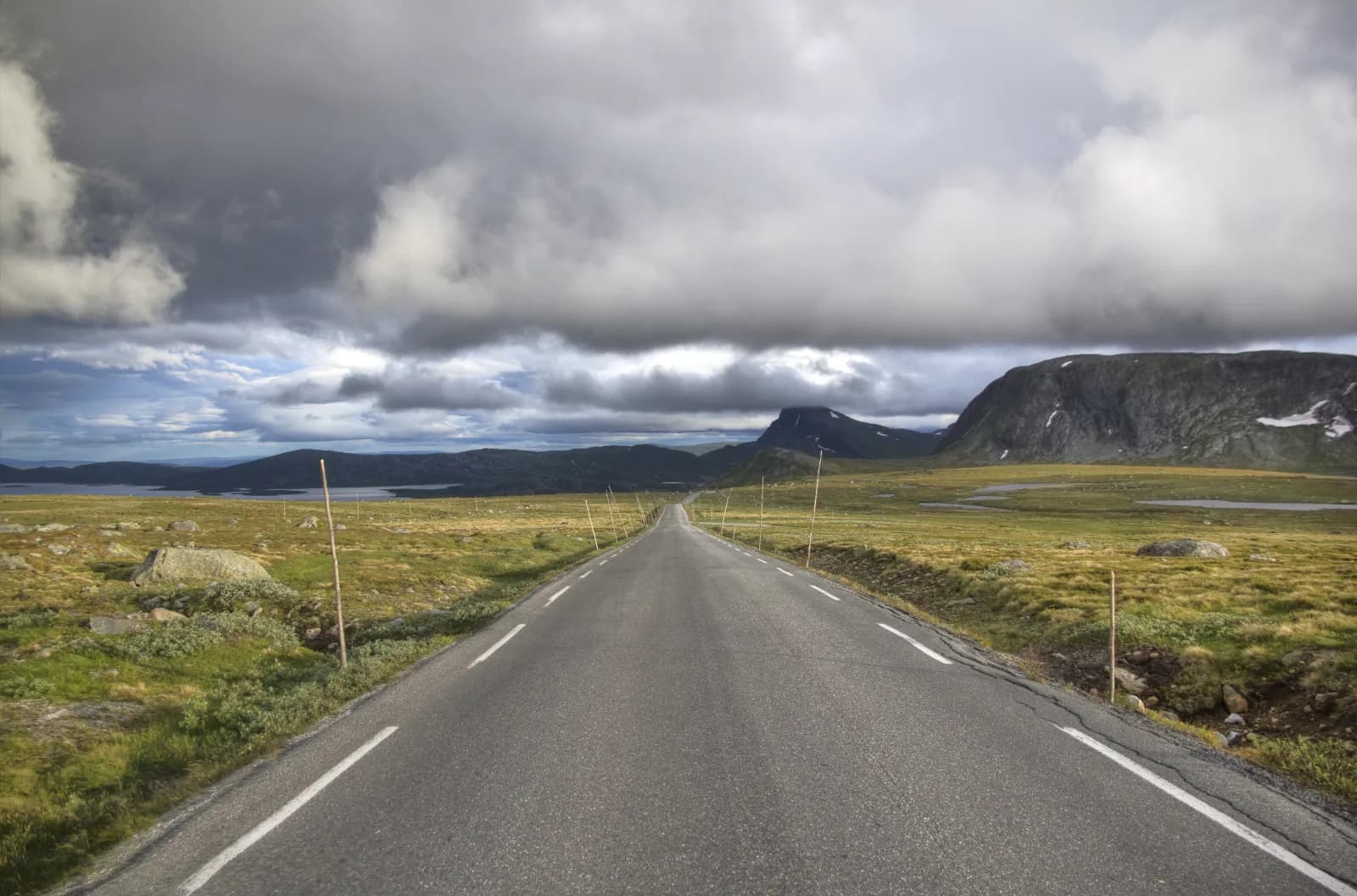
From Oslo you reach Valdres in three hours. There begins a journey from stave churches on steep hillsides, above the tree line and into Gjende, where Jotunheimen takes over. On Valdresflye the road reaches 1,389 metres above sea level — among the National Tourist Routes, only Sognefjellet goes higher.
The route follows fv. 51 all the way down Sjodalen, then rv. 15 for the final kilometres to Vågå. Deliberately so: you drive no section twice, and return on the E6 through Gudbrandsdalen. Motorhome length is not the problem here — plan for the plateau's weather and parking at Gjende.
Stops along the route
1. Fagernes — the folk museum beside the lake
Fagernes is the commercial centre for all Valdres. On Storøya in Strondafjorden, Valdres Folkemuseum has collected old buildings since 1901 — now around a hundred. In summer its farmyards come alive with craftspeople, folk music and animals.
Don't miss: The museum's mountain-farm buildings — a foretaste of the farms seen from the road over the plateau.
Motorhome tip: Fill up here. Fagernes Camping is a stone's throw from the museum, with drop-in motorhome pitches and a dedicated room where guests can empty toilets.
2. Lomen and Høre — the stave churches west of Fagernes
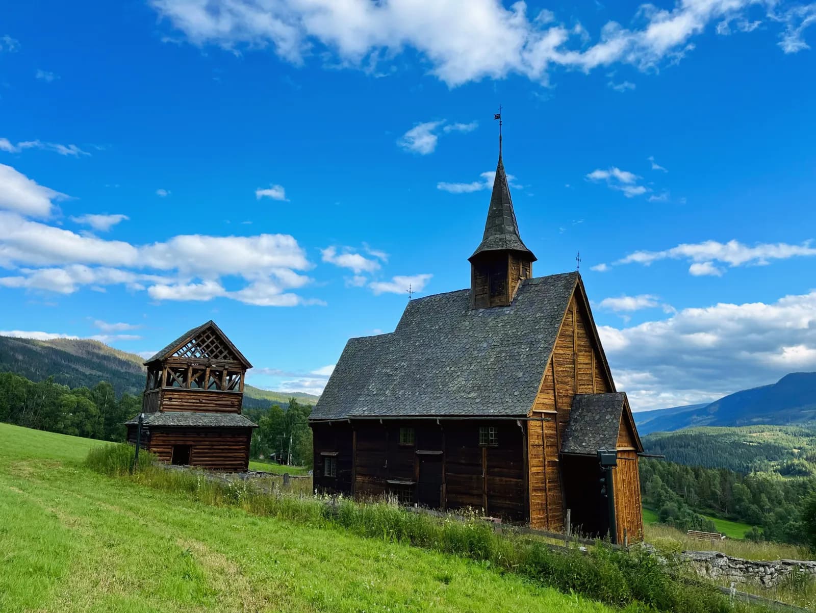
Follow the E16 west along Slidrefjorden. At the lake's end, Lomen stave church stands on the slope above the village; tree rings in its timbers date it to around 1192. Seven kilometres away in Vang stands Høre. According to a runic inscription, brothers Elling and Audun probably had the timber felled in the year Earl Erling fell in Nidaros, 1179 — supported by a log felled in winter 1179–80.
Don't miss: The gate into Høre churchyard — an old roof turret, carved in the same style as the one at Borgund stave church. Høre has guided tours Sunday–Wednesday from late June to mid-August. Øye stave church beside Vangsmjøse, 28 km further west, has tours Thursday–Sunday over roughly the same period.
Motorhome tip: At Lomen there is a small car park around 200 metres below the church, along a narrow village road. From Høre, take fv. 2510 back east and fv. 2508 north over Eggeåsen to fv. 51. Both are mostly 5–6 metres wide, but fv. 2508 narrows to around four metres in places, with cattle grids and a 9% slope. To stay on wide roads, follow fv. 51 directly from Fagernes; it passes Hegge stave church, still a parish church.
3. Beitostølen — last shopping before the plateau
Beitostølen lives on tourism in summer and winter. Shop and empty tanks here before the mountains, all around 900 metres above sea level. Three kilometres north of the centre, at Garli, stands the barrier that closes the road in winter.
Motorhome tip: First Camp Beitostølen – Valdres is open all year, and non-guests may use its dump station for a fee.
4. Rjupa — above the tree line
Beyond Garli the forest falls away. From Rjupa you look over Vinstre, with mountain-farm meadows along its shores. Some farms in the area still operate, selling butter, sour cream and cheese.
Don't miss: Bitihorn, 1,607 metres above sea level. The cairn-marked path is not difficult; allow two–three hours to the summit from fv. 51 just south of the hotel at Bygdin. On a clear day you can see as far as Gausta.
5. Flye 1389 — at the top
This is the highest point. Valdresflye Kafé serves local food in summer; toilets open from March through October. A kilometre and a half further north is Steinplassen, where Peter Fischli and David Weiss placed one large stone on another — a cairn as an artwork.
Don't miss: Views towards Besshøe and Tjønnholstinden.
Motorhome tip: Up here the road is exposed to wind, noticeable in a tall motorhome. Most lay-bys across the plateau and spaces at the café are designed for cars, but half a kilometre south of the café is roadside parking for large vehicles.
6. Vargebakkane and Gjendeosen — down to Gjende
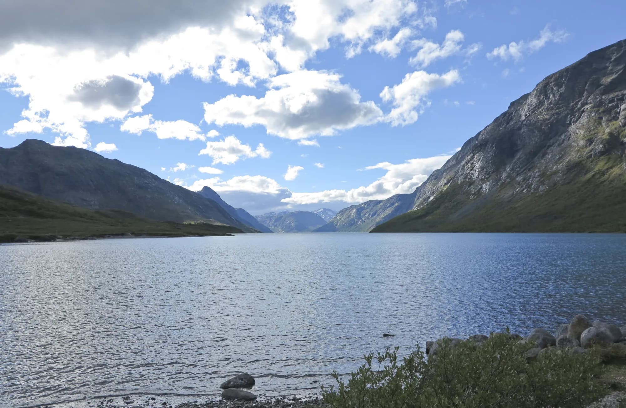
From the top the road descends towards Gjende, at around 7% at its steepest, past Vargebakkane viewpoint looking into Leirungsdalen. At Maurvangen a branch of fv. 51 leads a little over two kilometres to Gjendeosen. Gjende is 18 km long and green with glacial silt, with mountains rising above 2,000 metres on both sides. The quay has a café and toilet, and Gjendebåten leaves from here.
Don't miss: Reindeer hunter Jo Gjende's small cabin, from around 1840, across the river from the tourist lodge.
Motorhome tip: Gjendeosen allows a maximum two-hour stay, free with a machine-issued ticket. For a hike or boat trip, park at Reinsvangen, a large paid car park two kilometres before the quay, and take the shuttle. Parking only is allowed there, no overnight stays. With a large motorhome, staying at Maurvangen is easiest: walk to the boat or take the campsite bus in season.
7. Besseggen — a day on foot
Besseggen is not a drive, but the reason many come here. Most take Gjendebåten to Memurubu, around 20 minutes, and walk back over the ridge to Gjendesheim. The hike is 13 km with around 1,000 metres of ascent — allow a full day, 6–8 hours with breaks. The highest point is Veslfjellet at 1,743 metres. On Bandet you stand on a narrow ridge, with Bessvatnet on one side and an almost 400-metre drop towards Gjende on the other.
Motorhome tip: Buy your boat ticket before arriving — without a pre-purchased ticket, a place from Gjendesheim is not guaranteed. Booking for the following summer usually opens on 1 December. In high season, reach Reinsvangen an hour before departure. If the ridge is too exposed, you can turn back at Bandet.
8. Sjodalen — Bessheim and Ridderspranget
Fv. 51 continues down the Sjoa, past Øvre and Nedre Sjodalsvatnet. Bessheim stands beside the upper lake. The mountain farms here, then called Besseter, hosted mountain tourists even before the Norwegian Trekking Association built Gjendesheim in 1878, and its first cairn-marked route began here. The tourist route ends at Hindsæter.
Don't miss: Ridderspranget, six kilometres before Randsverk, where the Sjoa has carved a narrow rocky gorge. A short path leads from the car park.
Motorhome tip: Beyond Randsverk the road initially climbs, then drops steeply over the final five–six kilometres towards Randen, with signs warning of 8% then 10%. Use a low gear. Randsverk Camping guarantees motorhome pitches, with water and emptying facilities.
9. Vågå — the church and Jo Gjende's grave
Fv. 51 meets rv. 15 at Randen; Vågåmo is seven kilometres east. Vågå church was built in the 1620s on the site of a 12th-century stave church, and two carved portals from the old church survive. Reindeer hunter Jo Gjende lies in the churchyard.
Don't miss: Jo Gjende's grave. The Norwegian Trekking Association erected a soapstone memorial, with wild reindeer drawn by Gerhard Munthe.
Motorhome tip: Fill up here. Smedsmo Camping stands beside rv. 15 in the centre, with 96 electric pitches usually first come, first served. Lom is half an hour west.
Practical info for motorhomes
Roads: All roads on the route — E16, fv. 2510, fv. 2508 and fv. 51 right to Gjendeosen — permit vehicle combinations of 19.5 metres (the road administration's road database). Fv. 51 has no tunnels and is mostly 6–7 metres wide over the mountains; no tunnel or bridge on the E16 from Oslo to Fagernes and Øye is lower than 4.4 metres. Valdresflye closes for winter between Garli and Maurvangen; in past years closures began between 15 December and 9 January, with reopening between 22 March and 5 April. Soon after spring reopening it may close at night and in bad weather. Check vegvesen.no/trafikk or call 175.
Tolls: Toll points in Oslo, on the new E16 between Sandvika and Hønefoss and on the E16 north of Bagn, plus several on the E6 through Gudbrandsdalen and along Mjøsa. Fv. 51 is toll-free. An M1-registered motorhome over 3,500 kg receives the car rate only with an AutoPASS agreement and tag.
Parking: Gjendeosen: maximum two hours. Reinsvangen: paid long-stay parking with shuttle, bookable ahead at visitgjende.no. Spaces across the plateau are small.
Overnight stays: Use campsites — there are many along fv. 51. The right of public access (Outdoor Recreation Act, section 9) applies to tents and outdoor stays: at least 150 metres from an inhabited house or cabin, no more than two days in one place without landowner consent, except in the high mountains or far from buildings. Motorhomes must follow signs and landowner rules. Never drive into the terrain.
Campsites:
- Fagernes Camping — beside the folk museum, drop-in for motorhomes
- First Camp Beitostølen – Valdres — open all year
- Besseggen Fjellpark, Maurvangen — open all year, guaranteed pitches, closest to Gjende
- Bessheim Fjellstue og Hytter — small campsite, June–September
- Sjodalen Hyttetun og Camping — open all year
- Randsverk Camping — guaranteed pitches, emptying facilities
- Smedsmo Camping — central Vågå
Fuel: Fill up in Fagernes. Near the route is YX at Ryfoss, just below Høre — and at Heggenes if taking fv. 51 from Fagernes. The next reliable station after that is in Vågå, over 100 km away.
Waste disposal: Not in toilets along the tourist road. Statens vegvesen refers visitors to Fagernes and Vågåmo. En route: First Camp Beitostølen (also for non-guests, for a fee), and for guests at Maurvangen and Randsverk Camping.
Ferries: None. Gjendebåten takes passengers only.
Combine with
- Sognefjellet and Jotunheimen — begins in Lom, around 30 km west of Vågå along rv. 15.
- Rondane and Peer Gynt-vegen — rv. 15 to Otta and E6 to Ringebu, around 85 km. From there the route crosses Venabygdsfjellet to Folldal.
- Aurlandsfjellet and Nærøyfjorden — from Øye the E16 crosses Filefjell to Borgund stave church, around 50 km. Drive that route backwards, over the mountains from Lærdal and down to Aurland without turning at Stegastein.
- Around Mjøsa — from Fagernes, E16 and fv. 33 run east via Dokka to Gjøvik, around 100 km.
Weather
Winters are cold and summers mild; Øystre Slidre's July daily mean is around 14 degrees. Mountains to the west intercept much of the precipitation, so Vågåmo receives under 400 millimetres annually. On the plateau, between 1,200 and 1,400 metres above sea level, it is colder and windier — bring wool and windproof clothing even in July. Check yr.no for “Fv. 51 Valdresflye”.
This route is part of Bobilvei's hand-picked motorhome routes in Norway. Every route is quality-checked with a focus on motorhome suitability, parking and local experiences.