- Route
- Hønefoss – Sokna – Krøderen – Noresund – Ørgenvika – Flå – Nesbyen – Gol – Hemsedal – Rjukandefossen – Hemsedalsfjellet – Borlaug (Rv 7, Fv 288, Fv 280, Rv 52)
- Length
- about 230 km from Hønefoss to Borlaug. The old road via Krøderen and Noresund is around 30 km longer than taking the Rv 7 straight through to Ørgenvika. From Oslo to Hønefoss it is about 57 km, mostly on the E16.
- Driving time
- Around four hours without stops
- Recommended number of days
- 2–4
- Best season
- June–September. None of the roads closes for the winter, but the Rv 52 over Hemsedalsfjellet can have convoy driving or close in bad weather, and at Storeskar there are roadworks until the road is due to reopen in 2027, with long closures from 21 October to 17 December 2026. The heritage railway and the museums have a summer season.
- Difficulty
- Moderate. Good, wide roads all the way, no ferries and no toll stations on the route as described. The Rv 52 climbs above 1,100 metres, and the last descent to Borlaug is steep.
- Last checked
- October 2026
Why this route?
Most people drive the Rv 7 through Hallingdal without stopping, on their way to Geilo or Bergen. This route takes its time. It follows the old road along Lake Krøderen, where the heritage railway has its terminus, calls at the open-air museum in Nesbyen and leaves the Rv 7 at Gol. From there the Rv 52 takes you up Hemsedal, past the waterfalls, and over the mountain to Borlaug on the Lærdal side.
Hønefoss is around an hour from Oslo, so the route suits a long weekend. If you would rather cross Hardangervidda, stay on the Rv 7 from Gol to Geilo, where Across Hardangervidda begins.
Stops along the route
1. Hønefoss — a waterfall in the middle of town
In the middle of town the Ådalselva river drops over the Hønefossen falls. By the falls stands Knut Steen's sculpture «Oppgangssaga», moved here in 1987. It recalls the sawmills and the water power the town grew up around. Hønefoss became a town in 1852, and today the Norwegian Mapping Authority, Kartverket, has its head office here.
Don't miss: Riddergården, a listed house from the 1730s with interiors from the second half of the 1800s. Ringerikes Museum runs it.
Motorhome tip: The E16 passes west of the centre and the Rv 7 branches off it, so coming from Oslo you need not drive through town. If you do, the underpass by the railway station is signed at 4.2 metres. Fill up and shop here. From Oslo you pass several toll stations, among them Skaret and Avtjerna on the E16 (Vegfinans).
2. Krøderen — the heritage railway at the end of the lake
At Sokna you leave the Rv 7 and take the Fv 288 and Fv 280 down to the village of Krøderen, around 20 km. This is the terminus of Krøderbanen. The line opened in 1872 as a narrow-gauge branch from Vikersund, 26.4 kilometres long. Regular passenger trains stopped in 1958 and freight in 1985. Today it is a museum railway, run by volunteers from Norsk Jernbaneklubb together with Buskerudmuseene. Georg Andreas Bull designed the station. Since 1981 both the station and the last 2.6 kilometres of track leading to it have been protected.
Don't miss: A ride behind the steam engine. In 2026 the trains ran every Sunday from late June to late August between Krøderen and Vikersund, with both steam trains and railcars. A few trains also run in autumn and in Advent. See njk.no/kroderbanen.
Motorhome tip: The railway club points visitors to the car park at the station and, when that is full, to the area north of the engine shed and along the road south of the station. It says nothing about motorhomes, so arrive early on a train Sunday. The Fv 288 and Fv 280 are wide roads, around seven metres, and take vehicles up to 19.5 metres long.
3. Along Lake Krøderen to Flå — the old road
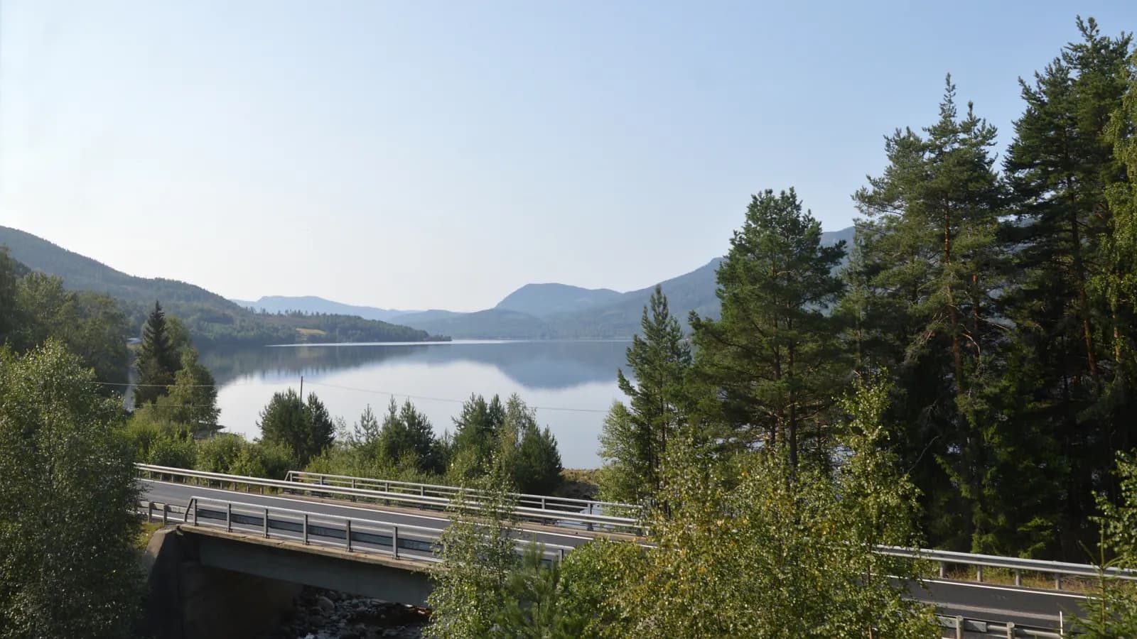
The Fv 280 follows the east side of Krøderen northwards. The lake is around 40 kilometres long, and at Noresund it narrows to a couple of hundred metres, with a bridge across. At Ørgenvika you rejoin the Rv 7. The new trunk road from Sokna, opened in 2014, is 21 kilometres shorter than the old trunk road via Noresund (without the detour down to Krøderen). In return it has two long tunnels, of 2.8 and 3.7 kilometres, and the Rv. 7 Brekkebygda toll station, which charges in both directions. The old road avoids both. North of Ørgenvika the Rv 7 runs close along Krøderfjorden, through the short Hallingporten tunnel, and on to Flå.
Don't miss: Bjørneparken in Flå, with bears, wolves, lynx and elk. In 2026 the park stayed open until 11 October. Only a limited number of tickets are sold each day, so buy yours on bjorneparken.no before you come.
Motorhome tip: There is fuel at Noresund and at Flå. If you take the new Rv 7 straight through, you pay at the toll station. Prices are on vegfinans.no.
4. Nesbyen — the open-air museum and the heat record
On 20 June 1970 the thermometer in Nesbyen showed 35.6 degrees. Nowhere in Norway has a higher temperature been measured. The village sits on the sandy flats on the west side of the river, and just above the centre, where the Rukkedalen valley begins, lies Hallingdal Museum. Among its buildings is Staveloftet from Ål, a storehouse from before the Black Death. The museum was the idea of the agricultural director Gudbrand Tandberg from Nes in 1899 and was founded in 1900. The buildings came one by one: in 1907 an old farmhouse from Kolsrud in Flå, which needed seven railway wagons to move, and in 1908 Staveloftet.
Don't miss: A guided tour of the open-air museum. In summer the Hallingdal Museum sites offer guided tours.
Motorhome tip: The museum is just under a kilometre up Rukkedalsvegen from the Rv 7. In autumn 2026 it was open on Thursdays only, so check buskerudmuseene.no before you come. In summer the ticket is valid for six days at all the Hallingdal Museum sites, including Gol and Hemsedal. In Nesbyen the Rv 7 goes through an underpass signed at 4.4 metres, the lowest after Hønefoss. Sutøya Feriepark by the Rv 7, four kilometres north of the centre, takes motorhomes and is open all year.
5. Gol — where the road divides
Gol is the junction of Hallingdal. Here the Rv 7 carries on towards Geilo, while the Rv 52 turns north-west towards Hemsedal. The stave church from Gol was built in the 1100s or 1200s. When the parish wanted to pull it down in 1881, the Society for the Preservation of Norwegian Ancient Monuments bought the church, and in 1884 it was moved to Bygdøy in Oslo. It now stands at Norsk Folkemuseum. A copy, consecrated in 1994, stands in the centre of Gol.
Don't miss: Gol bygdemuseum, one of the Hallingdal Museum sites. The summer ticket from Nesbyen is valid here too.
Motorhome tip: First Camp Gol lies by the Rv 7, around three kilometres east of the centre. It has motorhome pitches with electricity for vehicles up to ten metres and a waste disposal point by the service buildings. There are plenty of filling stations in Gol, and the next ones are in Hemsedal centre.
6. Hemsedal — the mountain valley
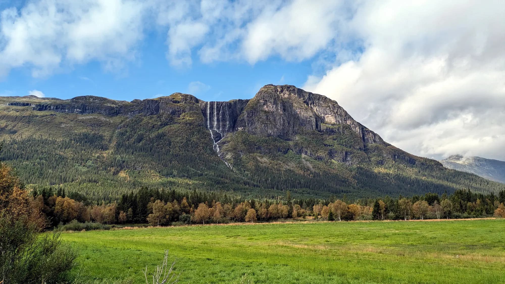
The Rv 52 follows the river up the valley for just over 30 kilometres to Trøim, the centre of Hemsedal. This is a mountain community in every sense: four fifths of the municipality lies above 900 metres. The first ski area opened in 1961, and the valley has grown with tourism since the 1970s. Hemsedal kyrkje, a wooden church from 1882, stands in the centre. Around seven kilometres south of Trøim, Hydnefossen falls down the rock face of Veslehorn, 475 metres in all.
Don't miss: Hydnefossen seen from the valley floor, especially after rain.
Motorhome tip: Hemsedal Fjellcamp is on the Hulbak farm, around four kilometres from Trøim, and is open all year. Elvely Camping at Ulsåk, south of the centre, is a small site that closes in winter. Fill up in Hemsedal: between Trøim and Borlaug, around 50 kilometres, we found no filling station. Hemsedal's tourist office asks visitors to use the campsites, keep at least 150 metres from houses and never stop in a passing place.
7. Rjukandefossen — a waterfall at the roadside
At Tuv the valley splits in two, and the Rv 52 climbs Mørkedalen. Right by the road, six kilometres after Trøim, Rjukandefossen plunges into a narrow ravine. The drop is 18 metres, and the river splits into two channels on the way down.
Don't miss: The falls from the viewpoints by the ravine. Keep children by the hand.
Motorhome tip: There is a car park right by the falls. Around ten kilometres further up, at Storeskar, the Norwegian Public Roads Administration is rebuilding a short stretch of road, with a gentler bend and a new bridge over the Mørkedøla. From 21 October to 17 December 2026 the road there is closed for periods six days a week, including 20:00–06:00 Monday to Friday. It is open on Sundays. There is no local diversion: the roads authority points to the Rv 7 over Hardangervidda or the E16 over Filefjell. The work is due to be finished in 2027. Check vegvesen.no before you set off.
8. Hemsedalsfjellet — above 1,100 metres
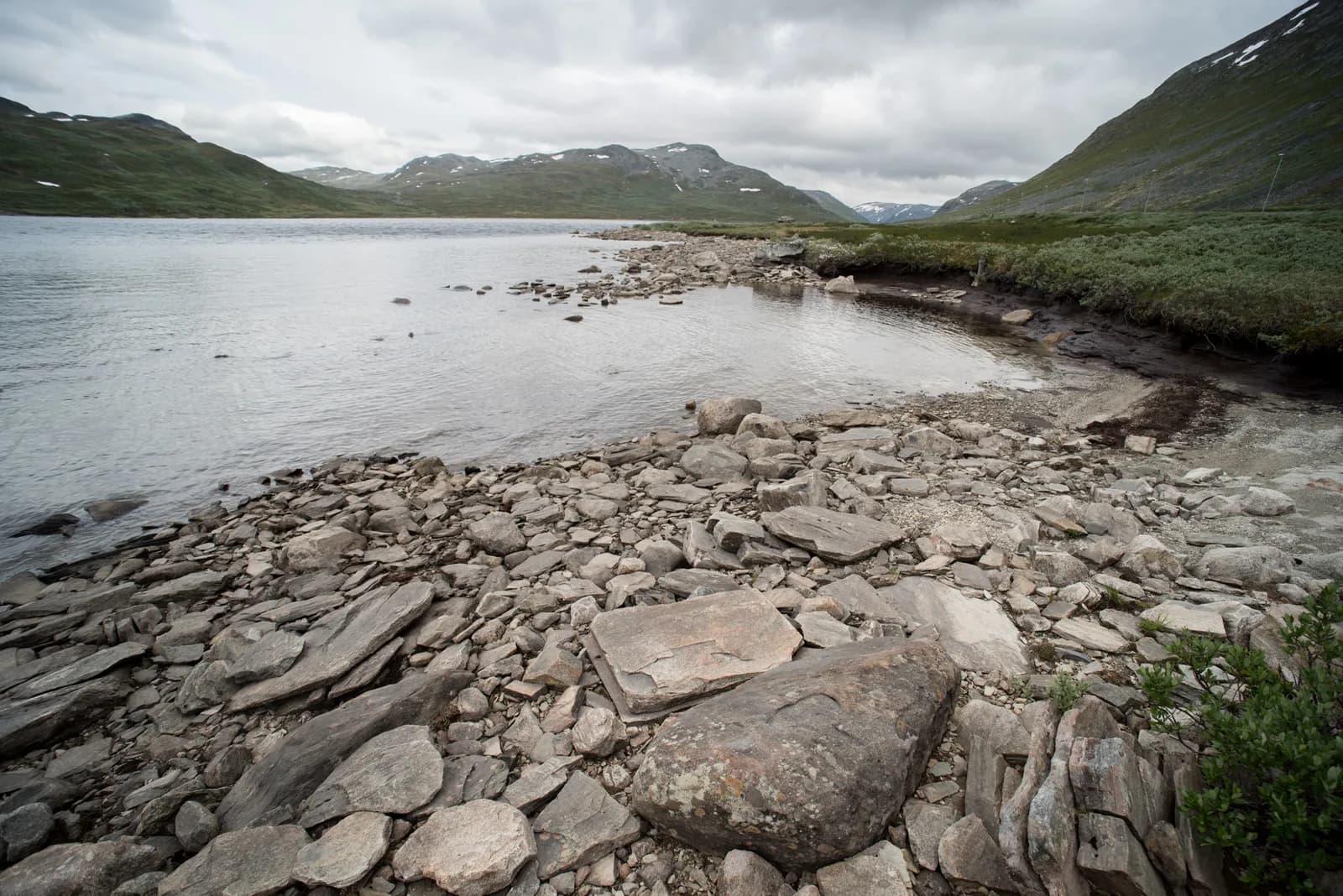
Mørkedalen takes you up onto the bare mountain. Bjøberg is a sheep farm 1,030 metres above sea level. The Norwegian encyclopaedia Store norske leksikon counts it as the highest farm in the country worked all year round, and according to the encyclopaedia local goat's cheese is sold there. The road is at its highest by Eldrevatnet, 1,137 metres above sea level. Here you cross the county line into Vestland and Lærdal. Then the road heads downhill, past Breistølen.
Don't miss: A break by Eldrevatnet. It is colder up here, even in July.
Motorhome tip: The Rv 52 is kept open in winter, but it is on the roads authority's list of mountain passes. In bad weather there may be convoy driving behind a snowplough, or the road may close. If the barrier is down, wait, even if the weather looks better where you are. Yr has its own forecast for «Rv. 52 Hemsedalsfjellet», with a webcam from the mountain.
9. Borlaug — down to the E16
From the mountain the road descends steadily to Borlaug, 507 metres above sea level. The last six kilometres are the steepest, averaging 6–7 per cent. At the Borlaug junction you meet the E16. Eastwards it crosses Filefjell towards Valdres, westwards it heads for Lærdal. Borgund stave church is around ten kilometres west of the junction and is described in Aurlandsfjellet and Nærøyfjorden.
Don't miss: Borgund stave church, which many consider the best-preserved stave church in the country.
Motorhome tip: Use a low gear on the descent to Borlaug to spare your brakes. Borgund Hyttesenter og Camping is by the E16, 2.5 km from the stave church, and has motorhome pitches with electricity. If you are going on towards Bergen: from 16 November 2026 the Lærdal Tunnel closes in the evenings and at night for around two years. Check vegvesen.no.
Practical info for motorhomes
Roads: The whole route, the Rv 7, Fv 288, Fv 280 and Rv 52, is open to vehicles up to 19.5 metres long (Statens vegvesen's road database). The roads are wide: the Fv 288 and Fv 280 are around seven metres, the Rv 52 mostly 6.5–7 metres and the Rv 7 mostly seven metres or more. The only tunnel on the route as described is Hallingporten on the Rv 7, 60 metres long. Outside Hønefoss centre the lowest signed height is 4.4 metres, at the underpass in Nesbyen. If you drive into Hønefoss centre, the underpass by the station is signed at 4.2 metres. The Rv 52 climbs to 1,137 metres, and the steepest stretch is the descent to Borlaug, averaging 6–7 per cent over the last six kilometres. None of the roads closes for the winter, but the Rv 52 can have convoy driving or close in bad weather. Roadworks at Storeskar continue until the road is due to reopen in 2027. Check vegvesen.no or call 175 before you set off.
Tolls: There are no toll stations on the route as described. If you take the new Rv 7 from Sokna to Ørgenvika instead of the road via Krøderen, you pass the AutoPASS station Rv. 7 Brekkebygda, which charges in both directions until June 2029. From Oslo you pass several toll stations, among them Skaret and Avtjerna on the E16. Prices and vehicle classes for the Vegfinans stations are on vegfinans.no.
Parking: At Krøderen station, park at the station, or north of the engine shed and along the road south of the station when it is full. At Rjukandefossen there is a car park by the road. Never park in a passing place.
Overnight stays: The Outdoor Recreation Act lets you pitch a tent on uncultivated land at least 150 metres from an inhabited house or cabin, and for no more than two nights in the same place without the landowner's consent. For a motorhome, signs and the landowner's rules apply, and it must stand on a legal parking place. Hemsedal's tourist office asks visitors to use campsites and motorhome sites and to leave four metres between vehicles. Never drive off the road into the terrain.
Campsites:
- Sutøya Feriepark, Nesbyen — by the Rv 7, four kilometres north of the centre, open all year
- First Camp Gol – Hallingdal, Gol — motorhome pitches with electricity up to ten metres, waste disposal point
- Hemsedal Fjellcamp, Hemsedal — on the Hulbak farm, around four kilometres from Trøim, open all year
- Elvely Camping, Ulsåk in Hemsedal — small site south of the centre, closed in winter
- Borgund Hyttesenter og Camping, Borgund — by the E16, 2.5 km from the stave church
Fuel: Hønefoss, Sokna, Noresund, Flå, Nesbyen and Gol have filling stations, and Hemsedal centre has two. Between Hemsedal and Borlaug, over the mountain, there are none. Fill up in Hemsedal at the latest.
Waste disposal: First Camp Gol has a waste disposal point. OpenStreetMap map data also shows free disposal points at the Gol treatment plant, in Flå and in Hemsedal centre, but we have not been able to confirm them with the municipalities. Ask at the campsite if you are unsure.
Ferries: No ferries.
Combine with
- Across Hardangervidda — from Gol it is around 50 km on the Rv 7 to Geilo, where that route begins. It is the alternative if you are heading for Hardanger rather than Lærdal.
- Aurlandsfjellet and Nærøyfjorden — that route ends at Borgund stave church, ten kilometres west of Borlaug. Drive it in reverse, over Aurlandsfjellet to Nærøyfjorden.
- Valdres and Valdresflye — from Borlaug it is around 100 km on the E16 over Filefjell to Fagernes. From Gol you can also take the Fv 51 over Golsfjellet, around 50 km.
- Numedal and its stave churches — from Geilo the Fv 40 runs south over Dagali and through Numedal to Kongsberg. Drive that route in reverse.
Weather
Nesbyen holds Norway's heat record, 35.6 degrees. On Hemsedalsfjellet, above 1,100 metres, it is much cooler, and the weather can turn quickly, even in midsummer. Check yr.no for Nesbyen, Hemsedal and «Rv. 52 Hemsedalsfjellet».
This route is part of Bobilvei's hand-picked motorhome routes in Norway. Every route is quality-checked with a focus on motorhome suitability, parking and local experiences.