- Route
- Geilo – Ustaoset – Haugastøl – Halne – Dyranut – Vøringsfossen – Måbødalen – Øvre Eidfjord – Eidfjord (Rv 7, Norwegian Scenic Route Hardangervidda from Haugastøl)
- Length
- about 95 km. Oslo to Geilo is around 220 km, Bergen to Eidfjord around 150 km.
- Driving time
- Around 2 hours without stops. In winter, convoy driving may make it much longer.
- Recommended number of days
- 2–3
- Best season
- June–September. The road is open all year, but in winter traffic often crosses the mountain in convoy, and bad weather can close it.
- Difficulty
- Moderate. A wide main road throughout, but it reaches around 1,250 metres on the plateau and drops around 650 metres through four tunnels down Måbødalen.
- Last checked
- October 2026
Why this route?
Rv 7 is the shortest driving route between Oslo and Bergen, and many cross the plateau without stopping. That is a shame. In under a hundred kilometres you go from the cabin resort of Geilo across treeless high mountains where wild reindeer roam and down into a gorge where the road vanishes into the mountain. At the bottom the fjord awaits.
The route runs east to west. From Oslo it is around 220 kilometres and 3.5–4 hours by motorhome to Geilo through Hallingdal. From Bergen it is around 150 kilometres and 2.5–3 hours to Eidfjord over Hardangerbrua — then follow the route in reverse, climbing Måbødalen first. Divide the trip in two: a night at Garen Camping beside Rv 7 just before Vøringsfossen gives you evening light on the plateau and morning light in Måbødalen.
Stops along the route
1. Geilo — shop and fill up before the mountains
Geilo lies around 800 metres above sea level, where Fv 40 from Numedal meets Rv 7. In winter it is a ski village. In summer it is the place to buy supplies, fill up and sleep well before the mountains.
Don't miss: Geilo kulturkyrkje, a fan-shaped church from 2010 with glass art by Kjell Nupen.
Motorhome tip: Fill up here — there is no fuel station between Haugastøl and Eidfjord. Geilo Hytter & Camping and Øen Turistsenter both have motorhome pitches.
2. Ustaoset — Hallingskarvet above the lake
Heading west, Rv 7 follows Ustevatnet. To the north Hallingskarvet stands like a wall, a ridge around 35 kilometres long, now a national park. Ustaoset is almost entirely cabins: over 900, with fewer than 30 permanent residents. Here the rails from east and west were joined during the construction of Bergensbanen in autumn 1907.
Don't miss: A stop by the lake on a still morning, with Hallingskarvet behind.
Motorhome tip: Buy anything missing here. Haugastøl, 13 kilometres further west, has no grocery shop.
3. Haugastøl — where Rallarvegen begins
At Haugastøl, Rv 7 crosses Bergensbanen, and Norwegian Scenic Route Hardangervidda begins. Rallarvegen also starts here, the railway construction road running along the tracks towards Finse and down to Flåm. In summer it is one of Norway's best-known cycle routes — 26 kilometres to Finse alone.
Don't miss: Hire a bike in Haugastøl and combine the ride with Bergensbanen. Bike-and-train packages are sold here.
Motorhome tip: A few kilometres south of Haugastøl are Vardestopp and Ørteren rest areas, described in the Hardanger route. Both are small, without large-vehicle spaces, and accessible from only one direction of travel.
4. Halne — a mountain lodge beside Halnefjorden
In the middle of the plateau, where Buskerud ends and Vestland begins, Halne Fjellstugu stands beside Halnefjorden. The lodge is open March–October, serving dishes including reindeer stew and mountain trout.
Don't miss: “Halnekongen”, the boat crossing Halnefjorden in 20–30 minutes in midsummer — a fine starting point for a hike onto the plateau.
Motorhome tip: After Halne the road climbs towards its highest point. Check wind and weather before continuing.
5. Dyranut — the roof of the route
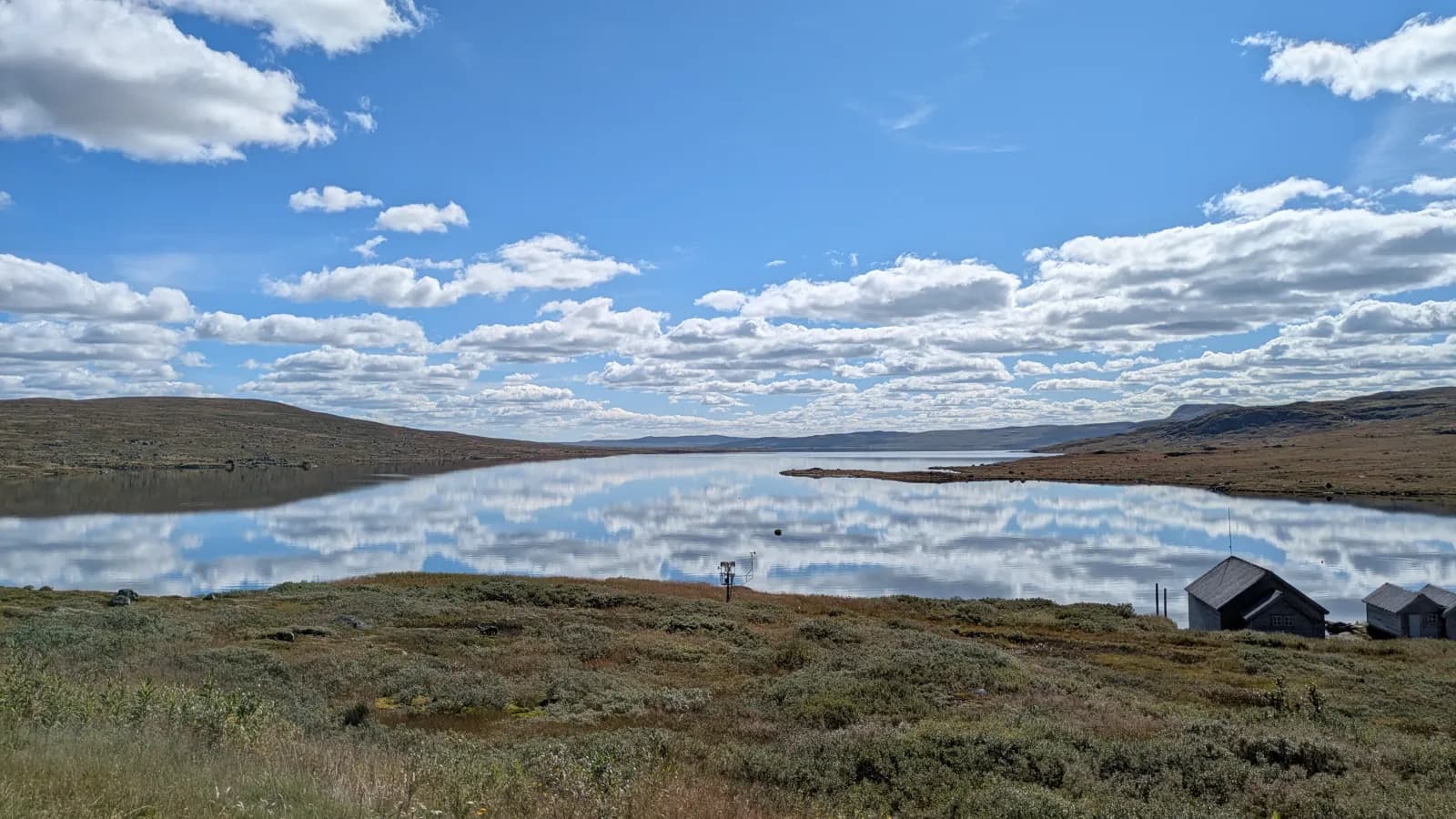
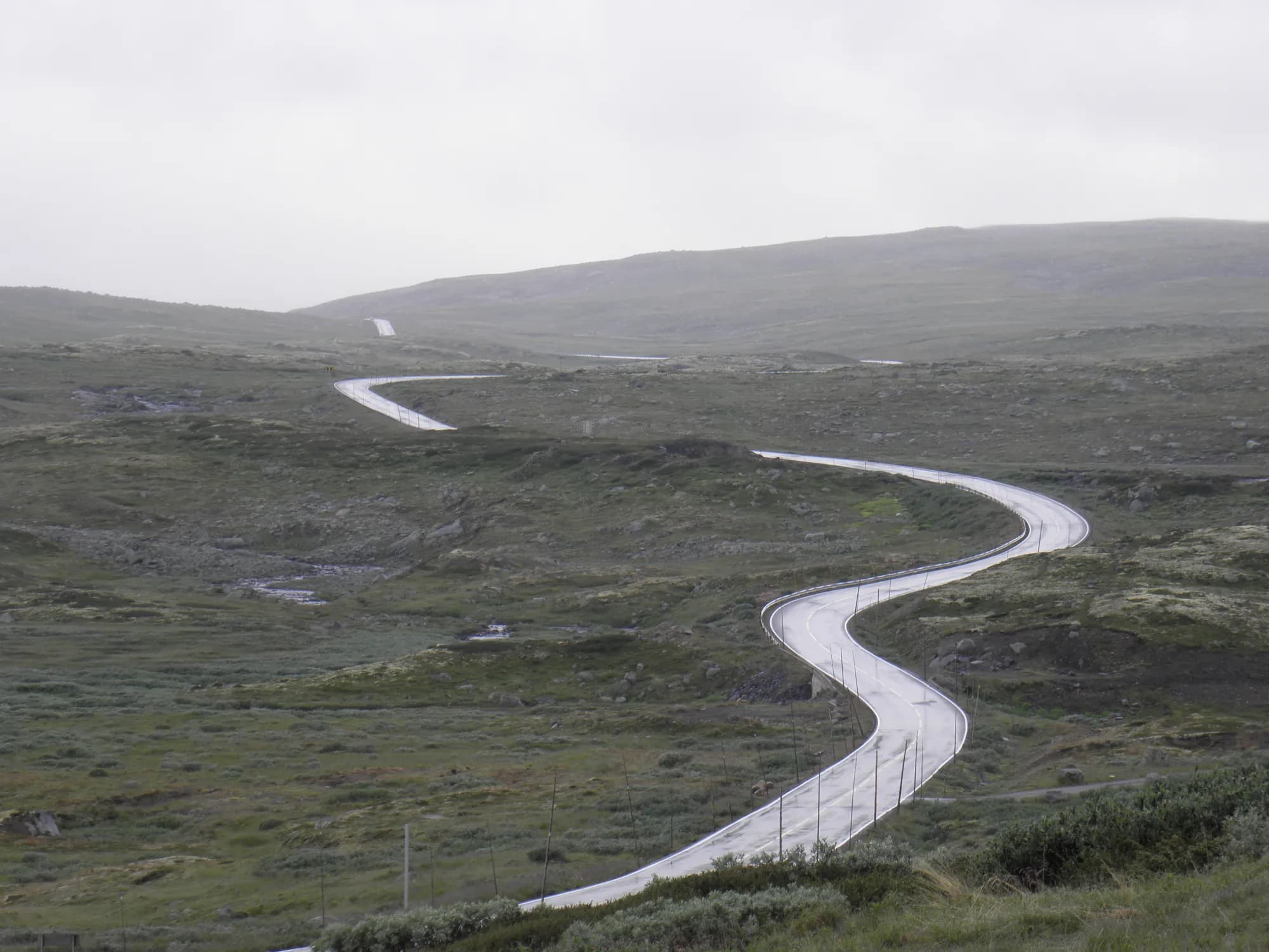
Just east of Dyranut, Rv 7 reaches its highest point, around 1,250 metres above sea level. No trees grow here: only heather, rocks and shining lakes as far as you can see. Dyranut Turisthytta runs a summer café, and marked paths lead onto the plateau.
Don't miss: Wild reindeer. Nowhere in Europe has larger wild reindeer herds than Hardangervidda. If you see animals from the road, stop somewhere safe, stay by the vehicle and enjoy the sight — do not approach them.
Motorhome tip: The plateau is exposed and tall motorhomes catch the wind. yr.no has a separate Dyranut forecast. In winter the road may also close for a period to protect wild reindeer.
6. Vøringsfossen — a short stop at the edge
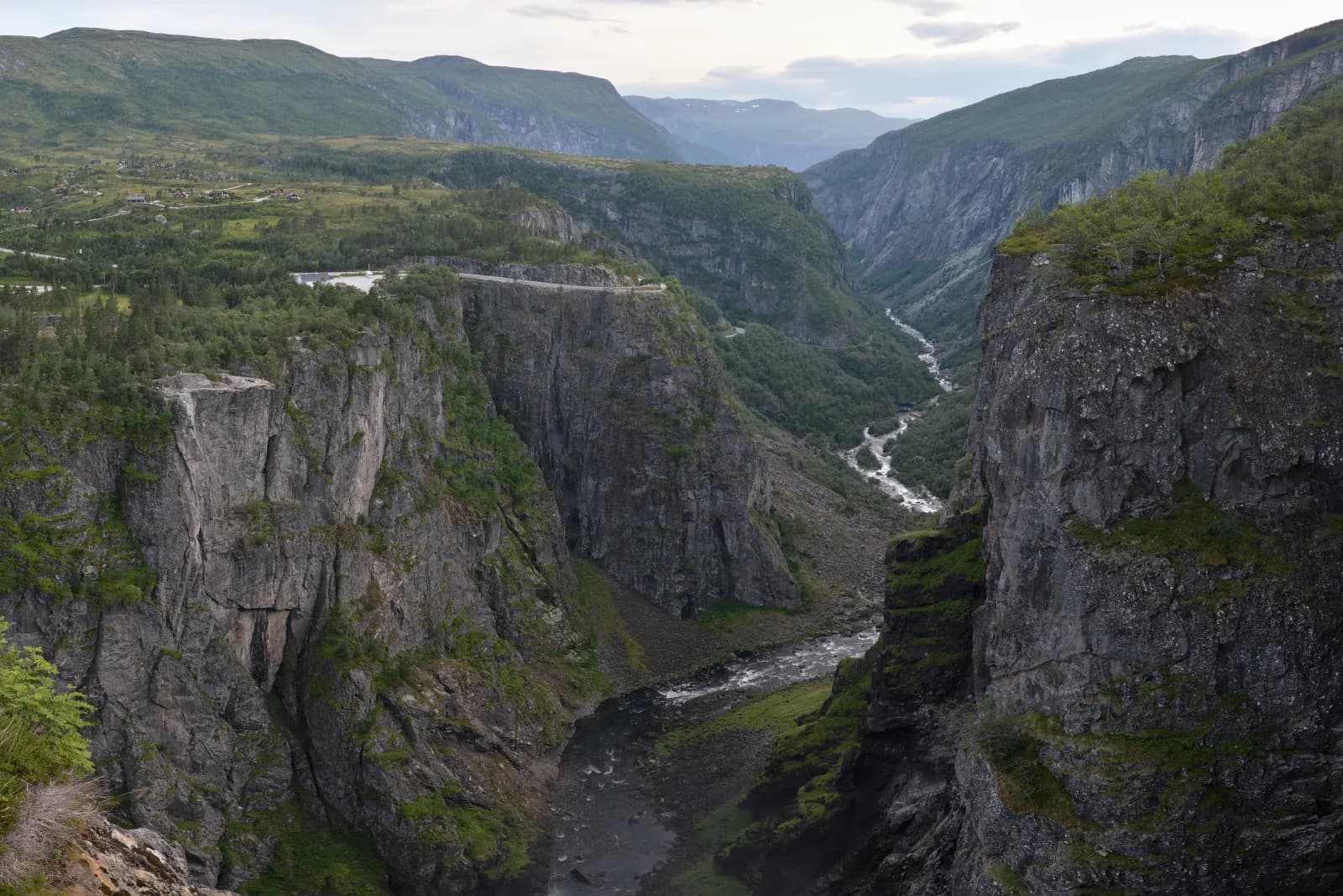
At Fossli, the Bjoreio drops over the edge, falling 182 metres into Måbødalen. Since 2020 you can cross the gorge on the stepped bridge, 47 metres of steps between Fossli and Fossatromma. The waterfall and fjord receive fuller coverage in the Hardanger route.
Motorhome tip: Choose the upper car park at Fossli: Vøringsfossen rest area has eight spaces for large vehicles. The new Fossatromma site is large but designed for cars. Toilets are open roughly April–November and are not for waste disposal. Fossli parking closes November–March.
7. Måbødalen — four tunnels down to the fjord
From Vøringsfossen to Øvre Eidfjord, Rv 7 drops around 650 metres in twelve kilometres. It passes through four tunnels inside the mountainside, turning more than half a circle in Storegjeltunnelen. The longest, Måbøtunnelen, is 1.9 kilometres. The old 1916 road remains down in the valley but is closed after several rockfalls.
Don't miss: Måbø bru, a stone arch bridge from 1910 at the outlet of Måbøvatnet.
Motorhome tip: Use low gear and engine braking throughout — tunnel gradients reach 7.8 %. Clearance exceeds four metres in all of them. Valley rest areas are small, designed for cars and closed mid-October to mid-April; the one at Måbø bru is accessible from only one direction.
8. Øvre Eidfjord — understanding the plateau
At the valley's foot lies Norsk Natursenter Hardanger, the visitor centre for Hardangervidda national park (formerly Hardangervidda Natursenter). Its panoramic film shows on a 21-metre screen, and the centre is open from late March to October.
Don't miss: The panoramic film and mountain trout in the aquariums.
Motorhome tip: Nasjonale turistveger lists Øvre Eidfjord as the nearest disposal location for the entire plateau. Sæbø Camping lies beside Eidfjordvatnet with 100 pitches and its own disposal room.
9. Eidfjord — from snow to fjord
After Eidfjordtunnelen, 2.1 kilometres long, you emerge at Eidfjord at the head of Hardangerfjorden — around 1,250 metres lower than Dyranut.
Don't miss: Eidfjord gamle kirke on the terrace southwest of the centre, a medieval stone church first mentioned in 1310.
Motorhome tip: Kjærtveit Camping lies where the Eio meets the fjord, within walking distance of the centre. Fill up here before continuing.
Practical info for motorhomes
Roads: All of Rv 7 on this route allows vehicle combinations of 19.5 metres; the lowest signed height is 4.2 metres in Eidfjordtunnelen (Statens vegvesen's road database). The road is open all year, but winter weather changes quickly on the plateau. Convoys behind a snowplough are common, and bad weather can close the road. In winter 2019–2020 it closed for over 1,000 hours and operated convoys for 600, according to a written parliamentary question in 2021. From 16 November 2026, Lærdalstunnelen closes evenings and nights for around two years, and Statens vegvesen considers Rv 7 an important alternative during that time. A motorhome with a maximum authorised mass of up to 7.5 tonnes need not carry chains but must have sufficient grip — in practice winter tyres on snow and ice. Ask the owner before a winter trip. Check vegvesen.no or call 175 before driving.
Parking: Rest areas on the plateau and in Måbødalen are small. At Vøringsfossen the eight large-vehicle spaces at Fossli are the safest choice, but close November–March.
Overnight stays: Statens vegvesen builds rest areas for breaks, not extended camping. The Outdoor Recreation Act's tent rules for uncultivated land — at least 150 metres from inhabited houses, two nights maximum — are a good guideline for motorhomes. Park legally — never in a passing place, bus bay or off-road in the terrain. Some plateau locations have special overnight rules: follow signs.
Campsites:
- Geilo Hytter & Camping — Geilo, motorhome pitches bookable online
- Øen Turistsenter — Geilo, motorhome pitches, open all year
- Garen Camping — beside Rv 7 just east of Vøringsfossen, open all year, electricity across much of the site
- Sæbø Camping — Øvre Eidfjord, beside Eidfjordvatnet, disposal room for guests, season until mid-October
- Kjærtveit Camping — where the Eio meets the fjord, walking distance to central Eidfjord, April–October
Fuel: Geilo has several stations, and Eidfjord also has one. There are none between Haugastøl and Eidfjord, around seventy kilometres.
Waste disposal: Not in toilets along the scenic route. Nasjonale turistveger refers you to Øvre Eidfjord at the foot of Måbødalen. Sæbø Camping has its own disposal room for guests.
Ferries: None on the route. From Eidfjord, Rv 7 continues to Bu, where Hardangerbrua (Rv 13, toll road) crosses the fjord.
Combine with
- Hardanger — from Eidfjord over Hardangerbrua and around the fjord, with more on Vøringsfossen, orchards and ferries.
- Valdres and Valdresflye — from Geilo it is around 100 km east via Gol to Fagernes, where that route starts.
- Telemarkskanalen and Vest-Telemark — Fv 40 runs south from Geilo via Dagali. Seljord, where that route ends, is around 185 km away. Follow it in reverse.
- Numedal and its stave churches — ends in Geilo, where this route begins. Drive it in reverse, south on the Fv 40 over Dagali and down Numedal to Kongsberg.
- Hallingdal and Hemsedalsfjellet — from Geilo it is around 50 km east on the Rv 7 to Gol, where that route crosses Hemsedalsfjellet to Borlaug.
Weather
Geilo lies around 800 metres above sea level, the plateau road between 1,000 and 1,250 metres, and Eidfjord by the sea. Mountain weather can change quickly even in midsummer, while conditions beside the fjord are milder. Check yr.no for “Rv. 7 Hardangervidda”, covering the whole Geilo–Eidfjord stretch.
This route is part of Bobilvei's hand-picked motorhome routes in Norway. Every route is quality-checked with a focus on motorhome suitability, parking and local experiences.