- Route
- Skei (Gausdal) – Peer Gynt-vegen – Gålå – Ringebu – Venabygdsfjellet – Atndalen – Folldal (Fv 27)
- Length
- about 155 km, including about 27 km of gravel on Peer Gynt-vegen
- Driving time
- about 3 hours without stops, but plan at least three days
- Recommended number of days
- 3–4
- Best season
- June–September. Peer Gynt-vegen is a summer road and usually opens in early June. Ringebu stavkirke and Folldal gruver have summer opening until late August.
- Difficulty
- Moderate. Long gravel road with gradients up to 10%, and narrow asphalt on parts of Venabygdsfjellet. One tunnel on the E6, no ferries.
- Last checked
- October 2026
Why this route?
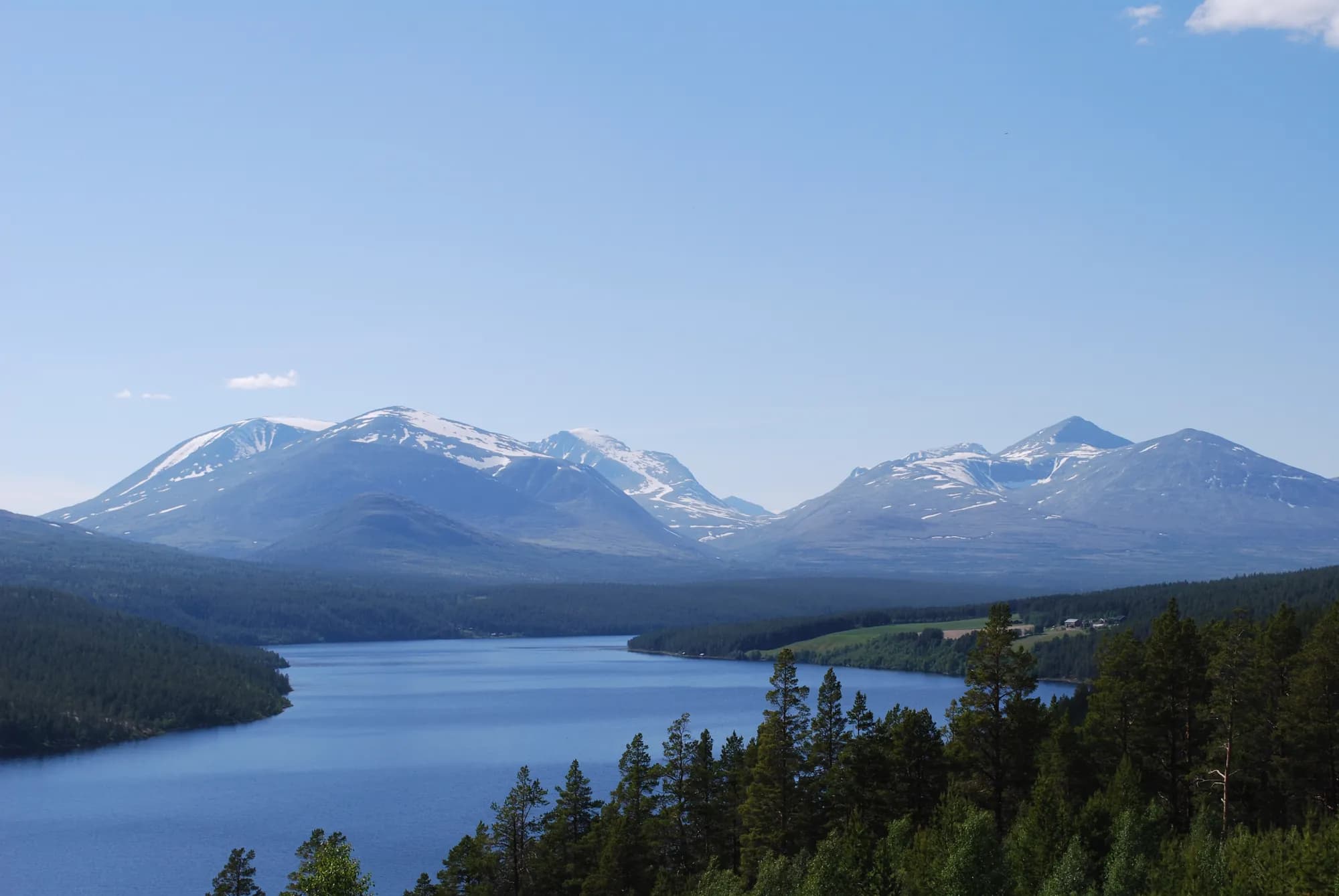
Rondane became Norway's first national park. This route takes you to the eastern side of the mountain massif. There the Fv 27 follows the Atna north through pine forest, with the Rondane peaks above Atnsjøen — the same scene Harald Sohlberg painted.
But first comes Peer Gynt-vegen: a private gravel toll road over the mountains between Skei and Gålå. Summer farms, open plateaus and views towards both Jotunheimen and Rondane. Then Ringebu stavkirke down in the valley, and finally National Tourist Route Rondane across Venabygdsfjellet and down Atndalen to the mining village of Folldal.
The motorhome questions here concern gravel and tolls, not length.
Stops along the route
1. Skei — onto Peer Gynt-vegen
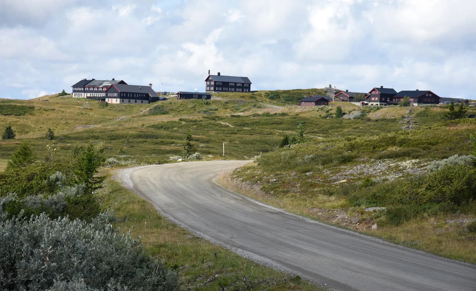
Skei lies beneath Skeikampen in Gausdal, around 40 km from Lillehammer. Here Peer Gynt-vegen leaves the county road and the asphalt ends. It is about 27 km of gravel to Gålå, past Dørdalsknappen and Fagerhøy. The highest point is Listulhøgda, 1,053 m above sea level.
Don't miss: The rest area at Dørdalsknappen — Jotunheimen to the west, Rondane to the north.
Motorhome tip: There is no barrier to stop at. Your number plate is read automatically, and you pay at youpark.no within 48 hours. Otherwise an invoice with a fee goes to the motorhome's owner — if renting, pay yourself. The first kilometres up from Skei are steep.
2. Gålå — where Gudbrandsdalsost began
The mountain village by Gålåvatnet. At Solbråsetra in 1863, the dairymaid Anne — later Anne Hov — thought of adding cream to whey cheese. It was the beginning of what we now call Gudbrandsdalsost. In late July and the first half of August, “Peer Gynt” is performed by the lake.
Motorhome tip: From Gålå the Fv 2584 descends to the E6 at Harpefoss. It is paved but steep — around 10% at the steepest. Use low gear and engine braking. South towards Ringebu, the E6 passes through Hundorptunnelen, just over 4 km long.
3. Ringebu stavkirke
Built around 1220 and still in use. The church gained its red tower when extended in the 1630s. In summer it is open to visitors every day until late August.
Don't miss: Ringebu prestegard nearby — a combined ticket is available.
Motorhome tip: Car park by the church. Elstad Camping lies by the Lågen, 4 km south of central Ringebu.
4. Venabygdsfjellet — up above the treeline
The Fv 27 branches from the E6 at Frya, just north of Ringebu, and climbs almost 800 vertical metres. National Tourist Route Rondane begins at Muen. The road reaches around 1,065 m above sea level, and the Rondane peaks appear to the north.
Don't miss: Muen (just over 1,400 m above sea level), a popular day walk straight from the road.
Motorhome tip: Lundes on Venabygdsfjellet has fuel, Kiwi and motorhome pitches. Do not stay overnight in roadside lay-bys up on the mountain. The road crosses a main wild reindeer migration route, and a government action plan for wild reindeer proposes considering a camping ban between Spidsbergseter and Enden.
5. Enden and Atnbrufossen
From the mountains there is a steep descent to Enden in Atndalen. To see the log church in Sollia, it is just over 12 km each way along the Fv 219. A little further north the Atna plunges over Atnbrufossen. Fossehuset by the falls is now a museum, with exhibitions and concerts — timber was once sawn and electricity generated here.
Motorhome tip: Skogli Camping at Atnbrua lies by the river and is open all year, including for large motorhomes. Summer is drop-in only. From 1 October to 15 May you must book in advance.
6. Sohlbergplassen and Kjøllen — the painting in real life
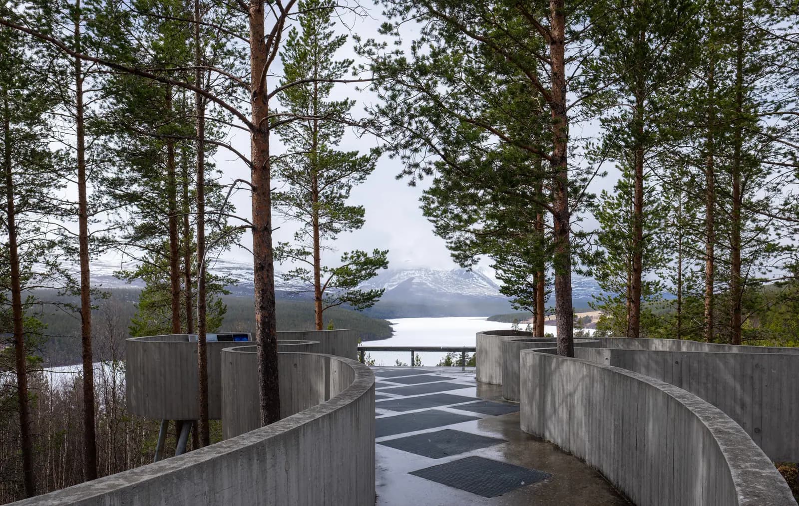
Harald Sohlberg struggled for around fifteen years with “Vinternatt i Rondane”, completed in 1914. In 1995 it won NRK's vote for Norway's national painting. The viewpoint was designed by Carl-Viggo Hølmebakk: a long, curved concrete platform in the pine forest above Atnsjøen. From here you see roughly what Sohlberg saw.
Two kilometres further on, at Kjøllen, the ground itself is an artwork. Matias Faldbakken's “Skyldner” consists of 26,000 granite stones, 20 × 13 metres, and you walk straight onto it. The image is Faldbakken's drawing of a carved wooden head from the Middle Ages, probably Christ.
Motorhome tip: Parking is beside the road, and the platform is wheelchair-accessible.
7. Strømbu — the gateway to Rondane
The tourist route's main rest area, beside the Atna. Hølmebakk designed this too, with a heated room and a rooftop terrace. Trails lead from here into the national park, including to Bjørnhollia mountain lodge. On the map the place is named Straumbu.
Motorhome tip: Toilets from Easter through October, but you cannot empty your motorhome toilet here. That applies to all the tourist route's rest areas.
8. Folldal gruver — the end point
The mines in Folldal operated for almost 250 years, until 1993. Around 70 buildings remain, and the Norwegian Directorate for Cultural Heritage regards the complex as one of fifteen industrial heritage sites the country should particularly preserve.
Don't miss: The mine train into the old mine. Ask about the next departure when you arrive.
Motorhome tip: Park below the complex. The season is short, with daily opening from late June to late August — see folldalgruver.no.
Practical info for motorhomes
Roads: Peer Gynt-vegen is a private gravel road throughout the Skei–Gålå toll section. The toll company lists no length or weight limit, only a separate rate above 7.5 tonnes. An ordinary motorhome can pass, but drive slowly and expect dust and potholes. To avoid the gravel, take the E6 from Lillehammer to Ringebu (about 55 km). The rest is asphalt, with no height or length limits that stop a motorhome. The route's only tunnel is Hundorptunnelen on the E6, and the E6 alternative passes through Øyertunnelen — both unproblematic for motorhomes. The Fv 27 is narrow and uneven on parts of Venabygdsfjellet (5.5–6 metres of asphalt), and roadworks may cause periodic closures. Check vegvesen.no before driving.
Winter closure: Peer Gynt-vegen usually opens in early June and closes when snow arrives in autumn. Driving on it when closed is prohibited. The Fv 27 is open all year, but may close briefly in bad weather. In winter and spring, stopping and parking are prohibited on parts of the road across Venabygdsfjellet for the sake of wild reindeer — follow the signs.
Parking: Stop in rest areas and designated spaces, not at the roadside.
Overnight stays: Use campsites. The right to roam (Outdoor Recreation Act § 9) applies to tents and outdoor stays: at least 150 metres from an inhabited house or cabin, and no more than two nights without the landowner's consent, except in high mountains or far from buildings. It does not govern motorhome parking — signs and landowner rules apply there. Driving into the terrain is prohibited under the Motor Traffic Act.
Campsites:
- Elstad Camping, Ringebu — by the Lågen, open 1 May–1 October
- Lundecamp, Venabygdsfjellet — motorhome drop-in at Lundes
- Skogli Camping, Atnbrua — by the Atna, open all year
- Grimsbu Turistsenter, Folldal — 11 km east of the centre, with waste disposal
Fuel: Fill the tank before Skei — there is no station on Peer Gynt-vegen. Then Ringebu, Lundes on Venabygdsfjellet, central Folldal and Grimsbu.
Waste disposal: Grimsbu Turistsenter has toilet disposal and a motorhome wash area. Nasjonale turistveger lists dump stations in Venabygd, at Grimsbu and at Hjerkinn. Refill water at campsites.
Toll road: Two toll sections, Skeikampen–Gålå and Fefor–Dalseter. Payment at youpark.no, prices at peergyntvegen.no.
Ferries: No ferries.
Combine with
- Sognefjellet and Jotunheimen — E6 north to Otta and Rv 15 to Lom, about 100 km from Gålå.
- Trollstigen and Geiranger — Fv 29 to Hjerkinn, E6 to Dombås and E136 down Romsdalen, about 165 km from Folldal to Åndalsnes.
- Peer Gynt-setervegen — a separate toll road across the mountains from Vinstra to Kvam (about 40 km), not the same as Peer Gynt-vegen. Summer road, steep descent through Veikledalen.
- Trondheim – Røros — from one mining community to another: Røros lies about 120 km east of Folldal.
- Dovrefjell and Romsdalen — from Folldal it is around 30 kilometres on the Fv 29 to Hjerkinn.
- Around Mjøsa — from Skei i Gausdal it is around 40 km to Lillehammer.
Weather
Folldal gets little precipitation, around 400 mm a year, and almost half falls in June–August. The July daily average is around 12 degrees: warm days, cold nights. Around 1,000 metres above sea level, on Venabygdsfjellet and Peer Gynt-vegen, it is colder and windier, and snow can come early in autumn. Check yr.no for Ringebu, Venabygdsfjellet and Folldal.
This route is part of Bobilvei's hand-picked motorhome routes in Norway. Every route is quality-checked with a focus on motorhome suitability, parking and local experiences.