- Route
- Åndalsnes – Trollstigen – Valldal – Linge–Eidsdal (ferry) – Ørnevegen – Geiranger
- Length
- about 90 km and one short ferry, plus around 55 km return for the side trips to Trollveggen and Dalsnibba
- Driving time
- 2–2.5 hours including the ferry, without stops, but allow a whole day
- Recommended number of days
- 2–3
- Best season
- June–September (Trollstigen closes for winter and opens sometime between late April and mid-June)
- Difficulty
- Challenging. Steep hairpins, narrow road, large changes in elevation. Not for nervous drivers with a large motorhome.
- Last checked
- October 2026
Why this route?
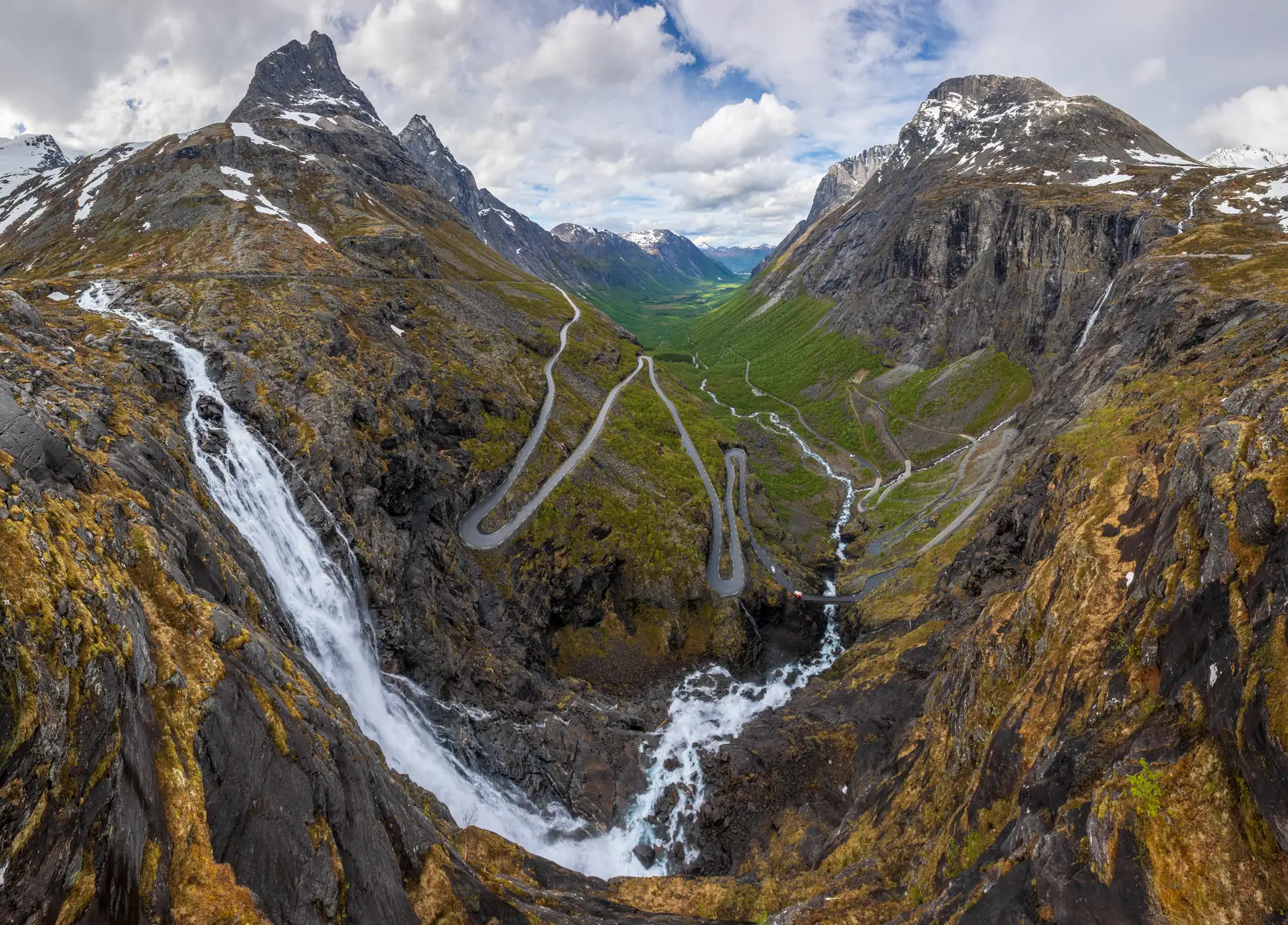
Trollstigen and Geirangerfjorden are Norway at its most dramatic. The road winds up the mountainside through eleven hairpin bends, with Stigfossen right beside you. And when you cross the mountain and first see Geirangerfjorden — that is one of the moments that makes a motorhome holiday in Norway unforgettable.
The route combines two of Norway's best-known experiences: the Geiranger–Trollstigen National Tourist Route and UNESCO-listed Geirangerfjorden. Together they make a short route with plenty to stop for — mountains, fjord and waterfalls.
Stops along the route
1. Åndalsnes — the starting point
The mountaineering capital at the foot of Romsdalseggen, where the Rauma river meets the fjord. Five kilometres up Romsdalen, at Sogge bru, Fv63 branches off towards Trollstigen. The bridge is single-lane — observe the give-way signs.
Don't miss: Romsdalseggen (10 km, 5–8 hours, challenging, usually from mid-June) for fit walkers — or simply enjoy the view of the peaks.
Motorhome tip: Åndalsnes Camping og Motell stands beside the Rauma river — a good base before Trollstigen. The municipality also has a motorhome car park in the centre.
2. Trollveggen (side trip)
The cliff drops around 1,000 metres vertically — no vertical wall in Europe is higher. Trollveggen is six kilometres further up the E136 from Sogge bru, a short detour. Stop at the rest area and let your neck do the work.
Motorhome tip: Trollveggen rest area has ten spaces for large vehicles.
3. Trollstigen
Eleven hairpins up the mountainside, with a signed 10% gradient. Halfway up you cross Stigfossbrua, a stone bridge from 1934 with the waterfall right beside it — falling almost 180 metres. From the plateau at the top, a path leads to viewing platforms over the edge — from the largest you look down on the road a couple of hundred metres below.
Motorhome tip: The signed length limit is 13.1 metres for the entire vehicle combination — trailers and bike racks count. In many bends the asphalt is less than five metres wide, so be ready to wait or reverse when meeting a bus. Drive early to avoid queues.
Important: The mountainside is prone to rockfalls — in June 2024 a rockfall closed the road for the rest of the season. Rockfall protection work can also close it during the day, as on weekdays in autumn 2026. Check vegvesen.no before driving.
4. Valldal and Linge — ferry across Norddalsfjorden
From the plateau the road descends Valldalen, past Gudbrandsjuvet, where the Valldøla river has carved a narrow gorge. At Linge, just west of Valldal, take the ferry to Eidsdal. A short, beautiful ferry leg.
Motorhome tip: The ferry shuttles back and forth, with a crossing of around 13 minutes. Fill up in Valldal — there is a dump station there too.
5. Ørnevegen and Ørnesvingen
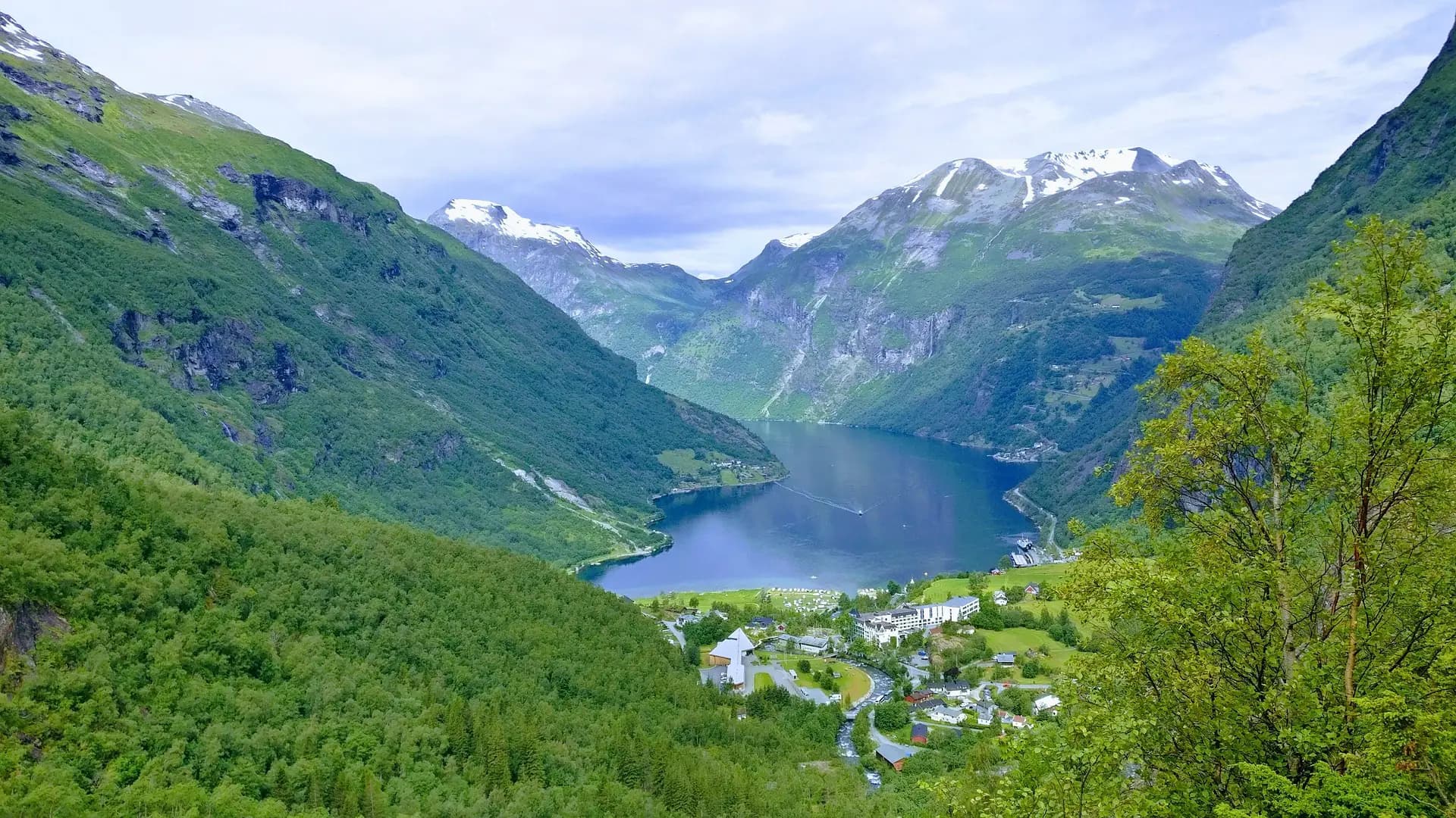
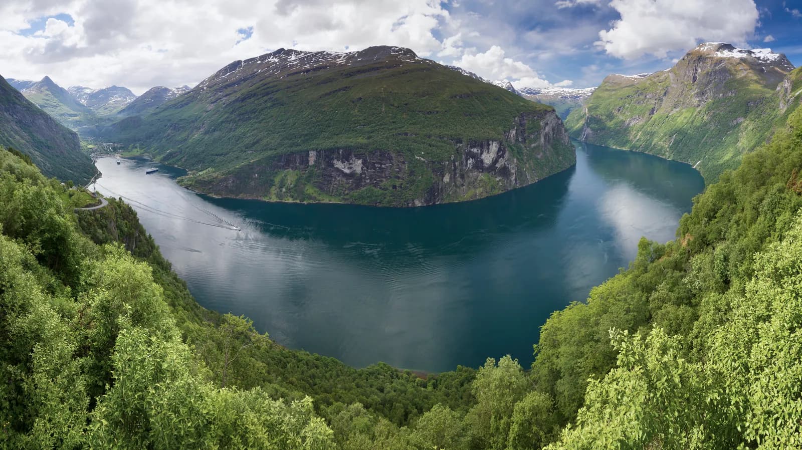
From Eidsdal the road climbs to Korsmyra, around 620 metres above sea level. Then comes Ørnevegen: eleven hairpins down towards Geiranger — as steep as Trollstigen but less famous. From Ørnesvingen you first see Geirangerfjorden from above, with De syv søstrene further out. Stop here.
Motorhome tip: The rest area at Ørnesvingen is small, with only one space for large vehicles. With a large motorhome, stop instead at Korsmyra just under two kilometres before it — but only Ørnesvingen has the fjord view.
6. Geiranger
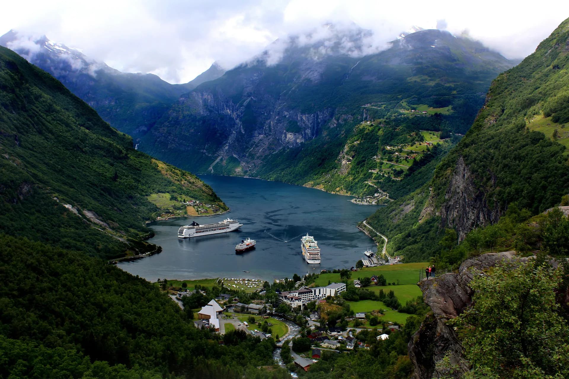
UNESCO World Heritage. The fjord is 15 km long, framed by steep mountainsides and waterfalls such as De syv søstrene and Friaren. Take a fjord cruise to see the falls from the water — a completely different experience from the road.
Don't miss: Flydalsjuvet, four kilometres up the road towards Dalsnibba — the classic Geiranger photo with the fjord and cruise ships below. Parts of the car park prohibit motorhomes.
Motorhome tip: Cruise ships are in the fjord most days from June to September, and the centre and viewpoints fill up at midday. Check the arrival list at stranda-hamnevesen.no and drive early or late. Campsites in the centre cannot be booked — arrive early in the day.
7. Dalsnibba (side trip)
Drive up to Dalsnibba, almost 1,500 metres above sea level, for views down over Geiranger and the inner fjord. It is around 21 km from Geiranger, the last five kilometres on Nibbevegen, a private toll road with its own hairpins. Snow can remain beside the road well into June.
Motorhome tip: Motorhomes are fine, but the road is only around 3.5 metres wide and shared with tour coaches — be ready to wait in a passing place. Cars and motorhomes pay the same toll, and there is motorhome parking at the summit. The season usually runs from May until around 1 October, often daytime only in spring and autumn — see the webcam at dalsnibba.no.
Practical info for motorhomes
Roads: Trollstigen is steep, narrow and winding, with a signed length limit of 13.1 metres for the complete vehicle combination. Between Valldal and the plateau, the road crosses several old, narrow bridges; two have signed clear widths of 3.5 and 3.7 metres. Ørnevegen is as steep as Trollstigen but a little wider. Between Eidsdal and Korsmyra, the main road passes through Indreeidstunnelen, almost five kilometres long. The old road alongside, which may open in summer, has a tunnel signed at 4.0 metres. Use a low gear downhill.
Winter closures: Trollstigen closes sometime between October and December and opens between late April and mid-June. Fv63 from Geiranger up past Dalsnibba also closes for winter. Ørnevegen and the ferry operate all year. Soon after opening, the road may close at night and in bad weather — check vegvesen.no.
Parking: Trollstigplatået has a large car park, but only six spaces for large vehicles; Trollveggen has ten. Ørnesvingen has only one large-vehicle space. At Flydalsjuvet, motorhomes are banned in parts of the car park, and the rest has time limits. Central Geiranger parking is paid and partly time-limited. Never park in passing places.
Overnight stays: Viewpoints are for short stops — sleep at a campsite or the motorhome car park in Åndalsnes. Park the motorhome legally, never in the terrain. (On uncultivated land you may pitch a tent at least 150 metres from an inhabited house for up to two days.)
Campsites:
- Åndalsnes Camping og Motell — by the Rauma, motorhome pitches close around 15 October
- Trollveggen Camping — in Romsdalen below Trollveggen, May–September
- Trollstigen Camping og Gjestegård — in Isterdalen at the foot of Trollstigen, with a dump station
- Trollstigen Resort — a couple of kilometres from Sogge bru, May–September
- Valldal Camping — beside Valldøla, around four kilometres up the valley from the centre, May–mid-October
- Geiranger Camping — beside the fjord in the centre, late April to 11 October, no booking
- Vinje Camping — just above the centre, on the road towards Flydalsjuvet, no booking
- Solhaug Fjordcamping — beside the fjord a couple of kilometres from the centre, only five pitches for large motorhomes
Fuel: Fill up in Åndalsnes or Valldal. Geiranger has one station.
Waste disposal: Never in toilets along the tourist road. Dump stations are at Esso Øran in Åndalsnes, Trollstigen Camping in Isterdalen, Valldal, Geiranger and most campsites.
Ferries: Linge–Eidsdal (Fjord1, about 13 min) forms part of the route. It shuttles all day, with fares based on motorhome length. To continue south, the Geiranger–Hellesylt ferry (Vestlandske, around an hour and a quarter) also takes vehicles — book through Norway's Best in high season.
Combine with
- Atlanterhavsvegen — about 2 hours from Åndalsnes via Molde. A natural combination.
- Sognefjellet and Jotunheimen — from Geiranger over Strynefjellet to Lom, about 2 hours, then over Sognefjellet towards Lustrafjorden.
- Hjørundfjorden and Norangsdalen — west from Geiranger, by ferry through the fjord to Hellesylt, then over Norangsdalen to Hjørundfjorden. Drive that route in reverse.
- Ålesund and Runde — the Art Nouveau town, 2 hours from Åndalsnes, and Runde's bird cliffs.
- Dovrefjell and Romsdalen — E136 up Romsdalen and over Lesja to Dombås.
- Gamle Strynefjellsvegen — from Geiranger up fv. 63 past the Dalsnibba turn-off and east on rv. 15 to Grotli, around 37 km, where that route ends. Drive it backwards over the old mountain road.
Weather
Mountain roads mean unpredictable weather. Sunshine in Åndalsnes can turn to fog and rain at the top of Trollstigen. Bring warm clothes in every season. Snow can remain beside Trollstigen well into June. Check yr.no for Åndalsnes and Geiranger.
This route is part of Bobilvei's hand-picked motorhome routes in Norway. Every route is quality-checked with a focus on motorhome suitability, parking and local experiences.