- Route
- Trondheim – Støren – Haltdalen – Røros (E6, fv. 30) – Olavsgruva – Brekken – Stugudal – Tydal – Selbu – Hell – Trondheim (fv. 31, fv. 705, E6)
- Length
- about 370 km around: about 155 km to Røros, about 215 km home via Tydal and Selbu
- Driving time
- Around 3 hours to Røros and 4–4.5 hours home, without stops
- Recommended number of days
- 2–4. Two days are enough for a long weekend.
- Best season
- June to early September, when campsites and Olavsgruva have their summer season. Roads are open all year.
- Difficulty
- Easy. Asphalt throughout, open to 19.5-metre vehicle combinations, no ferries and no long, steep slopes. In winter the Stugudal–Brekken mountain crossing demands respect.
- Last checked
- October 2026
Why this route?
Around three hours from Trondheim lies a town built on copper, 630 metres above sea level. The copper works kept Røros going for 333 years. Its log houses still stand, the slag lies where it was tipped, and the entire mining town is World Heritage.
Drive up Gauldalen, where Johan Falkberget set the ore hauliers' journeys in “Nattens brød”. Return by a different road: over the mountains at Stugudal, past the tarn regarded as Glomma's first, then down through Tydal and Selbu.
A weekend is enough: Røros on Friday evening, the mining town and mine on Saturday, the mountains and Selbusjøen on Sunday.
Stops along the route
1. Trondheim — see the original first
Haltdalen's stave church stands in Trondheim. The original, perhaps dating from around 1170, was dismantled in the 1880s and arrived at Sverresborg Trøndelag Folkemuseum in 1937. Haltdalen now has a replica.
Don't miss: Sverresborg, open all year. Take city bus 11 or 18 before collecting the motorhome.
Motorhome tip: There are toll points on the E6 south and east of town. Without an AutoPASS agreement, the bill goes to the owner; a motorhome over 3.5 tonnes pays the car rate only with an agreement and tag and registration as M1 with the tag provider. Agree toll settlement with the owner.
2. Støren and Gauldalen — the ore hauliers' valley
At Støren, just under an hour south of town, leave the E6 and follow fv. 30 up the Gaula, a renowned salmon river. The Røros railway keeps you company most of the way.
Motorhome tip: Circle K by the E6 at Støren opens around the clock — fill up here. Further up the valley are automatic pumps at Bjørgen in Singsås, Haltdalen and Ålen.
3. Haltdalen — the replica with an external gallery
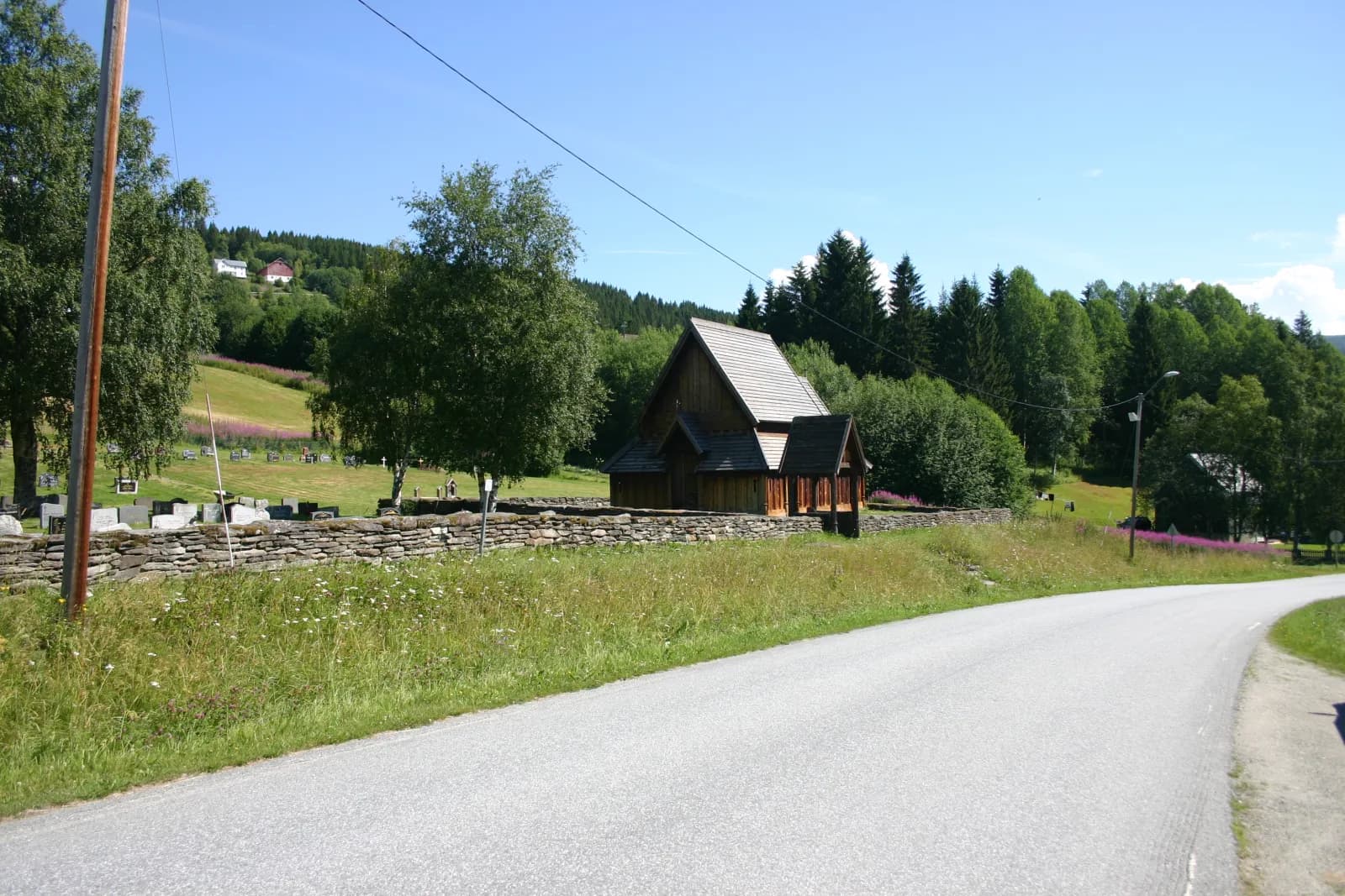
The village received its own stave-church replica in 2004, by the old cemetery beside the church from 1881. The replica has an external covered gallery around the walls. The original in Trondheim stands without one, but marks in its corner posts reveal that it once had one.
Motorhome tip: The stave church is less than 100 metres from fv. 30. The church car park is small, so keep stops short with a large motorhome and avoid services or funerals.
4. Røros — the mining town
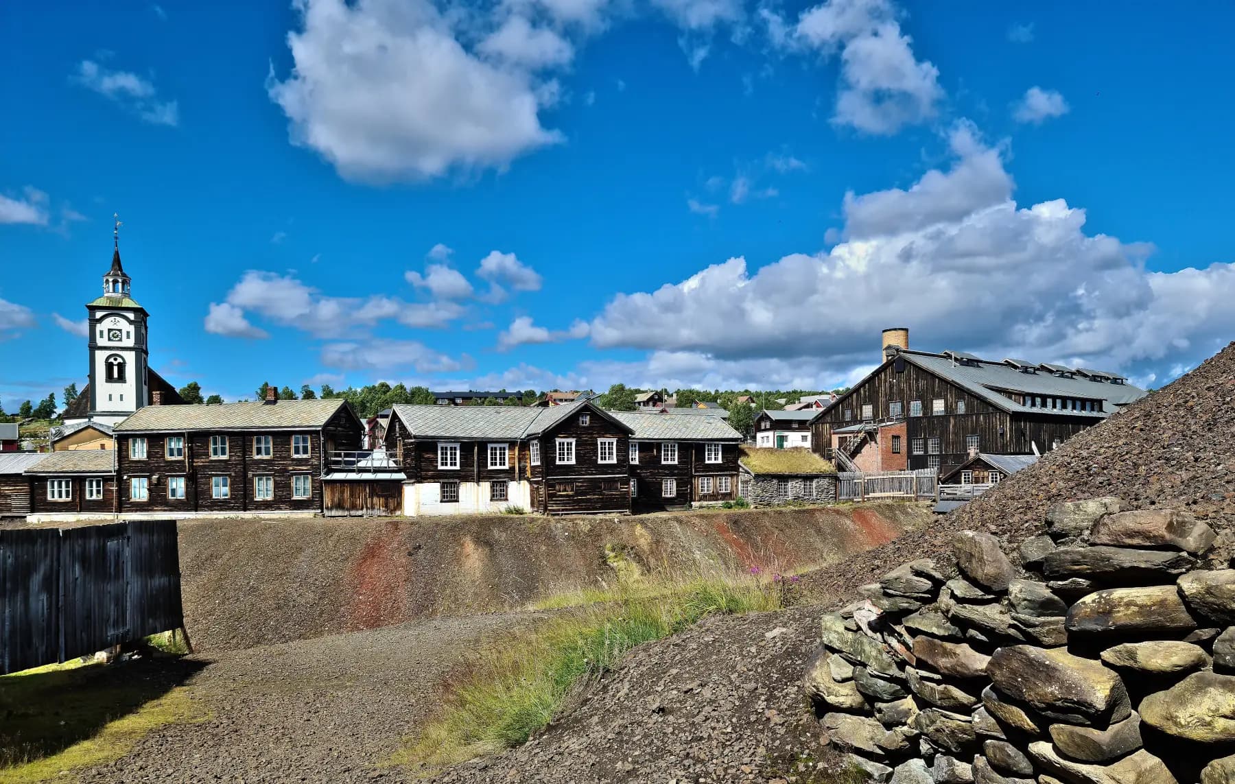
From Ålen the valley rises towards Rugldalen and Glåmos, and then Røros appears. The copper works was founded in 1644 and closed in 1977. Swedish soldiers burnt the town in 1679, and it was rebuilt in timber. The mining town entered UNESCO's list in 1980; in 2010 Circumferensen was added, the surrounding area where the works had preferential rights to ore, forest and water. The town's South Sámi name is Plaassja.
Don't miss: Røros church from 1784, Bergstadens Ziir. You can visit the church, including on a guided town walk.
Motorhome tip: Park at Røros IL's motorhome car park by Øra stadion, 500 metres from the centre, and walk in. It has electricity, showers and water. During Rørosmartnan, starting on February's penultimate Tuesday, and the Christmas market, central streets close and the town fills up. Book a pitch well ahead if coming then.
5. Smelthytta and the slag heaps
Beside Hitterelva in the town centre, ore was smelted into copper. The old smelting works burnt down; Rørosmuseet now occupies the rebuilt Smelthytta, opened in 1988. Around it lie the slag heaps, waste from around 300 years of smelting. Walk up them to see the church tower above the turf roofs.
Don't miss: Sleggveien, the narrow street of turf-roofed houses beside the slag heaps.
6. Olavsgruva — 50 metres into the mountain
Take fv. 31 east. After around six kilometres, Gruvveien branches off to Olavsgruva, 13 km from the centre. The tour begins in Nyberget, mined from 1650, and ends deep inside Olavsgruva, worked from 1936 to 1972: in Bergmannshallen, half a kilometre into the mountain and 50 metres below ground. Allow a little over an hour.
Don't miss: Warm clothes. The mine stays around five degrees, summer and winter.
Motorhome tip: Gruvveien permits vehicle combinations of 19.5 metres, and the mine has parking. In winter, bad weather can close the road. Book ahead — places are limited, and outside summer tours run only a few days a week.
7. Brekken and the mountains — where Glomma begins
Fv. 31 continues to Brekken beside Brekkfjorden, where Aursunden extends an arm northeast. Here fv. 705 branches off, initially along Brekkfjorden, then north up to around 920 metres above sea level. A little over thirty kilometres from Brekken, the road passes Mustjønna, a small tarn around 300 metres west of the road. Tradition puts Glomma's source here — Norway's longest river, 623 kilometres before reaching the sea.
Motorhome tip: Fill up in Røros or at Brekken's round-the-clock automatic pump; the next station is at Ås in Tydal, a little over 60 km away. If driving late, check it is open. Stop only where allowed and watch for reindeer — this is South Sámi reindeer pasture.
8. Stugudal and Tydal — Sylan to the east
Stugudal is the gateway to Sylan, the border mountains where Storsylen reaches 1,762 metres. Northeast of the village lies Nesjøen, dammed around 1970. When drained in 2021–2024, archaeologists found traces of South Sámi settlement from the early Viking Age on the lake bed. Beside fv. 705 west of Ås stands Tydal church from 1696, originally built with three arms like a Y.
Motorhome tip: Stugudal Camping only rents pitches for winter or a whole year. Gresslifoss Camping beside the Nea, around 12 km west of Ås, has nightly motorhome pitches in summer; call outside the season.
9. Selbu — mittens and a medieval church
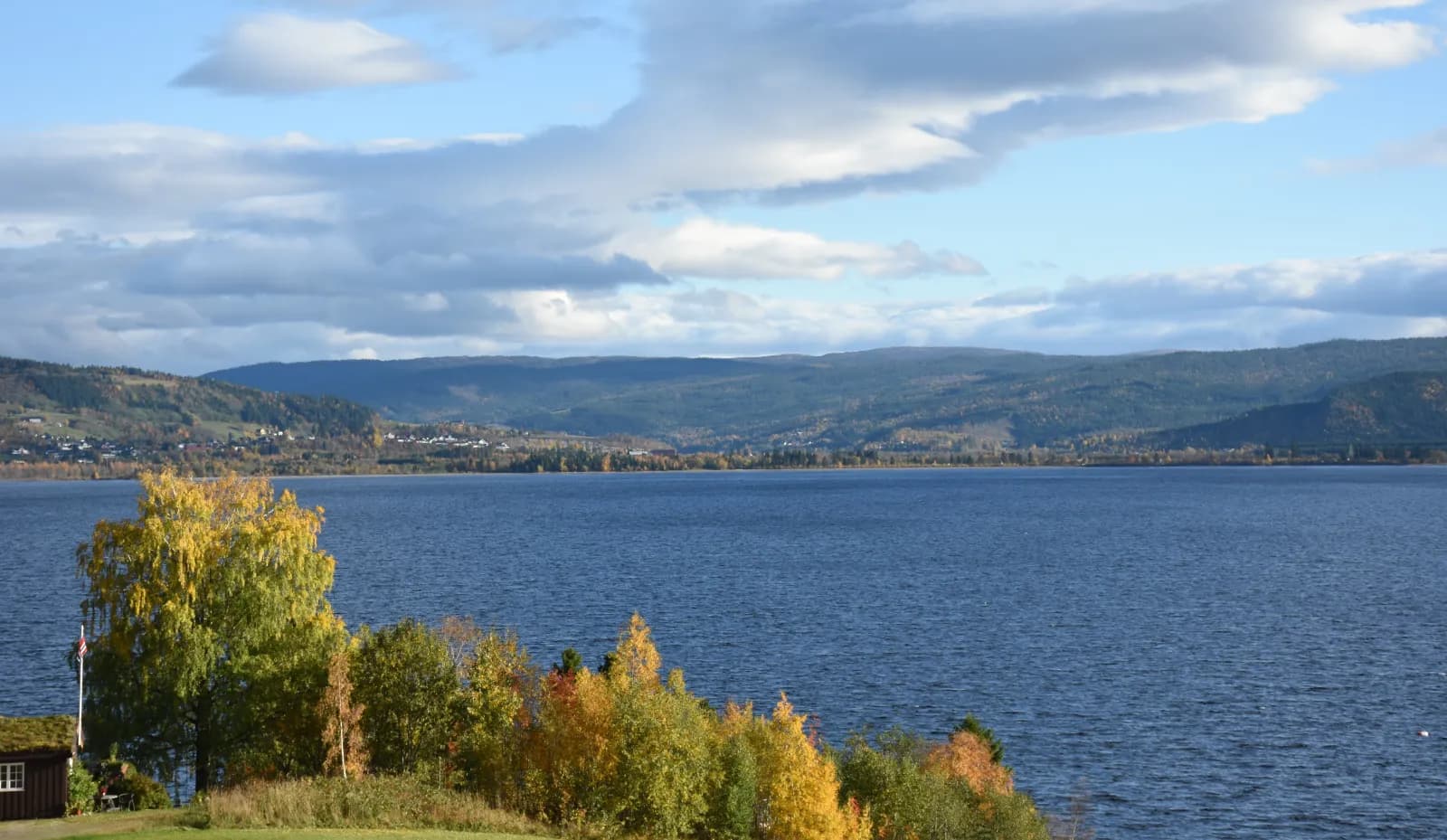
The valley opens towards Selbusjøen, one of Norway's 20 largest lakes. In Mebonden, where the Nea enters the lake, Selbu church stands beside fv. 705 — a stone church from around 1150. The village also gave its name to the Selbu mitten. It began with Marit Emstad (1841–1929): nobody sold mittens with Selbu rose patterns through Husfliden in Trondheim before her.
Don't miss: Selbu Husflidscentral beside the local museum, near the church. Selbu mittens are still sold here.
Motorhome tip: Marienborg Gjestgiveri & Camping is at the mouth of the Nea, and Selbu Camping beside the lake around five kilometres away along fv. 705. From here it is around an hour and a half to Trondheim via Hell, and Storsand Gård Camping by the E6 in Malvik suits the final night.
Practical info for motorhomes
Roads: The entire loop is paved, and E6, fv. 30, fv. 31 and fv. 705 permit vehicle combinations of 19.5 metres (the Norwegian Public Roads Administration's road database). The lowest signed height is 5.0 metres beneath a bridge on fv. 705 in Selbu; tunnels have no signed height limits. The steepest sections are short and below 10%. Fv. 705 is open all year, but storms can close the Stugudal–Brekken mountain crossing, as in January 2022. In winter, check vegvesen.no/trafikk or call 175 before crossing.
Parking: In Røros, use the motorhome car park at Øra stadion or the campsite and walk into the mining town; follow signs in central car parks. Parts of Kjerkgata are pedestrianised from June to September and in December. Parking at Haltdalen church is limited.
Overnight stays: The Outdoor Recreation Act permits camping or staying on uncultivated land at least 150 metres from an inhabited house or cabin, for no more than two days at a time without the landowner's consent — the time limit does not apply in the high mountains or far from buildings. It gives no right to park a motorhome; signs and landowner rules apply. Never drive into the terrain. Use campsites. Few open in winter — call before travelling.
Campsites:
- Røros IL Bobilparkering — at Øra stadion, 500 metres from the centre
- Røros Camping — 2 km from the centre, motorhome pitches
- Gresslifoss Camping — beside the Nea in Tydal, nightly motorhome pitches in summer
- Marienborg Gjestgiveri & Camping — in Mebonden, beside Selbusjøen, May–September
- Selbu Camping — beside Selbusjøen north of Mebonden, open all year, full service 1 May–15 October
- Storsand Gård Camping — by the E6 in Malvik, summer season (14 May to 1 September in 2027)
Fuel: Round-the-clock station at Støren, several in Røros and Selbu, otherwise automatic pumps. None between Brekken and Ås in Tydal, a little over 60 km across the mountains.
Waste disposal: Røros municipality directs visitors to the motorhome toilet and grey-water emptying point in Havsjøveien in the south of town, between Circle K and Extra. At Røros IL, cassette toilets are emptied indoors; you cannot drive up. Selbu Camping has chemical-toilet emptying. Fill water at campsites.
Ferries: None.
Combine with
- Rondane and Peer Gynt-vegen — south from Røros on fv. 30 and onwards to Folldal, about 120 km. Drive that route backwards, from one mining settlement to another. It is a summer route, with gravel on Peer Gynt-vegen.
- Femunden and Engerdal — fv. 6526 runs from Røros to the north end of Femunden, about 35 km, the final around 20 km on gravel. Femunden is Norway's third-largest lake.
- Hitra and Frøya — the same start in Trondheim, but towards the sea: Hitratunnelen and Frøyatunnelen to Titran.
- Inderøy and Den Gyldne Omvei — the same start in Trondheim, but north along the fjord: Levanger, Stiklestad and Inderøy's farm shops.
Weather
Røros is cold: Southern Norway's record low, −50.6 degrees, was measured here in January 1914. July's daily mean is around 12 degrees, and even then nights can drop below zero. July and August are the wettest months. Check yr.no for Røros, Stugudalen and Selbu, and “Fv. 705 Stugudal - Brekken” under mountain crossings.
This route is part of Bobilvei's hand-picked motorhome routes in Norway. Every route is quality-checked with a focus on motorhome suitability, parking and local experiences.