- Route
- Egersund – Hauge i Dalane – Sogndalstrand – Jøssingfjorden – Åna-Sira – Brufjell – Flekkefjord (Fv 44, Nordsjøvegen and the Jæren National Tourist Route)
- Length
- about 65 km on the Fv 44, about 75 km with the side trips to Sogndalstrand, Ruggesteinen and Brufjell. From Stavanger to Egersund: about 75 km. From Flekkefjord back to Stavanger on the E39: about 125 km.
- Driving time
- Around 1 hour 20 minutes without stops. From Stavanger it takes around 1 hour 20 minutes to Egersund, and around 2 hours 15 minutes home from Flekkefjord.
- Recommended number of days
- 2–3
- Best season
- May–September. The road is open all year, but the path to Brufjellhålene is not recommended in winter.
- Difficulty
- Moderate. The Fv 44 takes vehicles up to 19.5 metres, but at Jøssingfjorden it is narrow and winding, with two tunnels, one of them from 1922. The bridge at Åna-Sira is signed at 4.0 metres, and the road out to Brufjell has only 3–4.5 metres of asphalt.
- Last checked
- October 2026
Why this route?
The Jæren route ends in Egersund, and this is where Dalane really begins. The farmland disappears, and the heaths lie bare and pale, with smooth rock and knolls as far as you can see. The rock is called anorthosite. It is unusual on Earth, but one of the main rocks on the Moon. Magma UNESCO Global Geopark calls the bare, rounded heaths here the moon landscape.
Nordsjøvegen, the North Sea Road, is the travel route along the coast from Kristiansand to Haugesund. Between Egersund and Flekkefjord it follows the Fv 44, which is also the last part of the Jæren National Tourist Route. The stretch is short, so this is a weekend from Stavanger: drive down on Friday evening, take Dalane at an easy pace on Saturday and head home on the E39 on Sunday.
Stops along the route
1. Egersund — where the Jæren route ends
Egersund is the end point of the Jæren route and the starting point of this one. If you come straight from Stavanger, it is around 75 km on the E39. The wooden town is described in the Jæren route; here it is the sea beyond that you should see.
Don't miss: Eigerøy fyr, the lighthouse on a small island west of Eigerøya. No lighthouse on the Norwegian coast had been built of cast iron before Eigerøy fyr, which went up in 1853–54. The iron plates were bolted together on site, and to be on the safe side the tower was given a lining of 70,000 bricks on the inside. From the car park you walk around 2.3 kilometres each way through bare coastal landscape.
Motorhome tip: Don't drive the motorhome out to the lighthouse. According to Magma Geopark the road is so narrow that only cars and minibuses get all the way down to the car park. Hire a bike at the tourist office instead and cycle the roughly ten kilometres each way. The night before, you can stay at one of Eigersund Parkering's three motorhome car parks near the centre, with electricity and overnight stays allowed, but no waste disposal. The one in Sokndalsveien is on the Fv 44, where the route begins.
2. Hauge i Dalane — the centre of Sokndal
The Fv 44 climbs onto the heaths, and for the next 27 kilometres you see more rock than houses. In Hauge, the municipal centre of Sokndal, stands Sokndal kirke, a cruciform wooden church from 1803 with an altarpiece from 1608.
Motorhome tip: The municipality's motorhome site in Hauge centre has a waste disposal point for grey water and septic tanks, as well as electricity and water. The spaces are for motorhomes only, and you pay per day in the EasyPark app. Fill up with diesel in Hauge: in Åna-Sira there is only a small pump at the shop, and otherwise the next station is in Flekkefjord.
3. Sogndalstrand — the old trading post at the river mouth
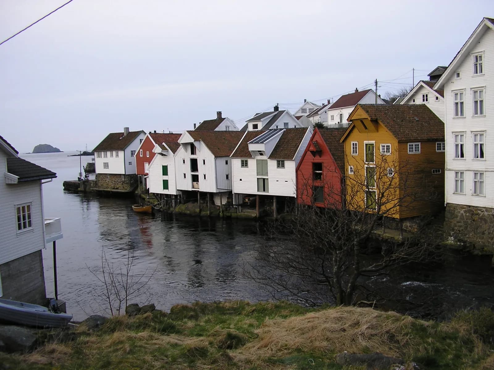
Two and a half kilometres south of Hauge the Sokna river runs into the sea, and the old trading post lies on both sides of the river mouth. The signs say Sogndalstrand; on the map it is Sogndalsstranda. Walk the street on the west side, between the sea houses and the town houses. Many of them date from the 1800s. As late as the 1880s the village shipped out large amounts of mackerel, salmon and lobster, and ten of the houses are now Sogndalstrand Kulturhotell. Since 2005 the houses and the landscape around them have been protected as a cultural environment. Until 1944 Sogndalstrand, together with Rekefjord, was a small town in its own right.
Motorhome tip: The Fv 4248, the last stretch down to the village, is six to seven metres wide. Park in the large car park by Strandaveien and walk the last 400–500 metres. The streets in the protected centre are narrow, and a motorhome has no business there.
4. Ruggesteinen — 74 tonnes on the tipping point
The ice left behind a 74-tonne boulder, and it came to rest so well balanced that you can try to make it rock. Magma Geopark calls it the largest movable stone in Northern Europe, and it was protected as early as 1923. It lies by the old ore railway from the Blåfjell mines, which is now a footpath and cycle path.
Motorhome tip: Turn off the Fv 44 east of Hauge, signed Ruggesteinen and Linepollen. After around 1.3 kilometres, park on the gravel car park by the bathing spot at Linepollen. From there it is just under a kilometre on foot.
5. Jøssingfjorden and Helleren — houses under the rock
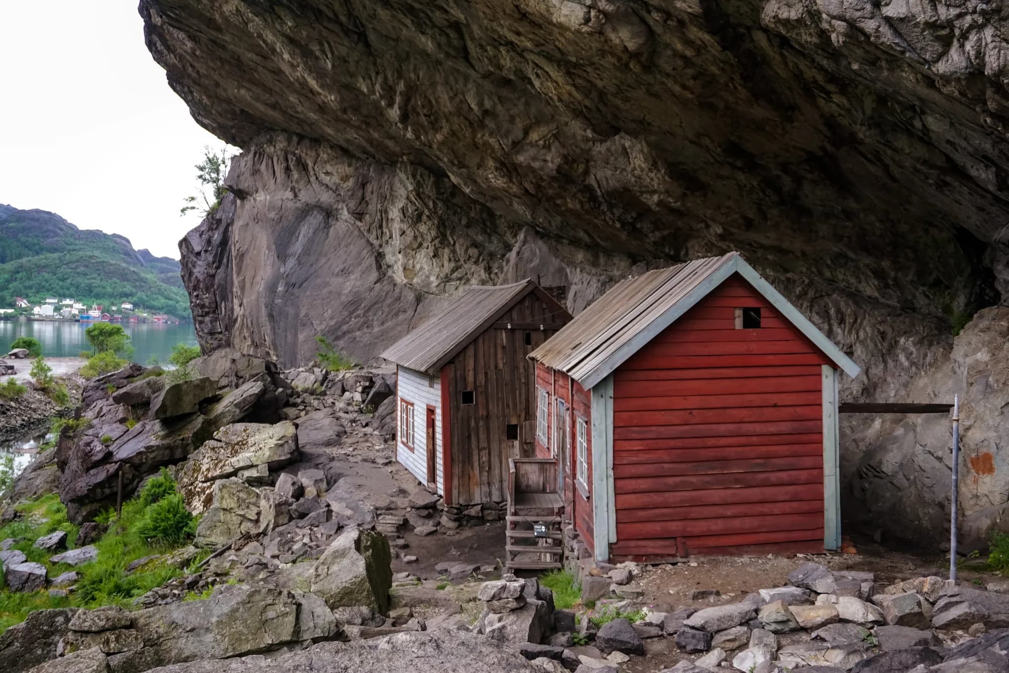
From the heath the Fv 44 winds down towards the head of a narrow fjord with steep sides. Down by the water the rock hangs out over two small houses. The red one dates from around 1840, the other probably from the 1700s. The overhang is ten metres deep where it reaches furthest out, and archaeologists have found traces of people here going back to the Stone Age. You can't go inside, but you can get close.
The fjord also has a wartime story. On 16 February 1940 the British destroyer HMS Cossack came in here, boarded the German supply ship Altmark and freed 299 British prisoners. Norway was neutral, and the affair had major consequences. The Norwegian Nazi party later tried to use “jøssing” as a term of abuse, but the word became a badge of honour for Norwegians who stood up to the occupation.
Don't miss: Jøssingfjord Vitenmuseum close by, a science museum about the geology and mining of Dalane and about the Altmark. It is usually open Tuesday–Sunday, and every day in the summer holidays. You can visit the café without a ticket.
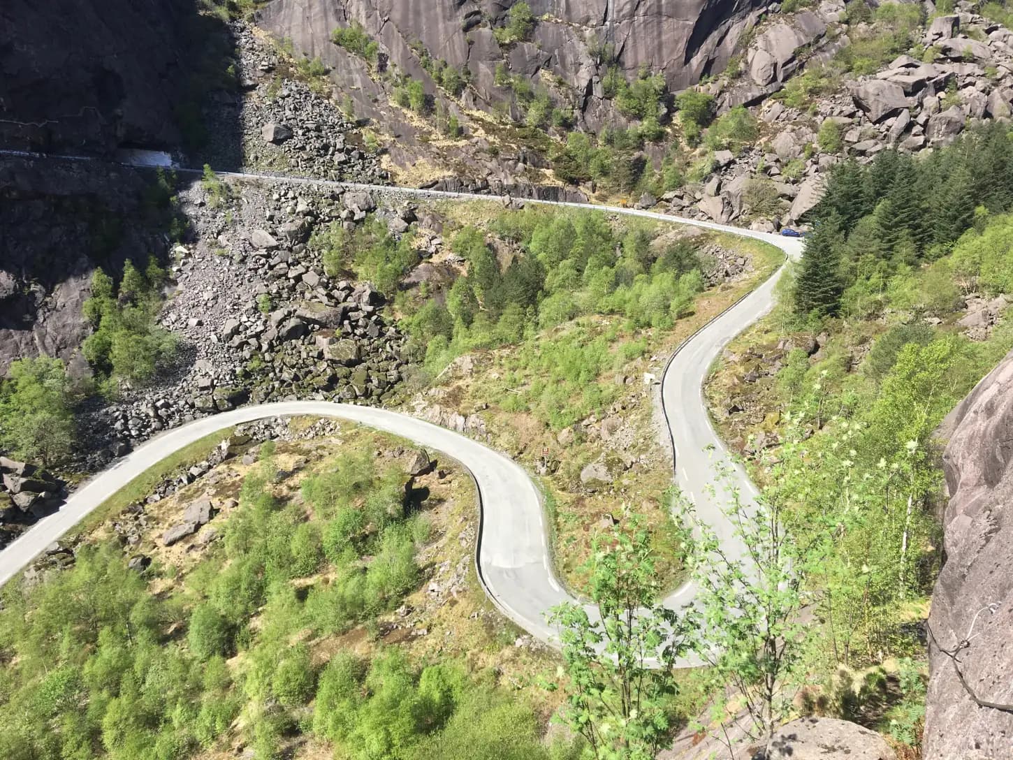
Motorhome tip: Follow the signs to the motorhome parking by the science museum. From the museum's car park it is under five minutes' walk to the houses. Take the bends slowly on both sides of the fjord. Both tunnels are signed at 4.5 metres. The road database gives a width of five metres for the long one (245 metres, on the north side) and four for the short one from 1922 south of Helleren. Two large vehicles cannot pass each other in either of them: if you meet a lorry or a motorhome, wait before the tunnel.
6. Åna-Sira — the border at the river
When you cross the bridge at Åna-Sira, you drive from Rogaland into Agder: the Sira river is the county border, and the village has houses on both sides. The wooden church from 1888 stands on the Sokndal side.
Motorhome tip: Sokndal municipality has a motorhome site just before the bridge, with electricity, a toilet building, toilet emptying and water. Here too the spaces are for motorhomes only, and you pay in EasyPark. The bridge over the Sira is signed with a 4.0-metre height limit. If your motorhome is taller, you cannot cross: drive the Fv 44 to Jøssingfjorden and back, and then take the E39 from Egersund to Flekkefjord.
7. Brufjell — potholes at the edge of the sea
The path starts where the road ends and takes you first up onto Brufjell, 184 metres high, with Lista on the horizon. Then it heads down towards the sea, to the potholes in a ledge in the cliff, around 20 metres above the water. Between 8,000 and 4,000 years ago the sea stood at the same height against this wall for thousands of years, because land and sea rose in step, and the waves had time to grind out the holes. The last stretch involves climbing, with handholds fixed in the rock, and the ledge at the bottom drops straight into the open sea — keep well back from the edge. Magma Geopark advises against the walk for children under ten and in rain, dogs are not allowed, and you should set aside at least five hours.
Motorhome tip: Half a kilometre after the bridge at Åna-Sira, the Fv 4142 turns off towards Roligheten. The road is narrow, with 3–4.5 metres of asphalt according to the road database. The car park around two kilometres in has room for around 25 cars, and from there you walk on along the road to the path. If it is full, all that lies ahead is an even narrower road, under three metres at its narrowest, and a turning place with no parking at the far end. With a large motorhome, or on a fine summer day, it is safer to stop at Brufjell Hostel & Parking, around a kilometre in, and walk from there. It has spaces for motorhomes, with electricity, showers and toilet emptying. Flekkefjord municipality closes Brufjellparken, toilets included, from 1 November to 1 March inclusive.
8. Flekkefjord — Hollenderbyen
From Åna-Sira it is 18 kilometres to the town at the head of the fjord. From the 1600s Dutch ships sailed here to fetch timber, which is why the old part of town is called Hollenderbyen, the Dutch Town. The houses stand close together, and the streets are cobbled. Flekkefjord museum is housed in a merchant's house from 1724. Look out for the octagonal wooden church from 1833 too.
Don't miss: A draisine ride on Flekkefjordbanen, the disused railway to Sira. The draisine is pedal-powered, and the trip goes through 17 tunnels. It takes around three and a half hours and runs from April to September.
Motorhome tip: Flekkefjord bobilcamp lies by the sea, three minutes' walk from the centre, with electricity, water, sanitary facilities and a waste disposal point. You pay the daily rate at a machine on site. Egenes Camping by the lake Selura, five kilometres east of the centre, is open all year. To get home to Stavanger, take the E39 via Moi.
Practical info for motorhomes
Roads: The Fv 44 is open to vehicles up to 19.5 metres all the way (Statens vegvesen's road database). From Egersund to Hauge the asphalt is mostly more than six metres wide. Between Hauge and Åna-Sira it is around six metres, but almost a fifth is under five, mostly at Jøssingfjorden, and dangerous bends are signed on both sides of the fjord. From Åna-Sira towards Flekkefjord more than a quarter is under five and a half metres. The lowest signed height is 4.0 metres on the bridge at Åna-Sira; elsewhere 4.3 metres under a bridge at Nodland south of Egersund and 4.5 metres in the tunnels at Jøssingfjorden. The road is open in winter, but the bends can be slippery. Check vegvesen.no before you drive.
Parking: Use the large car parks by the science museum in Jøssingfjorden and by Strandaveien in Sogndalstrand. At Brufjell space is tight (see stop 7). Never park in passing places.
Overnight stays: The municipalities have made room for you: three motorhome car parks near the centre of Egersund, two motorhome sites in Sokndal (Hauge and Åna-Sira) and the motorhome camp in Flekkefjord. Use them. On uncultivated land the Outdoor Recreation Act requires a tent to be at least 150 metres from an inhabited house or cabin, and that you stay no more than two days in the same place without the owner's permission. The rule applies to tents and gives no right to leave the motorhome anywhere you like for the night. Never drive off-road.
Campsites:
- NAF Steinsnes Camping — three kilometres north of Egersund, open all year
- Bakkaåno Camping & Gjestegård — farm campsite by the river, signed from the Fv 44 east of Hauge, two to three kilometres in
- Brufjell Hostel & Parking — at Brufjell, motorhome spaces with electricity and waste disposal
- Egenes Camping — by Selura, five kilometres east of Flekkefjord, open all year
Fuel: Several stations in Egersund, in Hauge and in Flekkefjord. In Åna-Sira there is only a small pump at the shop, and between Hauge and Åna-Sira there are none.
Waste disposal: Not in the toilets along the tourist route — Statens vegvesen does not allow it. The motorhome car parks in Egersund have no waste disposal; Steinsnes Camping takes drop-in visitors for grey water and filling up with water. Empty in Hauge (grey water and toilet), in Åna-Sira (toilet), at Brufjell Hostel & Parking, at the motorhome camp in Flekkefjord or at Egenes.
Ferries: None.
Combine with
- Jæren — drive the coast from Stavanger to Egersund on the first day instead of the E39. This route starts where that one ends.
- Lindesnes and Lista — carry on east from Flekkefjord towards the flatlands of Lista and Lindesnes fyr.
- The Sørland coast — from Flekkefjord it is around 100 km on the E39 to Kristiansand, where that route starts.
- Setesdal and Hovden — also starts in Kristiansand and heads north along the Rv 9.
- Hidra — the island off Flekkefjord, with the village of Kirkehamn and the old wooden houses of Rasvåg. You get there on a short ferry crossing from Kvellandstranda.
Weather
Dalane gets far more rain than Jæren. In Flekkefjord the normal is around 2,250 millimetres a year. May and June are the driest months, with around 100 millimetres, while October–January bring well over twice that. July has a normal daily mean of 15 degrees. Pack waterproofs, in July too. Check yr.no for Egersund, Hauge i Dalane and Flekkefjord.
This route is part of Bobilvei's hand-picked motorhome routes in Norway. Every route is quality-checked with a focus on motorhome suitability, parking and local experiences.