- Route
- Mandal – Lindesnes fyr – Spangereid and Båly – Farsund – Loshavn – the Lista beaches – Lista fyr – Nordberg fort and Vanse – Flekkefjord (E39, Fv 460, Fv 4078, Fv 43, Fv 470, Fv 463 and Fv 465)
- Length
- about 170 km from Mandal to Flekkefjord, including the drive out to Lindesnes lighthouse and back to Spangereid (around 23 km). From Kristiansand to Mandal it is about 40 km on the E39.
- Driving time
- Around 3.5 hours without stops
- Recommended number of days
- 2–3
- Best season
- May–September. The roads are open all year, but several campsites close in September.
- Difficulty
- Easy. Good roads, no mountain passes and no ferries. The Fv 4078 over Jåsund is narrower, and the last stretch into Loshavn is too narrow for a motorhome.
- Last checked
- October 2026
Why this route?
The Sørland coast heads east from Kristiansand. This route goes the other way. Just over half an hour west of the city lies Mandal, and beyond Lindesnes the coast changes character. The headland divides the Skagerrak from the North Sea, and on the western side the land grows lower and the wind fresher. On Lista a flat plain, three to four kilometres wide, lies between the heath and the sea, with dry-stone walls, farms in clusters, protected beaches and bird reserves.
The distances are short, so two or three days is plenty: a night near the lighthouse, one on Lista, and time to walk by the sea. The route ends in Flekkefjord, where the North Sea Road through Dalane takes over towards Egersund.
Stops along the route
1. Mandal — town beach and artists
There was lively trade on the Mandalselva river as early as the 1500s, which is why Mandal is often called the oldest town in Sørlandet. The painters Adolph Tidemand, Amaldus Nielsen and Olaf Isaachsen were born here, and so was the sculptor Gustav Vigeland. Mandal museum in Andorsengården, from 1805, holds work by all four, but it seldom has regular opening hours, so check vestagdermuseet.no first. Just west of the river mouth lies Sjøsanden, the town's long sandy beach, with the pine woods of Furulunden right behind it.
Don't miss: Mandal kirke. It was finished in 1821, after the town fire, and has 1,300 seats. Few wooden churches in Norway are larger.
Motorhome tip: Mandal Parkering has its own area for motorhomes by the Buen cultural centre, open day and night. It is paid, and there is no electricity, water or toilet. The municipality's free waste disposal point at the Grønvika treatment plant is signposted from the E39 and has drinking water. In Furulunden, Sjøsandskogen and at Risøbank, overnight stays outside the campsite are forbidden, and dogs must be kept on a lead all year in Furulunden and at Risøbank. Topcamp Sjøsanden lies between the woods and the beach.
2. Lindesnes fyr — where the land ends
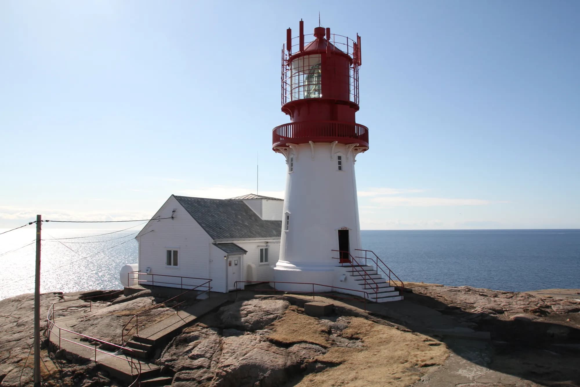
At Vigeland you turn off the E39 and follow the Fv 460 for 27 kilometres, over the Spangereid canal and right out to the southern tip of the Norwegian mainland. The name is said to mean something like the headland where the land runs out. This is where Norway got its first lighthouse, lit on 27 February 1656. The tower you see today is younger: 16 metres of cast iron from 1915, with a lens from Paris that is more than 60 years older than the tower itself. Lindesnes is also the only lighthouse in the country where keepers still work. It is usually open every day all year, except over Christmas and New Year.
Don't miss: The permanent exhibition about the «Palatia». Nearly a thousand people died when the ship was sunk off the headland in 1942, most of them Soviet prisoners of war.
Motorhome tip: Stay on the Fv 460 from Vigeland and follow the signs to the lighthouse. Your satnav may suggest a short cut west of Vigeland, Gåsesteinsveien and Møgedalsveien: narrow country roads with a gravel surface. The car park is where the road ends. The lighthouse sells overnight parking with two entry tickets included, but there is no electricity, water or waste disposal. Lindesnes Camping at Lillehavn, just under four kilometres back, has electricity and is open from 1 April to 15 September. You can empty your tanks free of charge at Gahre in Spangereid.
3. Spangereid and Båly — the canal and the restaurant under the sea
On the way back you cross the low isthmus at Spangereid, where the peninsula joins the rest of the country. Boat people have long used it as a short cut: in the Middle Ages they dragged their boats over land here rather than round Lindesnes. In 2001 archaeologists found traces of what was probably a canal from the 700s. The canal you see today was finished in 2007. It is 930 metres long and meant for small boats, with a park laid out along its banks. Out at Båly lies Under, Norway's only underwater restaurant, opened in 2019. The tables stand five and a half metres below the surface, facing a window of around 11 metres onto the seabed. From land you see the grey concrete body disappear into the sea.
Don't miss: Spangereid kirke, a stone church from the 1200s.
Motorhome tip: Under refers guests to the car park at the hotel next door. With a large motorhome it is probably easier to park by the canal and walk the kilometre or so out to Båly. If you want to eat there, you must book a table in advance, and children under ten are not admitted. The municipality's free waste disposal point at the Gahre treatment plant in Spangereid is open day and night and has drinking water. Overnight stays are forbidden at Njervesanden, the beach at Spangereid.
4. Farsund — the Lund family's town
From Spangereid the Fv 4078 takes you north over Jåsund bridge and on towards Lyngdal, where the Fv 43 turns west to Farsund. The town is the work of the Lund family: the merchant Jochum Brinch Lund built it up at the end of the 1700s, and in 1795 Farsund was granted trading-port status. Much of what stood before 1901 was lost when the town burned that year. It is spread over the mainland and three small islands in the sound, all linked by bridges.
Don't miss: The town walk with the watchman. Only two Norwegian towns still have a night watchman, and Farsund is one of them. The walk is free, needs no booking and usually starts at 12 noon Monday–Saturday from late June to early August, at «De fire trær» (the four trees) on the square.
Motorhome tip: Camp Farsund on Farøy has 25 motorhome spaces, a short walk from the centre. You pay by number-plate recognition or at a machine. Water and electricity are available as far as capacity allows, and you empty the toilet at the marked place. You get the code for the showers and toilets when you pay in advance. Check bobilcampfarsund.no before you come outside the summer.
5. Loshavn and Lomsesanden — the outport and the beach
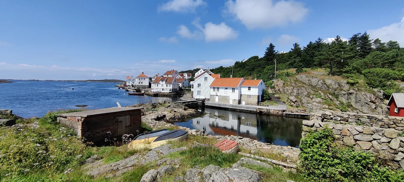
In the privateering war of 1807–1814 the privateers knew how to hide in Loshavn, at the far south-eastern corner of Lista, and the pilots had their station here. Loshavn and the neighbouring hamlet of Eigvåg were Farsund's outports, and in 1865 more than 200 people lived in the two. Today the white houses round the little harbour are mostly holiday homes, and only a few people live here all year.
Just west of Eigvåg lies Lomsesanden. This is where the Listastrendene protected landscape begins, and the campsite lies inside it.
Motorhome tip: The last kilometre from Eigvåg into Loshavn is mostly less than four metres wide, down to 2.8 metres at its narrowest. Park on the gravel area at the junction by Eigvåg and walk in. Lomsesanden Camping, a couple of kilometres away, has motorhome pitches with electricity and its own disposal point for toilet waste and grey water. In 2026 it was open from 19 March to 27 September.
6. The Lista beaches — sand, stones and migrating birds
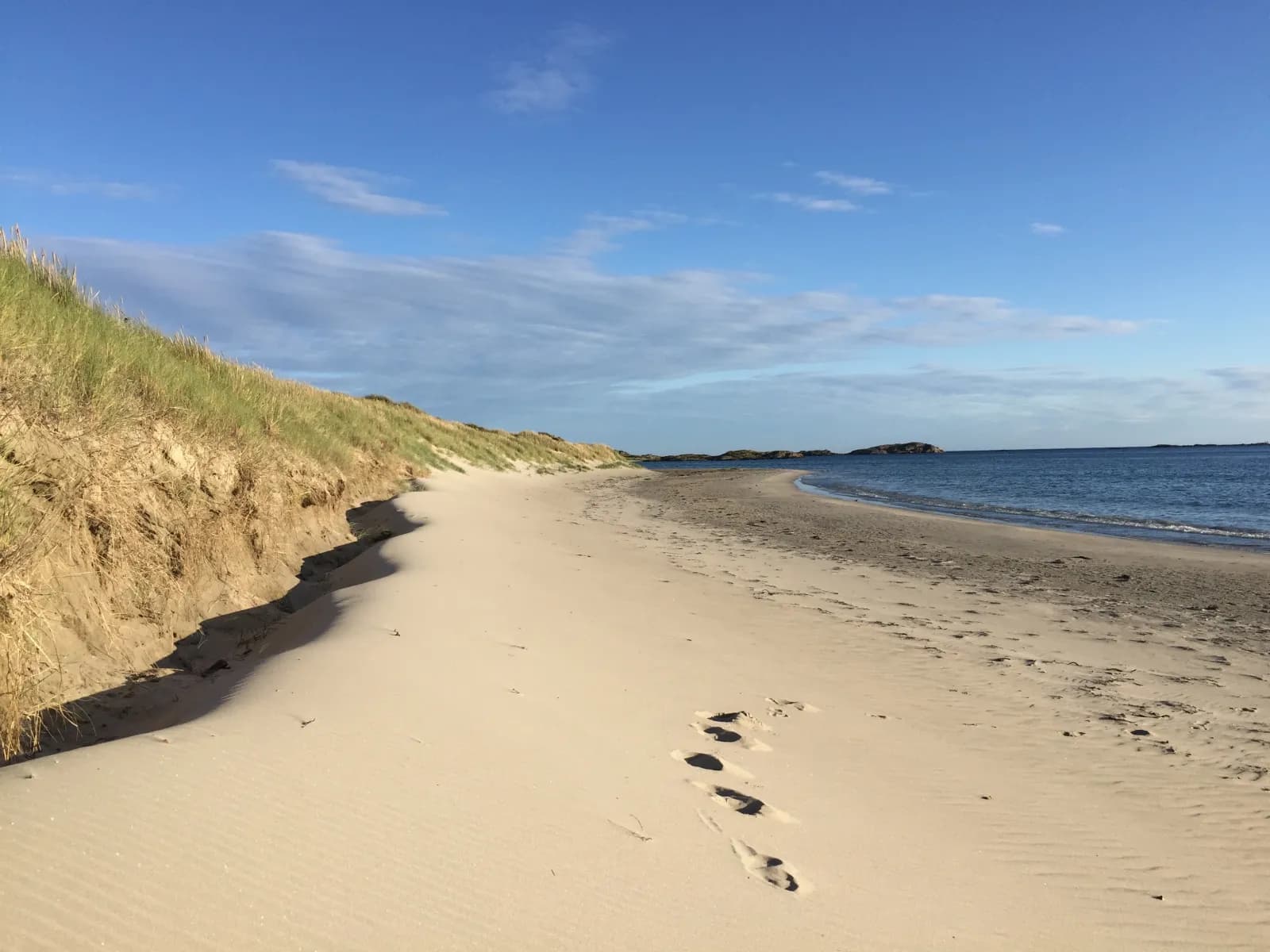
Further west the Fv 470 crosses the plain, and the beaches line up along the sea: Havika, Kviljosanden and more. From Lomsesanden in the south to Varnes in the north the coast has been protected since 1987, with sandy beaches, dunes and rounded stones, and bird reserves in between. The beaches and the wetlands behind them matter for migrating birds and for birds that spend the winter here.
Don't miss: A long walk along the shore at Havika. Keep your distance from the birds, especially in spring.
Motorhome tip: Use the marked car parks by the beaches. Driving off public roads and approved car parks is forbidden throughout the protected area, and tents and camping are forbidden in the dunes and in several of the bird reserves. Dogs must be on a lead from 1 March to 1 November in the bird reserves of Einarsneset, Havika, Kviljoodden, Fuglevika, Nordhasselvika and Steinodden, and over the same period wherever livestock graze. At the protected lakes and wetlands on Lista the lead rule applies all year, and elsewhere from 1 April to 20 August.
7. Lista fyr — the bird station by the sea
Lista lighthouse was first lit in 1836, a 34-metre granite tower. Because sailors could mistake its light for another lighthouse, the station got two more towers in 1853, and for twenty years Lista was the largest lighthouse station in the world. Today the lighthouse is just as well known for its birds. Lista bird observatory has been based on the lighthouse grounds since 1990 and is run by BirdLife Norway. It rings around 6,000 birds a year. The lighthouse has a café, a shop, exhibitions and tourist information, usually open every day from May to October and at weekends the rest of the year.
Don't miss: The bird ringing. The observatory shows visitors its work from mid-March to early June and from mid-July to mid-November. Book a time through listafyr.no and come early: the nets are up from sunrise until around 11 or 12 noon.
Motorhome tip: Stay on the Fv 43 all the way out to the lighthouse and on the Fv 463 towards Nordberg. Your satnav may choose Skollevollveien, a short gravel road. The tower itself was closed in summer 2026 for maintenance, so check listafyr.no before counting on the view. Borshavn Bobilcamp lies in the fishing harbour at Borhaug, just under two kilometres away. The municipality runs it, with 14 spaces, electricity, water, toilets, showers, a washing machine and a separate room for emptying toilet waste. The spaces cannot be booked, and you pay on arrival.
8. Nordberg fort and Vanse — the war and «American Lista»
During the occupation the Germans built Nordberg fort, in 1942. The buildings and trenches have survived, and from the fort you look out over much of Lista. A newer museum building has a café and exhibitions on the war years and on Lista's earliest history. Entry is free. The fort is usually open every day in midsummer and on Sundays the rest of the year. Further on you pass through Vanse, which has earned the nickname «Det amerikanske Lista», American Lista. Many Norwegian-Americans have settled here, and you can see it on the signs: both roads and shops have been given American names.
Don't miss: The exhibition «Med Junaiten i trunken» at the fort, about the people who left Lista to work in America. It has its own ticket.
Motorhome tip: The last 500 metres up to the fort are a narrow single-lane municipal road. Go back the same way: your satnav may suggest the Fv 4122 northwards, which is mostly less than four metres wide and only approved for vehicles up to 15 metres long. Vanse Bobilcamp in the middle of the village has 12 spaces with electricity, water, toilets, showers and toilet emptying, on a first-come, first-served basis.
9. Flekkefjord — on to Dalane
From Vanse you drive the Fv 43 east for just under five kilometres, then take the Fv 465 north, through the Ravnehei tunnel and past Åpta, to the E39. From there the E39 runs west to Flekkefjord, around 50 kilometres from Nordberg in all. Flekkefjord has its old Dutch quarter, Hollenderbyen, and a motorhome camp by the sea. Both are described in the North Sea Road through Dalane, which ends here.
Motorhome tip: The motorhome camp in Flekkefjord has both electricity and a waste disposal point, and the centre is close by. If you would rather stop for the night before you get there, Camp Åpta, at the head of Åptafjorden just off the Fv 465, takes motorhomes too.
Practical info for motorhomes
Roads: The Fv 460, Fv 4078, Fv 472, Fv 43, Fv 470, Fv 4098 (to Eigvåg), Fv 463, Fv 4126 and Fv 465 are open to vehicles up to 19.5 metres long (Statens vegvesen's road database). The Fv 460 from Vigeland out to the lighthouse mostly has more than six metres of asphalt. The Fv 4078 over Jåsund is narrower, mostly 5–6 metres. If you prefer a wider road, you can drive back to Vigeland and take the E39 and the Fv 43 through Lyngdal. That adds around 20 km, and near Vigeland you may pass through an underpass on the E39 signed at 4.3 metres. On the route as described, the lowest signed height is 4.5 metres: Audna bridge on the Fv 460 at Vigeland and the tunnels on the Fv 43 and Fv 465. The road into Loshavn and the Fv 4122 north of Nordberg are narrow. There are no mountain passes, and the roads are open all year. Check vegvesen.no before you drive.
Parking: At Lindesnes lighthouse there is a large car park where the road ends. In Mandal motorhomes have their own spaces by Buen. For Loshavn, park at the junction by Eigvåg, and at the Lista beaches only in marked car parks. Never park in passing places.
Overnight stays: Lindesnes municipality says plainly that the right to pitch a tent for two days on uncultivated land does not apply to motorhomes and caravans. Overnight stays are forbidden in the Furulunden area of Mandal and at Njervesanden. In Farsund the signs decide: where a sign bans motorhomes for a period of time, the municipality issues a penalty for breaches. Camping is forbidden in the dunes on Lista. Use the motorhome sites and campsites; there are plenty of them all along the route.
Campsites:
- Topcamp Sjøsanden, Mandal — between Furulunden and the beach, the campsite opens in late March
- Lindesnes Camping og Hytteutleie, Lillehavn — 1 April–15 September
- Camp Farsund, Farøy — 25 motorhome spaces near the centre
- Lomsesanden Camping, Farsund — usually from mid-March to late September
- Borshavn Bobilcamp, Borhaug — municipal, 14 spaces by Lista lighthouse
- Vanse Bobilcamp, Vanse — municipal, 12 spaces
- Camp Åpta, Åptafjorden — by the Fv 465 towards the E39
- Flekkefjord bobilcamp and Egenes Camping, Flekkefjord
Fuel: Fill up in Mandal or at the Vigeland turn-off before you head out towards Lindesnes. Along the Fv 460 and Fv 4078 there is little choice. Lyngdal is close to where the Fv 4078 meets the Fv 43, and Farsund, Vanse and Flekkefjord have several stations.
Waste disposal: Lindesnes municipality has two free waste disposal points, open day and night all year, both with drinking water: at the Grønvika treatment plant in Mandal and at the Gahre treatment plant in Spangereid. Topcamp Sjøsanden has disposal for its guests. There is no disposal at Lindesnes lighthouse. In Farsund you can empty at Camp Farsund, and guests can empty at Lomsesanden, Vanse Bobilcamp and Borshavn Bobilcamp. In Flekkefjord the motorhome camp has a waste disposal point.
Ferries: None.
Combine with
- The Sørland coast — starts in Kristiansand, around 40 km east of Mandal, and heads east to Kragerø. Together the two routes cover almost the whole coast from Kragerø to Flekkefjord.
- The North Sea Road through Dalane — this route runs from Egersund to Flekkefjord. Drive it in reverse from Flekkefjord, around 65 km on the Fv 44 to Egersund.
- Jæren — from Egersund on along the coast to Stavanger.
- Setesdal and Hovden — starts in Kristiansand and heads north along the Rv 9 to the top of the valley.
Weather
The sea keeps Lista mild in winter and cool in summer. At Lista lighthouse February is the coldest month, with a normal of around 2 degrees, and August the warmest at around 16. May is the driest month and October the wettest. The wind is often fresh on this coast, so pack a good jacket, in July too. Check yr.no for Mandal, Lindesnes fyr and Farsund.
This route is part of Bobilvei's hand-picked motorhome routes in Norway. Every route is quality-checked with a focus on motorhome suitability, parking and local experiences.