- Route
- Stavanger – Sola – Bore – Orre – Obrestad – Kvassheim – Brusand – Ogna – Egersund (Fv 507 and Fv 44, National Tourist Route Jæren from Bore)
- Length
- about 100 km along the coast, about 115 km including side trips to beaches and lighthouses. Back from Egersund to Stavanger: about 75 km.
- Driving time
- Around 3 hours without stops to Egersund including the side trips; around 1 hour and 20 minutes back via the E39
- Recommended number of days
- 2–3
- Best season
- May–September. The roads are open all year, and the autumn storms have their own following.
- Difficulty
- Easy. Flat, no tunnels south of Sola, no ferries. Watch out for wind, cyclists and low railway underpasses on side roads.
- Last checked
- October 2026
Why this route?
From central Stavanger to the first sandy beach it is only 15 kilometres. From there you follow the coast south through Norway's largest lowland plain: flat fields, stone walls, farms sitting low in the landscape — and behind it all, the North Sea.
This is a weekend trip rather than a mountain route: head out on Friday, sleep at a campsite by the sea and come home on Sunday. From Bore you follow National Tourist Route Jæren, an ordinary country road where you share the asphalt with tractors. Jæren is a working landscape, and every stone wall was built from stones cleared from the soil.
Stops along the route
1. Sola — the beaches closest to town
Solastranden lies just west of the airport, and a kilometre away stands Sola ruinkirke, rebuilt in 1995 on the walls of a church from the 1100s. Smaller county roads continue past the fishing harbour at Ølberg, where you can buy freshly cooked crab, to Hellestøstranden. From Ræge to Hellestø you can walk all the way along the coastal path.
Motorhome tip: The car park at Solastranden is large. The roads beyond are five–six metres wide, with many cyclists in summer. Ølberg Camping lies just behind the dunes and has a summer season, usually from early May to 31 August.
2. Borestranda — the surfers' beach
The sand stretches between Hodne and the mouth of the Figgjo, and when the waves roll in, the surfers line up. Out at sea northwest of the beach stands Feistein lighthouse, dating from 1859.
Don't miss: The service building by the car park, designed by Lie Øyen Arkitekter, with toilets open all year, and a shower.
Motorhome tip: Large car park, but arrive early on warm summer days. Bore Strandcamping is 200 metres from the beach and open all year.
3. Orre — five kilometres of sand
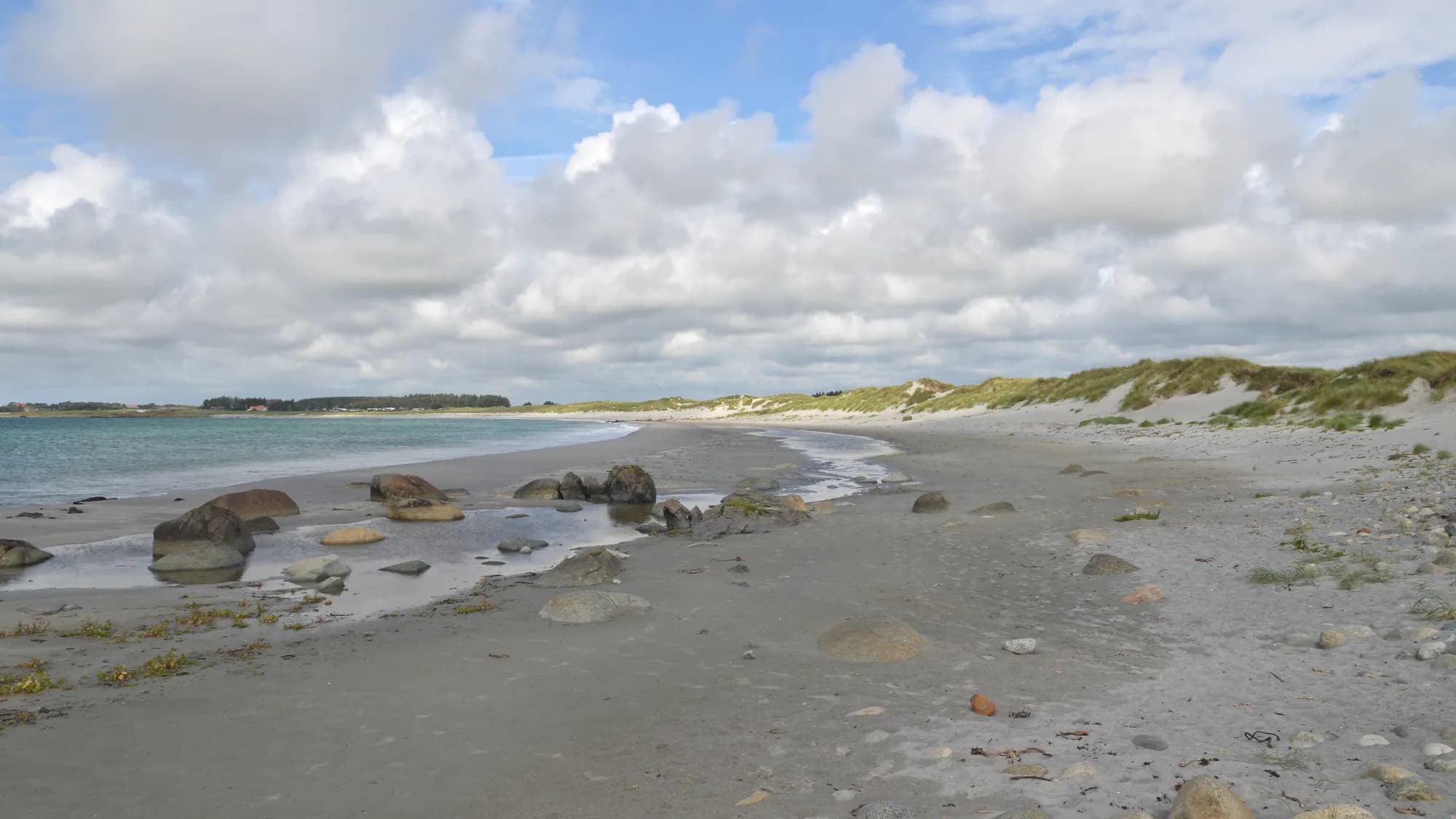
At Orre only a narrow strip of sand separates the sea from Orrevatnet. The beach is around five kilometres long, and Nasjonale turistveger calls it the country's longest sandy beach. The stone church Orre gamle kyrkje, built around 1250, stands by the river flowing out of Orrevatnet.
Don't miss: Friluftshuset, Jæren friluftsråd's nature centre, and the walk north to Revtangen, home to the Nordic countries' oldest bird observatory since 1937.
Motorhome tip: Park at Friluftshuset — parking is prohibited at the turn-off from the county road.
4. Refsnesstranda — sand and pebbles
Walking south from the car park brings you to sand and dunes; northwards it is mostly pebbles. From the aluminium toilet building, a path made of sleepers leads down towards the dunes — keep to it.
Motorhome tip: The car park is small. The toilets are open all year, but not for emptying motorhome toilets.
5. Hå gamle prestegard and Obrestad lighthouse
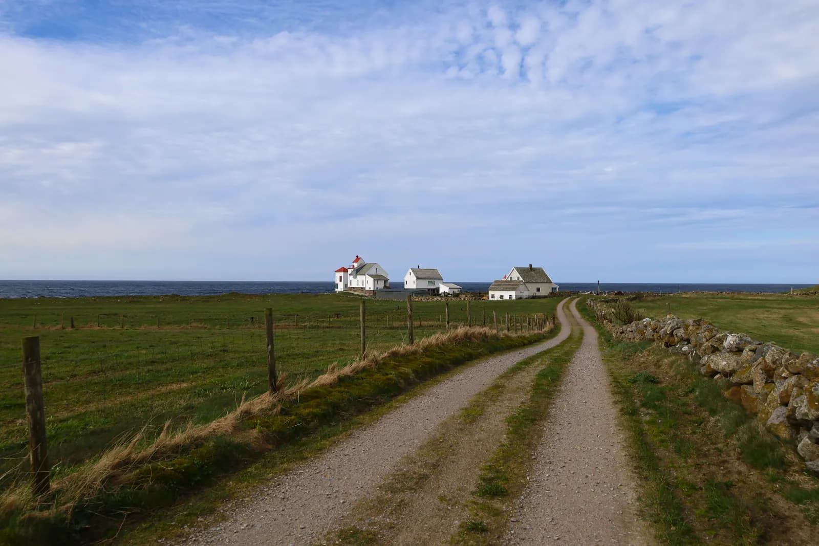
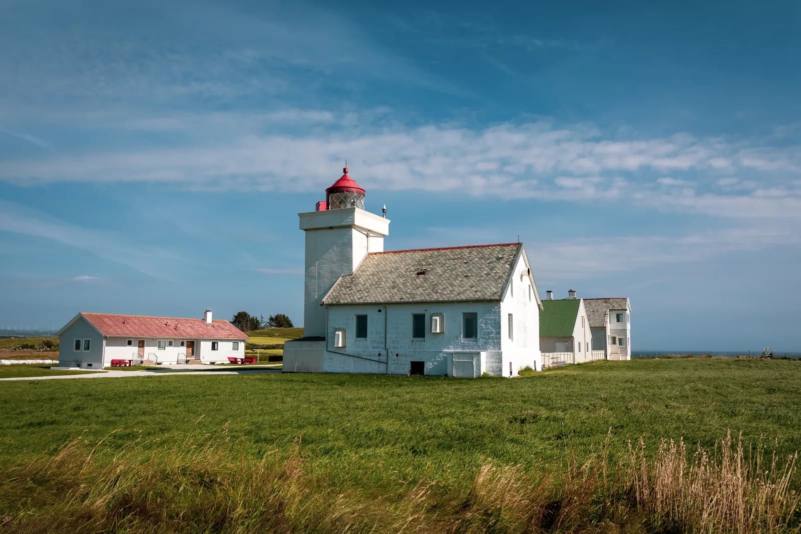
At Vigre, Håvegen branches off the Fv 44. It passes Obrestad and ends at the vicarage, which dates from 1637 and now houses contemporary art and a café, surrounded by an area of ancient monuments. Further south stands Obrestad lighthouse from 1873, with a small harbour just to its south. The fog signal from 1950 had such deep tones that people called it “Studen på Obrest”.
Motorhome tip: Håvegen is narrow — over a third is less than five metres wide. There is little room at the lighthouse. The vicarage has a larger car park around a kilometre further north.
6. Madland hamn — the storm shelter
Madland hamn lies between Varhaug and Vigrestad. On a day with gale-force winds, take your coffee down to the storm shelter, sit behind the glass and watch waves strike the two breakwaters. Your vehicle stays in the long parking area just above.
Motorhome tip: The toilets by the car park are open all year.
7. Kvassheim lighthouse — Friluftsfyret
Jæren friluftsråd has opened the lighthouse from 1912 to everyone: a café in the engine house, and exhibitions on wetlands, birds and plastic in the sea in the lighthouse keeper's house. A separate building houses the gig from Ingermanland, the Russian ship of the line that was wrecked in 1842. 389 people died.
Don't miss: The view from the old lantern. The islet Raunen out in the bay is a bird sanctuary, with access on land prohibited from 15 April to 31 July.
Motorhome tip: The lighthouse car park is small and gravelled. The café usually opens at weekends from January to October, and Tuesday–Sunday from late June to mid-August.
8. Brusand and Ogna — where Jæren ends
Jæren ends at Brusand: north of the village lie the plains, while to the south the moors of Dalane take over. Brusanden and Ognasanden are long sandy beaches with large dunes. Many ships have run aground in Ognabukta, and this is where Tønnes Puntervold, the man behind Redningsselskapet, had his idea. At Ogna Camping, Jærmuseet's small sea rescue museum, Varden, tells the story. At Brusand the Germans' stone barriers still stand in rows, built against an invasion from the sea — people call them “Hitlertennene”.
Don't miss: Ogna kyrkje. The walls from around 1250 survived the fire in 1991, and the church was rebuilt around them.
Motorhome tip: From Varden to Ogna the Sørlandsbanen railway runs between the road and the sea. The signed turn-off to the beach north of Ogna passes under a railway bridge with 2.9 metres clearance — too low for many motorhomes, so check the height of yours. From central Ogna, Nordsjøvegen passes under the railway with 4.0 metres clearance. Brusand Camping and Ogna Camping, both by the beach, are reached directly from the Fv 44.
9. Egersund — the wooden town
After Ogna the landscape becomes hilly, and the Fv 44 winds the last twenty kilometres into Egersund, one of Rogaland's oldest towns. After the fire in 1843 the centre was rebuilt with straight streets, and the wooden houses stand close together.
Don't miss: Egersund Fayancemuseum, with stoneware from the factory that operated from 1847 to 1979.
Motorhome tip: Eigersund Parkering has motorhome pitches with electricity at Gruset, Perrongen and Sokndalsveien, five–eight minutes' walk from the centre. Overnight stays are permitted there, but waste disposal is not. NAF Steinsnes Camping, three kilometres north of the centre on the Fv 44, accepts drop-ins for grey-water disposal and water refilling for a fee. Ask whether you can also empty the toilet.
Practical info for motorhomes
Roads: The main roads are open to vehicle combinations of 19.5 metres, and there are no tunnels south of Sola. The Fv 507 is mostly around six metres wide, the Fv 44 a little wider. The landscape is open, and the wind catches a tall motorhome.
Watch out for the railway. Between Nærbø and Ogna several side roads pass beneath it, and some underpasses are low: 2.9 metres on Kviavegen towards central Nærbø, 2.8 metres on one road into Vigrestad and 2.9 metres down towards the beach at Ogna. If visiting Jærmuseet's science centre Vitengarden at Kvia, enter from the Fv 44 via Skjerpevegen and return the same way — do not continue under the railway towards Nærbø. Around Stavanger, Sandnes and Sola the toll stations charge automatically. Check vegvesen.no before driving.
Parking: Beach car parks are for daytime visits. Keep your dog on a lead all year: Jæren friluftsråd states that leads are compulsory along all of Jærstrendene, and in the bird sanctuaries this is part of the protection regulations.
Overnight stays: Jærstrendene is a protected landscape. Camping is prohibited in the dunes and bird sanctuaries, and Jæren friluftsråd states that camping is not allowed on or beside the large sandy beaches, including Ogna. Much of the land behind the beaches is cultivated land and managed pasture, where the right to roam does not allow you to set up camp. Sleep at a campsite or motorhome pitch, and never drive into the terrain.
Campsites:
- Mosvangen Camping — in Stavanger, open all year
- Ølberg Camping — Sola, by the beach, summer season
- Bore Strandcamping — Klepp, 200 metres from Borestranda, open all year
- Brusand Camping — by the beach at Brusand, drop-in for motorhomes
- Ogna Camping — by the beach between Brusand and Ogna, open all year, call first outside summer
- NAF Steinsnes Camping — three kilometres north of Egersund, open all year
Fuel: Fill up in Sola or at Sele, before the Fv 507. Between Bore and Ogna the stations are in the villages; from Ogna southwards several are on the Fv 44.
Waste disposal: Not in the toilets along the tourist route — this is prohibited. Mosvangen in Stavanger and Steinsnes near Egersund have dump stations for guests; the other campsites on the route do not list waste disposal, so ask when booking.
Ferries: No ferries.
Combine with
- Ryfylke and Lysefjorden — from Stavanger, Ryfast takes you under the fjord to Preikestolen in around an hour.
- Sørlandskysten — around 170 km from Egersund via Flekkefjord to Kristiansand, where that route starts.
- Nordsjøvegen through Dalane — the rest of National Tourist Route Jæren: Fv 44 from Egersund to Flekkefjord, around 65 km, past Jøssingfjorden with a side trip to Sogndalstrand. The tunnels at Jøssingfjorden are signed at 4.5 metres, the bridge at Åna-Sira at 4.0 metres.
Weather
Jæren faces the open sea, and the wind rarely disappears. At Obrestad lighthouse August is warmest, with a normal daily average around 15 degrees, while January is around two degrees above zero. Most rain falls in autumn, least in May. Check yr.no for Sola, Nærbø and Egersund — and look at the wind forecast.
This route is part of Bobilvei's hand-picked motorhome routes in Norway. Every route is quality-checked with a focus on motorhome suitability, parking and local experiences.