- Route
- Bud – Kårvåg (Averøy), National Tourist Route Atlanterhavsvegen
- Length
- 36 km, of which around 8 km crosses the islets from Vevang to Kårvåg
- Driving time
- Under an hour without stops, but plan a full day
- Recommended number of days
- 2–3 (with side trips and overnight stays)
- Best season
- May–September. The storms in the winter half of the year are dramatic, but make driving demanding.
- Difficulty
- Easy. No tunnels or height restrictions, but narrow coastal roads near Bud and Skotheimsvik.
- Last checked
- October 2026
Why this route?
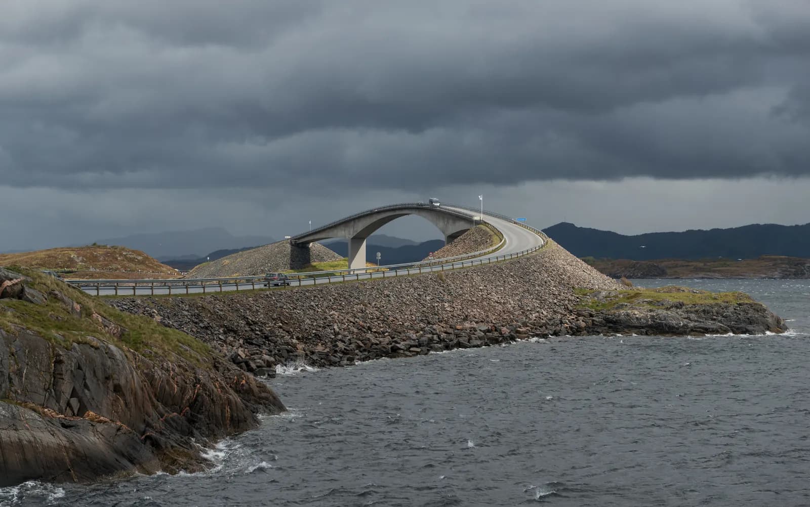
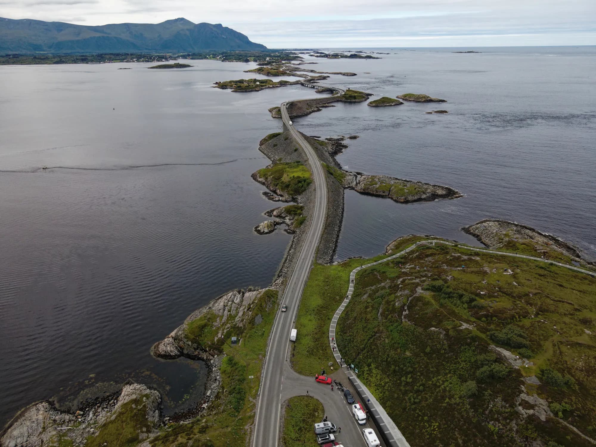
It has been called the world's most beautiful drive, and in 2005 it was named Norway's Construction of the Century. Facing the open sea between Molde and Kristiansund, the road runs on stone causeways across small islands and on seven bridges over the sounds between them — and in a motorhome the experience is quite different from a car. You sit higher, see further and can spend the night right beside the sea.
But Atlanterhavsvegen is more than the bridges. The 36 kilometres between Bud and Kårvåg offer fishing villages, wartime history, coastal culture and fishing spots reached straight from the road.
Stops along the route
1. Bud — start here
The tourist route starts in the fishing village of Bud, at the southwestern end of Hustadvika. In 1533 Norway's Council of the Realm met here for the last time. Walk along the quay and have lunch before driving north.
Don't miss: Ergan coastal fort, built by the Germans in 1941–45 as part of the Atlantic Wall. Today it is a war history museum, with a guided tour inside two of the bunkers. It opens daily from late June to mid-August, otherwise only for groups.
Motorhome tip: Bud Camping is by the sea, within walking distance of the centre, and opens all year. Bud also has fuel and a dump station.
2. Kjeksa and Askevågen — the first viewpoints
Kjeksa, just northeast of Bud, is a rest area with benches and views over Hustadvika — the sea you will follow for the rest of the day.
Don't miss: Askevågen, a short detour from the main road. A steel viewing platform stands out on the breakwater in the little fishing village. It is beautiful in calm weather and in storms, but stay away when the sea washes over the breakwater.
3. Farstadsanden and Vevang — dunes, a coastal path and art
Behind the sandy beach lie dunes, and the bay is a nature reserve. To stretch your legs, follow the coastal path north along the sea to the light at Nordneset, 2.5 km each way.
Motorhome tip: Park by the toilet building at Farstadsanden (open all year). The coastal road onwards via Skotheimsvik is only around four metres wide; with a large motorhome you can instead take the wider Fv663 a little further inland.
Don't miss: Hågå at Vevang, the last rest area before the bridges. Along the path into the heather lies Jan Freuchen's Columna Transatlantica, a white marble column divided into pieces.
4. Myrbærholmbrua — the fishing bridges
The bridges begin after Vevang. In 2010 Myrbærholmbrua gained a steel fishing bridge on each side, so you can fish without standing in the road. The current beneath the bridge is strong, and saithe and cod often bite. Bring your fishing rod.
Motorhome tip: There is only a small roadside lay-by here. If it is full, continue to Eldhusøya.
5. Storseisundbrua — the high bridge
The largest bridge on Atlanterhavsvegen: 260 metres long and around 23 metres above the sea, allowing boats beneath. From some angles the road seems to end in mid-air at the top. On the bridge you cross the municipal boundary from Hustadvika to Averøy.
Don't miss: The bridge seen from the side — from Myrbærholmen or Eldhusøya.
Motorhome tip: Never stop on the bridge or at the roadside to take photos.
6. Eldhusøya and Svevestien
The main stop on the tourist route. Svevestien, a steel walkway just over half a kilometre long, loops above heather and coastal rock. It is wheelchair accessible and open all year. The café in the service building opens daily in summer and at weekends in spring and autumn.
Motorhome tip: Large car park and a toilet open all year. Emptying a motorhome toilet is not allowed here — use the dump station in Kårvåg.
7. Geitøya — a fishing path and a boat to Håholmen
A wheelchair-accessible fishing path leads down to a platform beneath Geitøybrua. For views instead, it is a short walk up onto the rocky knolls.
Don't miss: Håholmen, a salt-cod fishing settlement since the early 1700s and now a hotel and restaurant. The crossing from Geitøya takes around seven minutes. In summer the boat has scheduled departures; in May and September arrange the trip with the hotel, which closes for the season on 30 September.
Motorhome tip: The car park is large. Try Geitøya if Eldhusøya is full.
8. Kårvåg (Averøy) — the end point
You are now on Averøy. From here it is around 30 km to Kristiansund through Atlanterhavstunnelen, an undersea tunnel just under six kilometres long with gradients approaching 10 %.
Motorhome tip: Atlanterhavsveien Sjøstuer has motorhome pitches by the harbour, looking towards the bridges. Kårvåg also has a dump station and fuel.
Side trip: Bergtatt marble mine in Eide
Between Atlanterhavsvegen and Molde, around 20 km from Vevang, take a boat across an underground lake in Bergtatt marble mine, which has been worked since 1938. Good for children and a good choice on a rainy day. In summer tours run daily except Monday — see berg-tatt.no.
Practical info for motorhomes
Roads: Tarmac throughout, and neither tunnels nor height restrictions between Bud and Kårvåg. Atlanterhavsvegen (Fv64) is over six metres wide, but the coastal roads are narrow: Fv6060 between Bud and Farstad is in places under five metres, and Fv6070 via Skotheimsvik around four metres and only for vehicles up to 15 metres. From Molde you drive through Tussentunnelen (signed height 4.2 metres). Check vegvesen.no/trafikk before driving.
Parking: Stop only in car parks — never on the bridges, at the roadside or in passing places. Out by the bridges, Geitøya and Eldhusøya are the largest. Summer traffic is heavy; come early or late in the day.
Overnight stays: Use the campsites. Statens vegvesen asks you to use rest areas for breaks and follow signs prohibiting overnight stays; where overnight stays are allowed, the limit is usually one day. Never drive into the terrain.
Campsites:
- Bud Camping — by the sea in Bud, open all year
- Blåhammer Camping — a small site with a sandy beach southeast of Bud, May–September
- Atlanterhavsveien Sjøstuer — motorhome pitches by the harbour in Kårvåg, open all year
- Atlanten Turistsenter, Kristiansund — motorhome drop-in, with a dump station
Fuel: There are stations in Bud, at Farstad (automated pump) and near Kårvåg, but the safest choice is to fill up in Molde or Kristiansund.
Waste disposal: Not in the toilets along the tourist route — it is prohibited. The National Tourist Routes point to dump stations in Bud, at Vevang, in Kårvåg, Eide, Molde and Kristiansund.
Toll roads: None on the route. Atlanterhavstunnelen became free on 1 July 2020. Further from Kristiansund towards the E39 (Rv70), you pass the toll stations of Bypakke Kristiansund.
Ferries: No ferries on the route, whether coming from Molde or Kristiansund.
Combine with
- Trollstigen and Geirangerfjorden — from Molde take the Sølsnes–Åfarnes ferry to Åndalsnes, where the route begins. From there it crosses Trollstigen and descends to Geiranger.
- Kristiansund and Sunndalen — the salt-cod capital, then on along the Rv 70 to Sunndalsøra and Oppdal.
- Fosen and the Trøndelag coast — from Kristiansund it is around 150 km to Orkanger, with the Kanestraum–Halsa ferry.
Weather
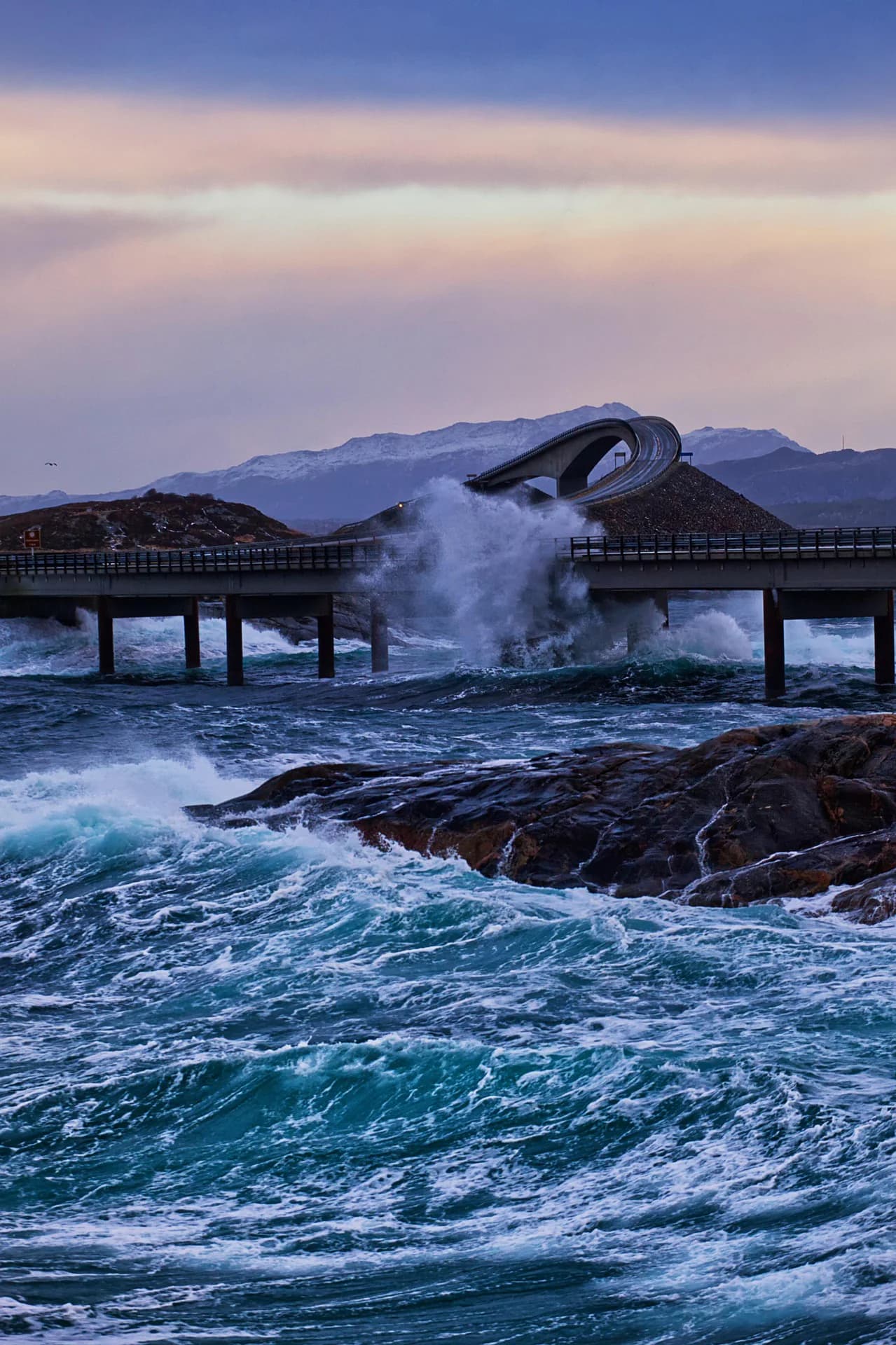
Atlanterhavsvegen is spectacular in all kinds of weather. Sunshine brings turquoise sea and idyllic photos. Storms bring waves crashing against the causeways and low bridges — dramatic and unforgettable. A tall motorhome catches plenty of wind on the bridges, so drive slowly. Check yr.no for Hustadvika and Averøy.
This route is part of Bobilvei's hand-picked motorhome routes in Norway. Every route is quality-checked with a focus on motorhome suitability, parking and local experiences.