- Route
- Ålesund – Aksla – Atlanterhavsparken – Giske – Godøy (Alnes fyr) – Sulesund–Hareid (ferry) – Ulsteinvik – Herøy – Runde (E136, rv. 658, fv. 5957, fv. 5952, E39, fv. 61, fv. 654, fv. 5876)
- Length
- about 145 km from Ålesund via Giske and Godøy to Goksøyr at the far end of Runde, including the ferry. Runde is a dead end — directly back to Ålesund it is just over 80 km.
- Driving time
- 3.5–4 hours without stops, including the ferry, but plan at least two days
- Recommended number of days
- 2–3
- Best season
- May–July. Puffins come ashore in the evenings from April to July; for a good chance of seeing plenty of birds, come in May or June. You can drive around Ålesund and the islands all year.
- Difficulty
- Moderate. Good main roads and short distances, but steep undersea tunnels, narrow roads and bridges towards Runde, and a low tunnel on the way there.
- Last checked
- October 2026
Why this route?
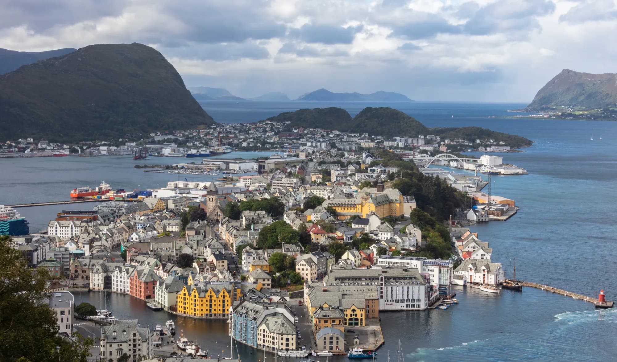
One January night in 1904, Ålesund burned down. Three years later most of it had been rebuilt, now in masonry — with towers, spires and curling Art Nouveau ornamentation. The centre is small enough to walk everywhere, and everything is close: the town mountain in its midst, an aquarium on a headland and islands reached through tunnels more than a hundred metres below the sea.
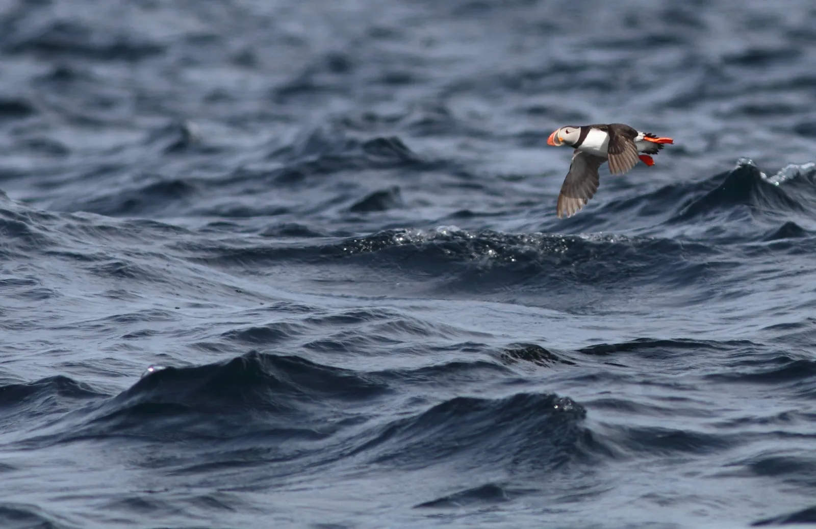
The trip ends on Runde, the island with Norway's southernmost large seabird colony. Walk up to the cliffs and wait for the puffins returning from the sea in the evening. Allow two days, preferably three: one for the town and islands, one for Runde.
Stops along the route
1. Ålesund — the town that was rebuilt
During the night of 23 January 1904, a fire broke out in Nedre Strandgate. The storm drove the flames through the wooden houses, and by the end more than 10 000 people had lost their homes. The new town had to be built in masonry — Parliament had decided that. Walk along Brosundet and up into the streets behind: most of what you see was built in the years immediately after the fire.
Don't miss: Jugendstilsenteret in the old pharmacy from 1907, where the pharmacy interior has been preserved.
Motorhome tip: The centre is densely built, so leave the motorhome parked. Ålesund Bobilparkering has two sites within walking distance: Hjelsetgården on the north side of the centre, with 50 pitches exclusively for motorhomes, and Skjerva on the west side, with 57 pitches. Both have electricity, water, showers and toilet waste disposal, and pitches cannot be booked.
2. Aksla and Fjellstua — 418 steps to the view
The town mountain Aksla is 189 metres high. From Byparken, 418 steps lead up to Fjellstua, taking around a quarter of an hour. At the top the town lies on its islets directly below, with the islands you will visit out towards the open sea and Sunnmørsalpene to the southeast.
Motorhome tip: Leave the motorhome below and climb the steps — from Hjelsetgården it is a few hundred metres to Byparken. If you drive up Fjelltunvegen anyway, the Public Roads Administration's road list sets an 11-metre limit, so with a trailer you may be too long. Parking at Fjellstua is free, but spaces are few.
3. Atlanterhavsparken — the sea behind glass
Out on Tueneset, three kilometres west of the centre, the aquarium has been open since 1998. The large Atlantic tank holds four million litres of seawater, drawn from a depth of 45 metres off the headland, and above it is only the sky.
Don't miss: The penguins are fed every afternoon.
Motorhome tip: The car park is large, and the aquarium itself says there is room for motorhomes. From Skjerva you can walk.
4. Giske — a marble church
From Ålesund, rv. 658 passes through Ellingsøytunnelen and Valderøytunnelen, both dating from 1987 and descending to around 140 metres below the sea. Across Giskebrua you reach a flat, green island where the Giske family had its seat in the Middle Ages. Their chapel from around 1130, Giske kyrkje, is built of white marble — no other church in the country is built this way.
Don't miss: Makkevika on the west of the island. Wading birds rest here on their spring and autumn migrations, and few places in Norway matter more to them.
Motorhome tip: The road around Giske is mostly only 3–3.5 metres wide. Drive straight to the church and walk the rest.
5. Godøy and Alnes fyr
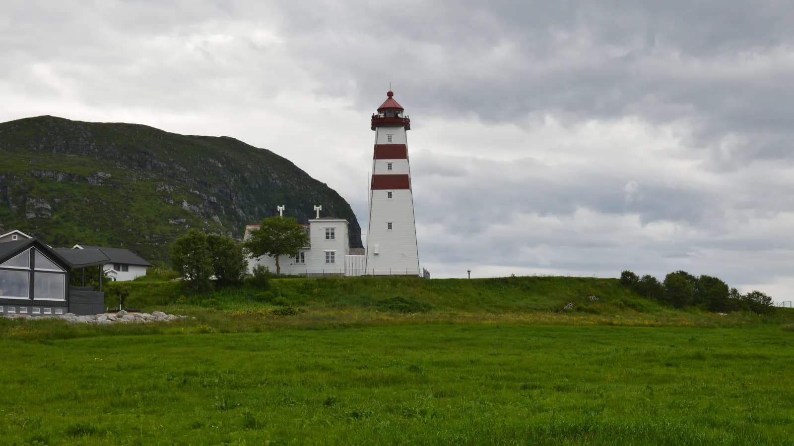
Godøytunnelen is the steepest of the three: 10 per cent, descending to 153 metres below the sea. At the far end of Godøya lies Alnes, an old fishing village that was for a long time the largest in Sunnmøre. The first lighthouse here was lit in 1853. Today an experience centre beside the lighthouse has a café and exhibitions, and sells tickets to the tower.
Motorhome tip: The last tunnel before Alnes, Alnestunnelen, is 1.5 km long and has just one lane, with passing places inside. Towards Alnes you must give way to oncoming traffic; on the way back, oncoming traffic must give way. The car park at the entrance is reserved for buses from April to October, and when cruise ships are in Ålesund it can get crowded. Use the gravel area by the walking trail below the lighthouse, or the public car park by the tunnel.
6. Hareid and Ulsteinvik — across the fjord
From the islands, drive back past Ålesund, across Vegsundet to Sula and out to Sulesund. The ferry to Hareid takes just over 20 minutes. Further on lies Ulsteinvik, a town built around its shipyards.
Motorhome tip: Fill up with diesel in Hareid or Ulsteinvik. In Saunesmarka in Ulsteinvik (Storehølvegen) there is a motorhome dump station. Hareid municipality has six motorhome pitches with electricity beside the marina.
7. Out to Runde — bridges and a low tunnel
Just before Fosnavåg, fv. 5876 branches off fv. 654, signposted to Runde. The road crosses Leinøya, in places only four metres wide, and Remøybrua from 1966. On Remøya you must pass through Sæviktunnelen, the only way onwards. Then comes Rundebrua, 428 metres long.
Motorhome tip: Sæviktunnelen is low. The sign on the south side from 2025 says 3.7 metres, and 4.0 metres if you drive down the middle — hence the warning about oncoming cars in the middle of the road. An older 3.4-metre sign may still stand at the entrance; if it does, it applies. Know your motorhome's height before you leave. In summer many cyclists use the tunnel. Rundebrua can close in strong winds and at high tide.
8. Runde Miljøsenter — birds and a sunken treasure
By the harbour, around three kilometres after the bridge, is the environmental centre, with a research station, café and exhibitions. The bird exhibition shows how badly the birds here have suffered: only around one in five remains after 40 years. In 1725 the Dutch ship Akerendam sank off the island. Three recreational divers found the treasure in 1972, and during 1972 and 1973 around 57 000 coins and coin fragments were recovered.
Don't miss: The summer boat trip around the island from Runde harbour, weather permitting — from the sea you see the cliffs from below.
Motorhome tip: The environmental centre has toilets and showers open all year.
9. Goksøyr and the bird cliffs — puffins arrive in the evening
The road ends at Goksøyr. From here a marked path leads up towards Rundabranden, just under 300 metres above sea level. It starts as tarmac beside a railing and continues over planks and stone slabs towards the cliffs. In Lundeura the puffins nest in the scree and return from the sea in the evening — best after 18:00. The circuit via Runde fyr is just over ten kilometres.
Don't miss: The gannets on Rundabranden and the great skuas over the moor.
Motorhome tip: Goksøyrtunnelen just before the village is only wide enough for one vehicle and is signed at 4.0 metres. After the tunnel there is roadside parking, around 50 spaces for cars and three for large vehicles. In summer there is a toilet by the car park. If it is full, turn at the turning area at the end — parking there is prohibited. Sheep often walk in the road, and dogs must be on a lead throughout Runde. Keep to the path: the cliffs are steep, and from 15 March to 31 August leaving the marked routes in the bird protection areas is forbidden.
Practical info for motorhomes
Roads: Tarmac throughout, and the main roads allow vehicle combinations up to 19.5 metres. The last stretch, from the village of Runde to Goksøyr, has a 15-metre limit in the road lists and gets narrower the further you go — beyond the harbour, in places under four metres. The undersea tunnels are steep: 8.5 per cent in Ellingsøytunnelen and Valderøytunnelen, 10 per cent in Godøytunnelen. Change down before entering and use engine braking. The lowest tunnel is Sæviktunnelen on the way to Runde (see stop 7). Elsewhere, Goksøyrtunnelen at the end of Runde is signed at 4.0 metres, Aurvågtunnelen on fv. 654 at 4.1 metres and Furnestunnelen on fv. 61 on Sula at 4.2 metres. For a different route home, take fv. 653 through Eiksundtunnelen — 7.8 km long, 287 metres below the sea and gradients up to 9.6 per cent — to Ørsta and the E39 with the Festøya–Solavågen ferry, about 120 km from Goksøyr to Ålesund. Check vegvesen.no/trafikk before driving.
Parking: Use the motorhome car parks in Ålesund. Space is tight at Fjellstua, Giske kyrkje and Alnes fyr; on Runde, park beside the road at Goksøyr. Never park in passing places or turning areas.
Overnight stays: The right of public access allows you to pitch a tent at least 150 metres from an inhabited house, for up to two nights in one place without the landowner's permission. In a motorhome, stop only where parking is allowed, and never drive into the terrain. Large parts of Runde are nature reserves and bird protection areas. Runde Miljøsenter points to Goksøyr Miljøcamping at Goksøyr, but it has no website we have been able to check — ask before counting on a pitch. Otherwise the motorhome pitches in Hareid are closest, just under 50 km away.
Campsites:
- Hjelsetgården bobilparkering — north of central Ålesund, 50 pitches exclusively for motorhomes
- Skjerva bobilparkering — west of the centre, 57 pitches, walking distance to Atlanterhavsparken
- Volsdalen Camping — by the sea east of the centre, a 15–20-minute walk to town, open all year
- The motorhome car park in Hareid — six pitches with electricity by the marina, book at www.havneweb.no
Fuel: Many stations in Ålesund, and a 24-hour automated pump on Valderøy. On the way south: Hareid, Ulsteinvik and Fosnavåg. There is no station on Runde — fill up by Ulsteinvik at the latest, or in Fosnavåg, a couple of kilometres past the turn for Runde.
Waste disposal: At the motorhome car parks in Ålesund when staying there, and at the dump station in Saunesmarka in Ulsteinvik. We have not found a public dump station on Runde — empty in Ulsteinvik on the way out.
Toll roads: Around Ålesund you pass the toll stations of Bypakke Ålesund. They charge in both directions, but you pay only once per hour. A motorhome over 3.5 tonnes pays as a large vehicle unless registered in vehicle category M1 — check the registration document — and equipped with an AutoPASS agreement and tag. The tunnels to the islands and the road to Runde are free.
Ferries:
- Sulesund–Hareid (Fjord1) — about 23 min, frequent daytime departures. The price depends on the motorhome's length.
- Festøya–Solavågen (Norled) — about 20 min, only if returning via Eiksund and Ørsta.
Combine with
- Trollstigen and Geirangerfjorden — E136 from Ålesund to Åndalsnes, about 110 km and around two hours. From there the route crosses Trollstigen to Geiranger.
- Atlanterhavsvegen — E39 to Vestnes, the ferry to Molde and onwards to Bud, about 120 km.
- Hjørundfjorden and Norangsdalen — starts in Ørsta, around 60 km from Ålesund with the Festøya–Solavågen ferry, and ends in Stranda.
Weather
Ålesund has a mild coastal climate. The average is just under 15 degrees in August and around 2–3 degrees in February. May is the driest month, and most rain falls from autumn through December. Out on Runde winds can be strong, and the bridge can close in storms. Bring a windproof jacket for the evening on the bird cliffs. Check yr.no for Ålesund and Runde.
This route is part of Bobilvei's hand-picked motorhome routes in Norway. Every route is quality-checked with a focus on motorhome suitability, parking and local experiences.