- Route
- Mo i Rana – Dunderlandsdalen – Polarsirkelsenteret – Saltfjellet – Storjord – Rognan – Fauske – Saltstraumen – Bodø (E6, Rv 80 and Fv 17)
- Length
- about 230 km on the E6 and Rv 80. The Saltstraumen detour is around 13 km each way from the Rv 80 at Løding, bringing the total to just under 260 km.
- Driving time
- Around four hours without stops, half an hour more with Saltstraumen
- Recommended number of days
- 2–3
- Best season
- June–August. The E6 is open all year, but winter storms can bring convoy driving or closure across the mountain. Polarsirkelsenteret is open from 1 May to mid-October.
- Difficulty
- Easy. Good E6 throughout, open to vehicle combinations of 19.5 metres. The challenges are mountain weather, reindeer on the road and almost ninety kilometres without a fuel station.
- Last checked
- October 2026
Why this route?
Kystriksveien often takes a week and several ferries. The E6 over Saltfjellet takes a day — and offers something completely different. From the pine forest in Dunderlandsdalen the road climbs above the treeline, and somewhere up there, without a tree in sight, you cross the Arctic Circle. Then it descends through Saltdalen to the fjord, past reminders of the prisoners of war who built the road, and onwards to the maelstrom at Saltstraumen.
The route heads north from Mo i Rana, as most people drive it on their way to Lofoten. If collecting your motorhome in Bodø, which has the area's largest airport, you can just as easily drive the other way. The towns are around 230 km apart, with no ferries.
Take two days, preferably three: one night at the foot of the mountains, one in Saltdalen or at Saltstraumen.
Stops along the route
1. Mo i Rana — before the mountains
The town lies at the head of Ranfjorden, and this is where you stock up for the trip. Across the mountains shops are far apart.
Motorhome tip: Fill up in town or at Storforshei at the latest, just under half an hour up the valley. From there it is just under ninety kilometres to the next fuel station, at Storjord. Røssvoll Camping lies by Ranelva, ten kilometres north of the centre, with electricity for motorhomes and caravans.
2. Krokstrand — the last stop before the plateau
The E6 follows Ranelva up Dunderlandsdalen, where iron ore mining has provided work, with interruptions, for over a hundred years. At Krokstrand around 20 km remain to the Arctic Circle, and the road climbs towards the treeless mountains.
Motorhome tip: Krokstrand Fjellpark has a campsite, café and climbing park. Nearby is Statens vegvesen's rest area, with eleven spaces for large vehicles.
3. Polarsirkelsenteret — 66° 33′ north
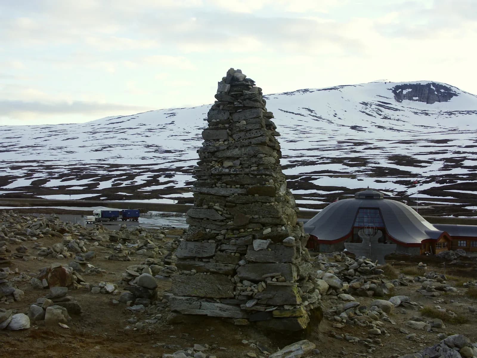
The round building stands alone on the plateau, with the E6 on one side and Nordlandsbanen nearby. Around it people have piled stones into cairns of every size. Inside are a shop, café and cinema. The war left traces up here too. Prisoners from Yugoslavia and the Soviet Union were forced to build road and railway across the mountains, many died, and memorials to them stand around the centre.
Don't miss: A photo by the Arctic Circle marker. It is why everyone stops.
Motorhome tip: The car park is large but has neither electricity nor waste disposal. Toilets are inside the centre, and opening hours vary through the season. The centre's website says nothing about overnight stays — to sleep nearby, Krokstrand Fjellpark is around 20 km further south.
4. Stødi and the plateau — reindeer and snow poles
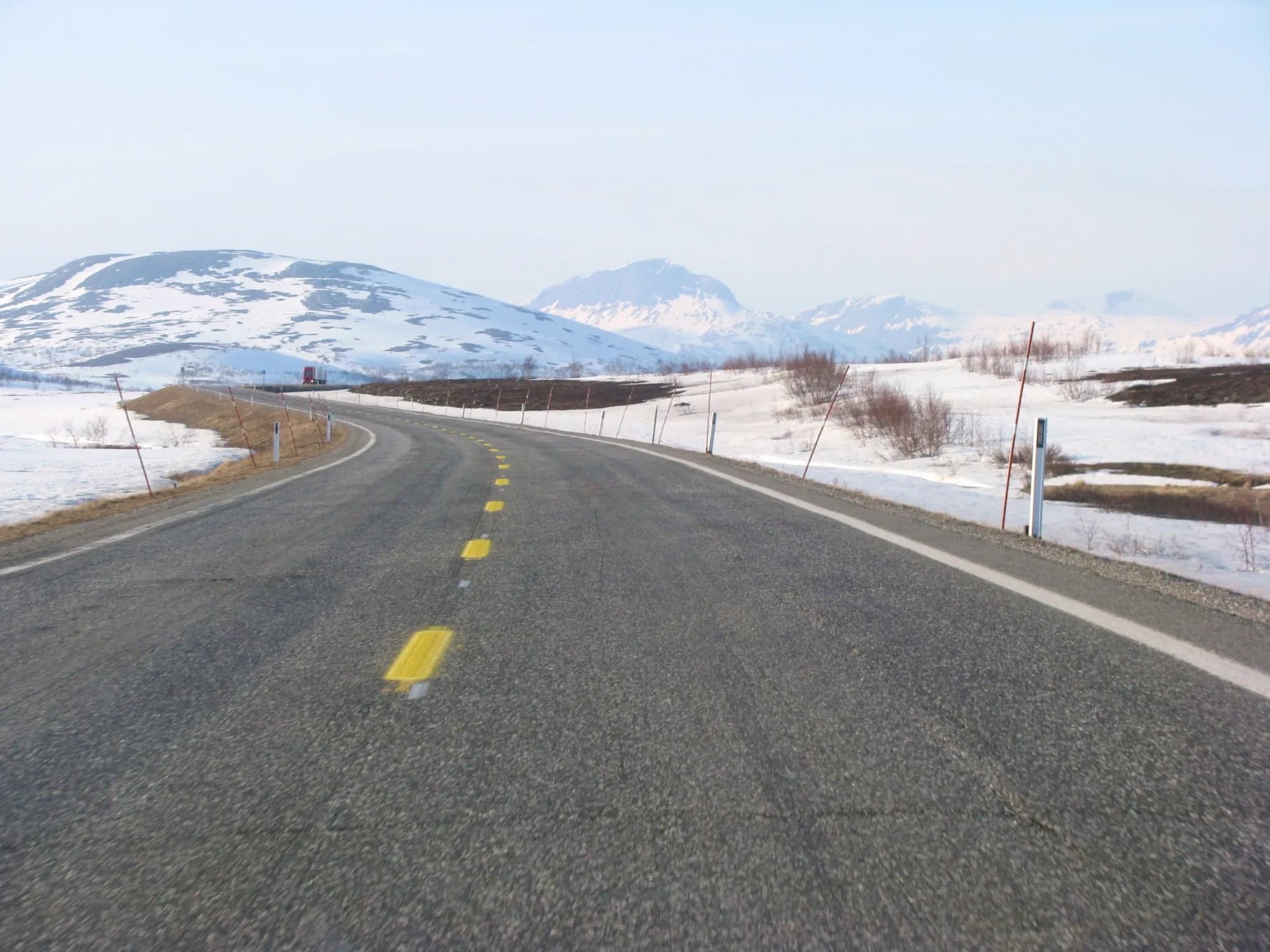
A couple of kilometres north of the centre lies Stødi, where the waters part: south towards Ranelva, north towards Saltdalen. The Sámi used these mountains long before the road arrived, and three sacrificial stones here are protected cultural monuments. Across much of the plateau the road lies 600–700 metres above sea level, with tall snow poles showing how much snow can fall.
Motorhome tip: Reindeer often walk on and along the road. Slow down when you see them and wait until the herd has crossed. Nothing stops the wind on the plateau, and a tall motorhome feels crosswinds strongly. For a break, Semska, Annas plass and Golanhøgda rest areas on the Saltdal side also have space for large vehicles.
5. Storjord — the national park centre and Junkerdalen
Down in Saltdalen is Nordland nasjonalparksenter, with exhibitions and an art gallery. Admission is free, and it opens daily from mid-June to mid-August. At Storjord the Rv 77 branches east towards Sweden through Junkerdalen. Just inside, the valley narrows to a gorge, and the steep scree above the river hosts plants you otherwise have to search for in Norway. They have been protected for almost a hundred years.
Motorhome tip: The fuel station beside the E6 at Storjord is the first since Storforshei. If continuing towards Sweden, remember that the Rv 77 over Graddis is also a mountain crossing that may have convoy driving in winter.
6. Rognan — boatbuilders and Blodveimuseet
Rognan lies where Saltelva flows into Saltdalsfjorden. The village has a long boatbuilding tradition, and after the fire in 1979 it gained a new centre. At Saltdal bygdetun, east of the river mouth, Blodveimuseet occupies a German barrack moved here from Dunderlandsdalen. The exhibition concerns prisoners from Eastern Europe forced to build roads and Nordlandsbanen during the occupation. Allow three quarters of an hour.
Motorhome tip: The centre lies west of the river; the E6 passes on the other side. Rognan Fjordcamp lies beside the fjord, a short walk from the centre. The museum has opened in summer; check times at nordlandsmuseet.no before travelling here for it.
7. Botn — Blodveien and the war cemeteries
Just east of Rognan a cross is painted on the rock face. In July 1943 a Yugoslav prisoner was shot while trying to escape, and his brother drew the cross with his blood. The cross has been maintained with fresh paint to this day. The first 463 Yugoslav prisoners arrived at the Botn camp in summer 1942, and after a year over half were dead. The road they worked on along the fjord was named Blodveien after the cross. Today the E6 runs through a tunnel here, while the old road has become a local road past the cross and out to Botn. There a Yugoslav and a German war cemetery lie close together, with a memorial to Soviet prisoners.
Motorhome tip: From the museum it is around 3.5 km to the war cemeteries, mostly on the old road along the fjord. It is a local road, but open to vehicle combinations of 19.5 metres and without a height restriction. Do not stop in tunnels or at the roadside on the E6. Continuing towards Fauske, the E6 passes through several tunnels signed at 4.2 metres.
8. Saltstraumen — the maelstrom beneath the bridge
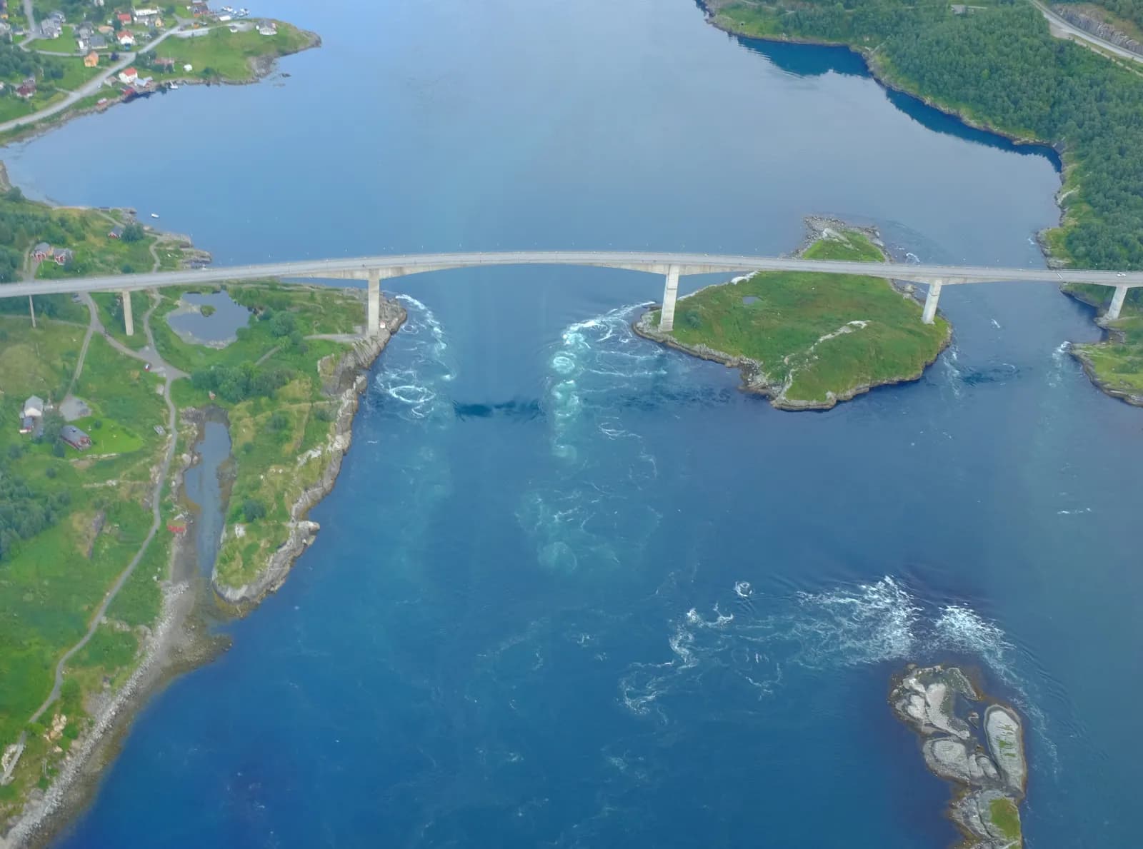
From Fauske follow the Rv 80 towards Bodø and turn onto the Fv 17 at Løding. Four times a day the tide changes direction, and the water between Saltfjorden and Skjerstadfjorden must pass through a sound only 150 metres wide at its narrowest. Then it swirls. The bridge across the sound opened in 1979 and is protected. Its main span is 160 metres long, and the water lies over 40 metres below.
Don't miss: Times of the strongest current are in the calendar at visitbodo.com. The current is strong for up to an hour before and after, and strongest around new and full moon. If fishing, use the marked places — catching wolffish is prohibited in the protected area.
Motorhome tip: Parking and toilets just north of the bridge. Pluscamp Saltstraumen Camping nearby has 80 drop-in pitches for motorhomes and caravans.
9. Bodø — the end point
From Saltstraumen drive back to the Rv 80 and into Bodø, around 30 km. The town is the terminus of Nordlandsbanen, and the ferry to Lofoten leaves from here.
Motorhome tip: Bodø's police by-law prohibits camping on and beside roads and open spaces in built-up areas unless signs say otherwise. Sleep at a campsite, and spend the final night at Saltstraumen if taking an early ferry.
Practical info for motorhomes
Roads: E6, Rv 80 and Fv 17 are open to vehicle combinations of 19.5 metres throughout (Statens vegvesen's road database). The lowest signed height on the route is 4.1 metres, beneath one bridge over the E6 between Rognan and Fauske and two over the Rv 80 just east of Løding. Tunnels are signed at 4.2 metres or more.
The E6 Saltfjellet is on Statens vegvesen's list of mountain crossings. In storms and blowing snow you must wait for a convoy to assemble, then everyone drives behind a snowplough. If conditions become too bad, the barrier comes down and nobody crosses — however fine it looks on your side of the mountain. Winter 2019/20 set a record: 141 closures or convoy operations by mid-April, according to Statens vegvesen. If driving in winter, keep plenty of fuel in reserve and enough clothing and food to wait several hours. Check vegvesen.no/trafikk or call 175. Reindeer may stand in the road at any time of year, and Statens vegvesen posts warnings at vegvesen.no/trafikk.
Parking: Polarsirkelsenteret and mountain rest areas have plenty of room for large vehicles. Never park in passing places or beside the road on the plateau.
Overnight stays: Use campsites when you can. The Outdoor Recreation Act allows tents at least 150 metres from an inhabited house or cabin and no more than two nights at one place without the landowner's consent — a useful guide for motorhomes too. Stay only where parking is allowed, and never drive into the terrain.
Campsites:
- Røssvoll Camping — by Ranelva, ten kilometres north of Mo i Rana, electricity for motorhomes
- Krokstrand Fjellpark — by the E6, around 20 km south of Polarsirkelsenteret, with a café
- Nordnes Kro og Camping — by the E6 at Røkland in Saltdal, with its own bakery
- Rognan Fjordcamp — by the fjord, a short walk from central Rognan
- Pluscamp Saltstraumen Camping — by Saltstraumen, 80 drop-in pitches
Fuel: Many stations in Mo i Rana, and the last before the mountains at Storforshei. The next is at Storjord, just under ninety kilometres further north. After that there are stations at Røkland, in Rognan and Fauske, at Saltstraumen and at Tverlandet. Easiest is to fill up completely in Mo i Rana.
Waste disposal: No dump station across the mountains. Empty at campsites. At Tverlandet, on the Rv 80 near the Saltstraumen turn-off, there is a dump station at the Esso station. See bobilplassen.no.
Ferries: No ferries on the route. Continuing to Lofoten, Bodø–Moskenes takes around 3 h 15 min direct. Some spaces can be booked: book well ahead in summer at torghatten.no.
Combine with
- Helgelandskysten — the coastal alternative. Drive the E6 over Saltfjellet one way and Kystriksveien the other: the two routes meet at Saltstraumen.
- Lofoten — the Bodø–Moskenes ferry drops you near Reine and Å.
- Junkerdalen and Graddis — follow the Rv 77 east from Storjord towards Sweden.
- Bodø, Kjerringøy and Saltstraumen — from Fauske the Rv 80 heads west to Saltstraumen, where that route ends.
Weather
Up on Saltfjellet it is colder and windier than in the valleys, and the weather changes quickly. Summer is cool even by the fjord: Bodø's July daily average is around 13–14 degrees. At the Arctic Circle the midnight sun lasts only a few weeks around midsummer, and only where the mountains do not block it. In Bodø it lasts from early June into July. Check yr.no for “E6 Saltfjellet”, with forecasts for Mo i Rana, Saltfjellet and Lønsdal station and webcams along the road.
This route is part of Bobilvei's hand-picked motorhome routes in Norway. Every route is quality-checked with a focus on motorhome suitability, parking and local experiences.