- Route
- Stavanger – Preikestolen – Hjelmeland – Sand – Røldal (Rv 13, National Tourist Route Ryfylke)
- Length
- about 230 km, plus side trips
- Driving time
- 4–5 hours without stops, but plan at least four days
- Recommended number of days
- 4–6
- Best season
- May–September. The Rv 13 is open all year, but Lysevegen and the mountain crossing from Sauda close in winter.
- Difficulty
- Moderate. The main road is straightforward, but has many old, narrow tunnels. Lysevegen down to Lysebotn is challenging.
- Last checked
- October 2026
Why this route?
Ryfylke is the fjord country just east of Stavanger. Less than an hour after leaving town, your motorhome is at the foot of Preikestolen. The ferry is gone. Now you drive under the fjord.
From there you follow National Tourist Route Ryfylke inland. It is a quiet route: fruit-growing villages, salmon rivers, narrow waterside roads and small architectural gems. Lysefjorden is a chapter of its own, with a ferry in and 27 hairpin bends out. Take your time. Ryfylke is best for those who stop often.
Stops along the route
1. Stavanger — start in town
Gamle Stavanger with its white wooden houses and Norsk Oljemuseum by the harbour easily fill half a day.
Motorhome tip: The centre is tight. Mosvangen Camping lies a couple of kilometres away, is open all year and has a motorhome service point.
2. Ryfast and Solbakk — under the fjord
Ryfylketunnelen is just over 14 km long and descends to 292 metres below sea level. Just after the tunnel are the rock carvings at Solbakk: around 30 ships and several sun symbols, cut into the rock about 2,500 years ago.
Motorhome tip: The gradient reaches 7%, and the slopes are long. Use engine braking downhill and maintain a steady speed uphill. Ryfast is a toll road with AutoPASS.
3. Preikestolen — the plateau above Lysefjorden
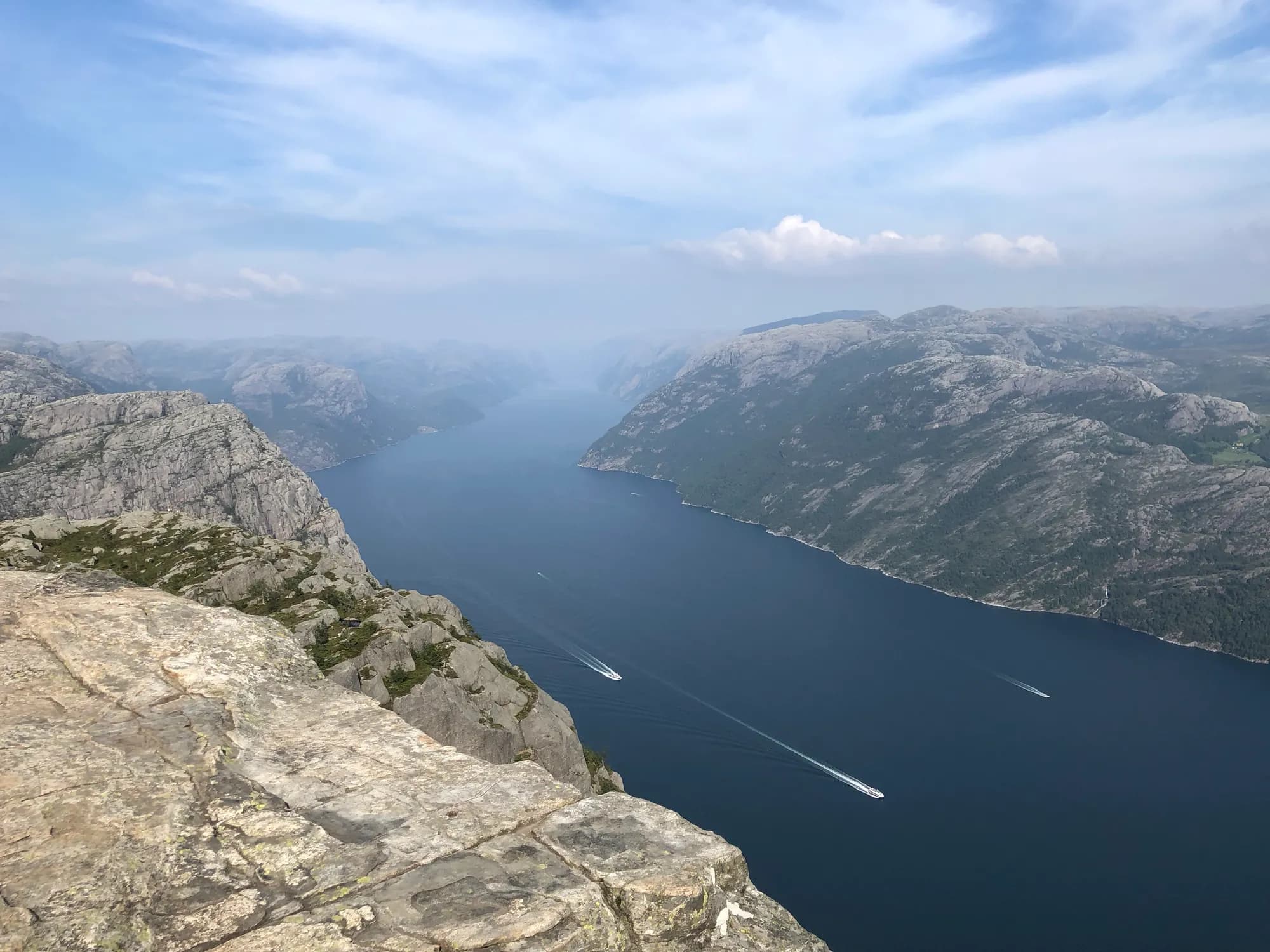
The rock shelf projects 604 metres above the fjord. The walk is around 8 km return with about 500 vertical metres — allow four hours.
Don't miss: The morning. Before eight you avoid the queue that builds throughout the day.
Motorhome tip: The car park is large but fills on fine days, and overnight stays in vehicles are not allowed. Preikestolen Camping lies around 4 km away and does not accept reservations — arrive early in the afternoon.
4. Høllesli — Lysefjorden from the road (side trip)
Just over ten kilometres south of Jørpeland, immediately before Lysefjordbrua, a short path through the rock ends out above the fjord.
Motorhome tip: Just north of the turn-off to Preikestolen is Notvik rest area, with a dump station. The car ferry to Lysebotn also calls at Oanes (or Forsand), a couple of kilometres south of Lysefjordbrua — check which quay it uses.
5. Lysebotn and Lysevegen — side trip, a day of its own
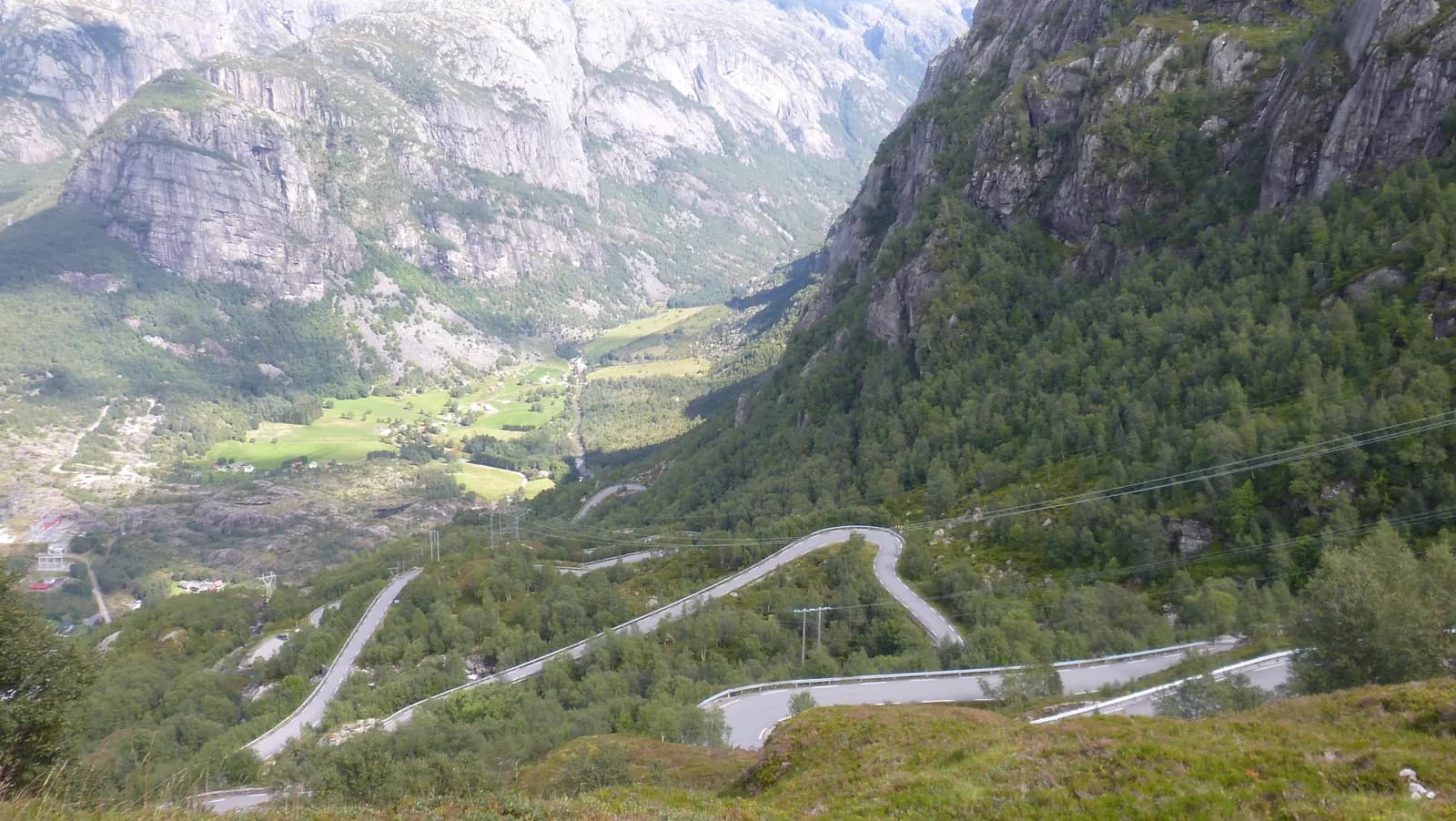
Lysebotn can only be reached by ferry or over the mountains from Sirdal. The car ferry starts at Lauvvik, calls at Oanes (or Forsand) and takes around two and a half hours inward, directly beneath Preikestolen and Kjerag. From the quay, Lysevegen (Fv 4224) climbs through 27 hairpin bends — first through a tunnel just over a kilometre long that curves around inside the mountain. After just under 8 km you reach Øygardsstølen, where the Kjerag trail begins.
Motorhome tip: The road is open to vehicles up to 15 metres, and buses drive it every summer. An ordinary motorhome can get up, but the road is steep and mostly less than five metres wide, and the tunnel is tight. Drive downhill in low gear and wait at passing places when a bus approaches. Lysevegen closes in winter, usually from October–November until mid- or late May. Book the ferry in advance. Via Sirdal it is about 150 km back to Stavanger.
6. Hjelmeland — the ferry across Jøsenfjorden
Back past Jørpeland and Tau, follow the Rv 13 past Tysdalsvatnet to the fruit-growing village of Hjelmeland. Here you take the ferry to Nesvik — a quarter-hour crossing.
Motorhome tip: The ferry runs frequently and cannot be booked. Payment with AutoPASS.
7. Lovra and Sand — the salmon river
Lovra is easy to drive past: a viewpoint in the forest looking towards Lovraeidet. In Sand, Høse bru footbridge crosses Suldalslågen, one of Norway's well-known salmon rivers.
Motorhome tip: At Lovra you park in a small roadside area, and the path in is narrow. Sand has fuel and a dump station.
8. Suldalsvatnet and Kolbeinstveit
The Rv 13 follows the river to Suldalsosen and continues beside Suldalsvatnet. Just beyond Suldalsosen lies the museum farm Kolbeinstveit, with a loft building whose oldest parts date from 1281 — Rogaland's oldest surviving log building. Open in summer.
Motorhome tip: Tunnels come thick and fast along the lake, most from the 1970s, many only 5.5–6 metres wide. Slow down when meeting a bus. Fill the tank in Sand or Suldalsosen.
9. Brattlandsdalen and Røldal — the end point
Driving north from Nesflaten, you reach Juvo almost immediately: a view down into the gorge and a stretch of the old road. A little further up comes Flesefossen. Røldal stavkyrkje dates from the 1200s and remained a pilgrimage destination into the 1800s.
Motorhome tip: Flesefossen has room for a couple of buses and a toilet open all year — no rest area on the stretch is larger. Seim Camping in Røldal has waste disposal and water.
Alternative: across Saudafjellet
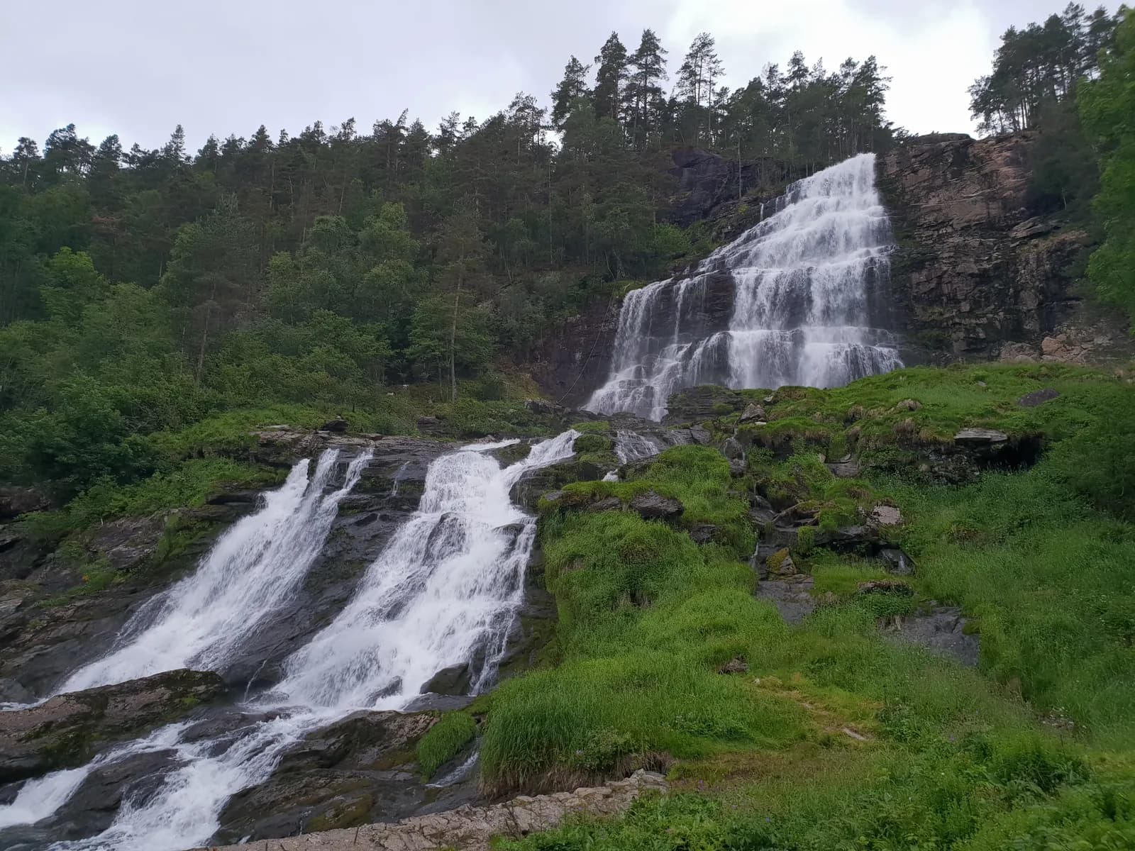
In summer you can take the tourist route's other branch. Cross Sandsfjordbrua past Ostasteidn, take a side trip to Ropeid and follow Saudafjorden to Svandalsfossen. A staircase with 540 steps has been built here, taking you right beside the water. East of Sauda lies Allmannajuvet, a zinc-mining museum designed by Peter Zumthor, before the Fv 520 climbs to 972 m above sea level and descends to Røldal.
Motorhome tip: The Fv 520 closes between Hellandsbygd and Røldal in winter, usually from November–December to May–June. It is narrow and winding. With a large motorhome, the Rv 13 through Suldal is the safer choice.
Practical info for motorhomes
Roads: The Rv 13 is well paved and has no special length limit (the usual 19.5 metres), but is narrow in many places, with many old tunnels. It may close briefly because of landslides or bad weather. Check vegvesen.no before driving.
Parking: Preikestolen has a large paid car park, but no overnight stays. Rest areas are intended for short stops.
Overnight stays: Use campsites where possible. For overnight stays elsewhere, the tent rule in the Outdoor Recreation Act is a useful guide: at least 150 metres from inhabited houses and cabins, maximum two nights in the same place without the landowner's permission. Never drive into the terrain.
Campsites:
- Mosvangen Camping, Stavanger — open all year
- Preikestolen Camping, Jørpeland — March to October
- Kjerag Lysebotn Camping — at the head of Lysefjorden
- Tysdal Camping — by Tysdalsvatnet
- Lindum Camping, Suldalsosen — May–September
- Seim Camping, Røldal
- Sauda Fjord Camping — for the Sauda variant
Fuel: Jørpeland, Tau, Hjelmeland, Sand, Suldalsosen, Sauda and Røldal. Fill up before Suldalsvatnet.
Waste disposal: Mosvangen Camping, Notvik rest area, Sand, Sauda and most campsites. Do not empty motorhome toilets in the toilets at the tourist route's rest areas — it is prohibited.
Ferries: Hjelmeland–Nesvik (Norled, about 13 minutes) is part of the route, without reservations. A car ferry to Lysebotn leaves from Lauvvik, calling at Oanes or Forsand — book through Kolumbus or Rødne. Lauvvik–Oanes is a small ferry across Høgsfjorden. Check operators' timetables.
Combine with
- Hardanger — from Røldal it is around 40 km to Odda.
- Sørlandskysten — E39 south from Stavanger.
- Jæren — long sandy beaches just south of Stavanger.
- Sirdal and Suleskarvegen — from Lysebotn the Lysevegen climbs around 34 km to Suleskard, where that route crosses the mountains to Setesdal. The Lysevegen is closed in winter.
Weather
Ryfylke is in Western Norway, and rain is part of the experience even in summer. Fog can hide the view from Preikestolen even when the fjord below is sunny — be flexible about your walking day. Lysevegen and Saudafjellet can have snow beside the road into June. Check yr.no for Jørpeland, Sand and Røldal.
This route is part of Bobilvei's hand-picked motorhome routes in Norway. Every route is quality-checked with a focus on motorhome suitability, parking and local experiences.