- Route
- Steinkjer – Namsos – Overhalla and Høylandet – Foldereid – Kolvereid – Rørvik – Gravvik – Bogen – (Leka) – Holm (Fv 17, Fv 770, Fv 771 and Fv 802)
- Length
- about 320 km from Steinkjer to the ferry quay at Holm, including the drive out to Rørvik and back. Leka comes on top: around 55 km of driving and two ferry crossings.
- Driving time
- 6–7 hours by motorhome without stops, and the Leka trip takes another half day
- Recommended number of days
- 3–4
- Best season
- May–September. The roads are open all year, but the campsites on Leka and at Holm close for the winter.
- Difficulty
- Easy. No mountain passes, and the Fv 17 is mostly 6–7 metres wide. The Fv 771 over Gravvik is narrower, and the road round Leka is narrow. Two toll stations just north of Steinkjer and one ferry at the end, Holm–Vennesund, plus the Leka ferry if you take the detour.
- Last checked
- October 2026
Why this route?
Kystriksveien, the Fv 17 coastal road, starts in Steinkjer, not in Brønnøysund. Its first stretch, through Namdalen, is the quiet one: a salmon valley, a long arm of fjord leading out to Foldereid, Kolvereid, the smallest town in Norway, and a coastal town on islands where the Hurtigruten coastal ships call both northbound and southbound.
The route does not stay on the Fv 17 the whole way. From Foldereid it heads out along the Fv 770 over Nærøysundbrua to Rørvik, then back and north on the Fv 771 to Leka, the island with the yellow and rust-red hills. At Holm you take the ferry across Bindalsfjorden. On the other side Kystriksveien carries on to Brønnøysund, where Helgelandskysten begins.
Allow three to four days: one to Namsos, one to Rørvik, one on Leka and half a day to Holm.
Stops along the route
1. Steinkjer — where Kystriksveien begins
The Fv 17 leaves the E6 at Asp, a few kilometres north of the centre. The town is described in Inderøy and the Golden Detour, where it is stop number three. From here the Fv 17 runs through Namdalseid and Bangsund to Namsos, around 75 km.
Motorhome tip: Fill up in Steinkjer. Right after the turn-off you pass the toll station at Dyrstad, and just under 20 km later the one at Sprova. Between Namdalseid and Bangsund you drive through Rødhammertunnelen, signed at 4.2 metres. That is plenty of clearance for an ordinary motorhome, but check the height of the one you are driving.
2. Namsos — the timber town on the Namsen
The sawmills and the timber trade gave Namsos its work and its growth, and the harbour was where timber from the forests of the valley went out by ship. The town became a trading port in 1845. At Spillum, on the east bank of the river and close to the Fv 17, Spillum Dampsag & Høvleri, the old steam sawmill and planing mill, is now Norsk Sagbruksmuseum, the Norwegian sawmill museum. In summer it has regular opening hours, and from September to May it opens by appointment only. Check sagbruksmuseet.no.
Don't miss: Klompen, the town's own hill, 105 metres high. From the centre the walk up takes around half an hour, and from the top the town lies right below you.
Motorhome tip: Leave the motorhome below when you go up Klompen. The road to the top is open to cars in summer, but there is little room at the top. Namsos Camping is five minutes east of the centre, with motorhome pitches with electricity and some with water and drainage. Its season is not on the website, so check namsos-camping.no before you arrive.
3. Overhalla and Høylandet — the salmon valley
From Namsos the Fv 17 follows the Namsen upstream through Overhalla. Overhalla is farming and forestry country, but the river is known for its salmon: the fishing in the Namsen and its tributary, the Bjøra, counts among the best in Norway. Fishing rights are sold as beats by the farms along the water. At Skogmo the road leaves the main valley and turns north through Høylandet. Here Kystriksveien runs a long way inland, along the Søråa river and past the village centre, before it reaches the sea again at Kongsmoen, at the head of Innerfolda.
Don't miss: Norsk Revyfestival, the Norwegian revue festival, which has been at home in Høylandet since 1987.
Motorhome tip: Bjøra Camping lies by the Fv 17 where the road crosses the Bjøra, and takes motorhomes. The bridge is signed at 4.7 metres. The map (OpenStreetMap) shows the last fuel stations before Foldereid in Høylandet; we have not checked their opening hours.
4. Foldereid — across Innerfolda
From Kongsmoen the Fv 17 follows Innerfolda outwards. Just before Foldereid you drive through Bergsviktunnelen, signed at 4.4 metres; then the road crosses the fjord on Foldabrua and goes straight into the short Finnmotunnelen. The village lies on the north side, and here the road divides. Kystriksveien carries on over the isthmus towards Bindal and Holm. You take the Fv 770 west, along the fjord, to Kolvereid and Rørvik.
Motorhome tip: The map shows a fuel station in Foldereid. Turn left, towards Kolvereid. You rejoin the Fv 17 further north, at Kjelleidet, after Rørvik and Leka.
5. Kolvereid — Norway's smallest town
Around 35 km west of Foldereid you reach Kolvereid. The town has fjord on two sides, Innerfolda and Sørsalten, and sits on the neck of land between them. It became a town in 2002, by decision of what was then Nærøy municipality, and officially no Norwegian town is smaller. South-east of the town lies Korsnesstrømmen, the sound where Foldafjorden turns into Innerfolda. Bring a rod; saithe is what you can hope for in the sound.
Motorhome tip: The map shows fuel stations in Kolvereid and Rørvik. Fill up there before you head for Leka; along the Fv 771 and on Leka we have not found a station we can vouch for.
6. Rørvik — the coastal town on Vikna
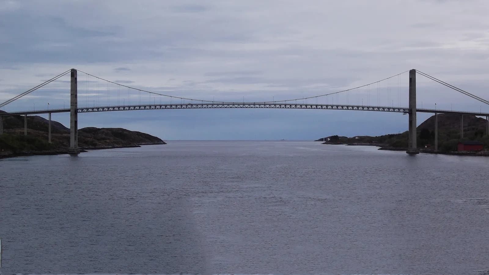
The Fv 770 crosses Marøya and goes over Nærøysundbrua to Inner-Vikna. The suspension bridge opened in 1981. It is 701 metres long, the main span is 325 metres, and ships have 41 metres of clearance beneath it. The shipping lane runs through the sound, and the Hurtigruten calls at Rørvik both northbound and southbound. By the harbour stands Norveg, the centre for coastal culture. The building was designed by Gudmundur Jónsson and has won a lot of praise. Kystmuseet Norveg tells the story of around 10,000 years along the Namdal coast and also has the Berggården trading post.
Don't miss: The boat to Sør-Gjæslingan. In summer it runs a few days a week from Rørvik and Namsos out to the islets south-west of the town, and the museum rents out rorbuer, fishermen's cabins, there from May to September. The fishing village, once the largest south of Lofoten, has been protected since 2010.
Motorhome tip: Outside the summer Norveg is open Tuesday–Saturday and closed on Sunday and Monday. For midsummer Visit Norway gives daily opening, so check museetmidt.no. Further along Strandgata, after Norveg, the street passes under a building signed at 4.3 metres. Kleiva Camping lies at Evenstad, around ten minutes' drive from the centre, and has 17 pitches for motorhomes and caravans with electricity, several of them down by the sea.
7. Herlaugshaugen and Skei — over to Leka
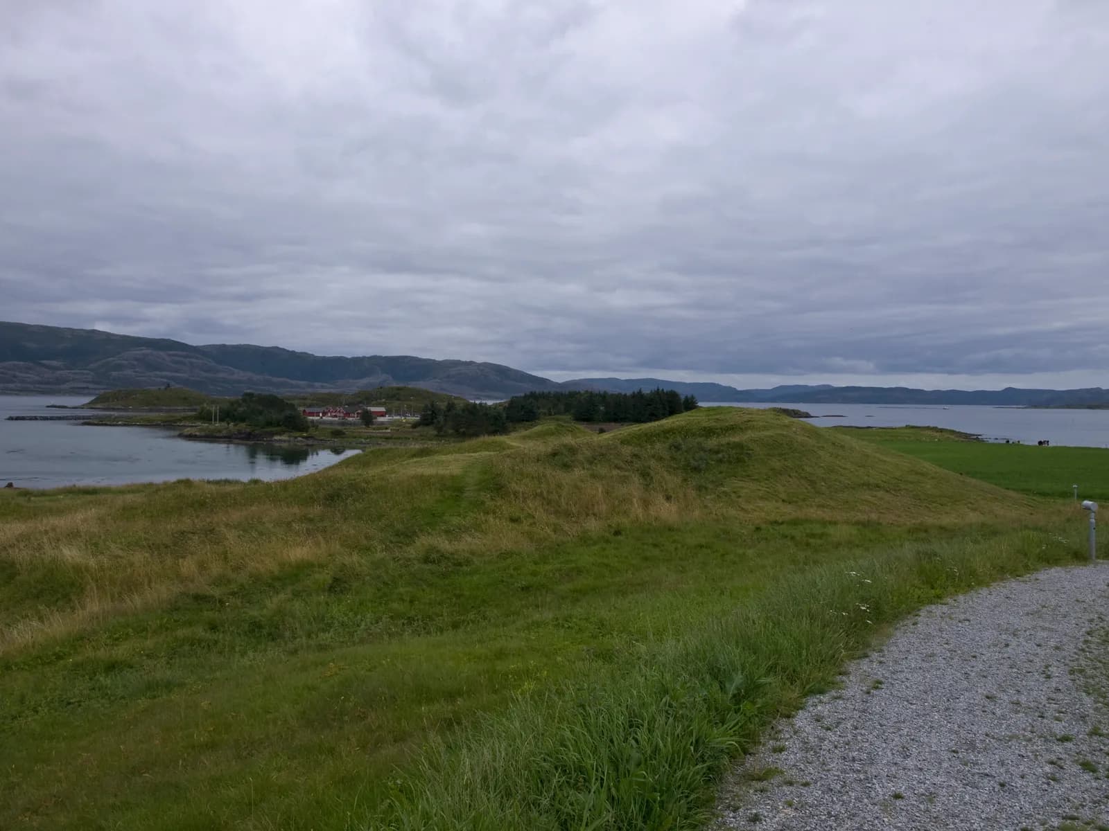
From Rørvik you drive back over the bridge and past Kolvereid, then take the Fv 771 north through Gravvik to Bogen, around 60 km. There the Fv 771 continues west to the ferry quay at Gutvik, 14 km away, while the Fv 802 turns off east towards the Fv 17. The ferry from Gutvik to Skei on Leka takes around 20 minutes. Less than a kilometre from the quay at Skei lies a long, grassy mound looking out over the shipping lane, the coast's main road in the Iron Age. Herlaugshaugen is 65 metres across, one of the largest burial mounds in Scandinavia, and nearly fifty smaller mounds surround it.
Don't miss: The heritage trail on Skeisnesset, at the northern tip of the island. Skei is one of Norway's 22 selected agricultural cultural landscapes.
Motorhome tip: The ferry runs all year, 8–14 times a day, with gaps of more than three hours between some departures at weekends. Check the timetable at atb.no before you plan your day. We have not found any way to book a place. From September to May the ferry is free. From 1 June to 31 August a summer fare by length applies: as of 2026, NOK 167 for a motorhome of 6–8 metres and NOK 239 for 8–10 metres running on fossil fuel (AtB). You pay with AutoPASS or FerryPay; otherwise the owner receives an invoice, so agree with the owner how you will settle up. The Fv 771 is mostly 5–6 metres wide, with a few short stretches under 5 metres. Bogen Feriehus, by the bridge at Bogen, has motorhome pitches and is open all year.
8. Round Leka — Lekamøya and the yellow hills
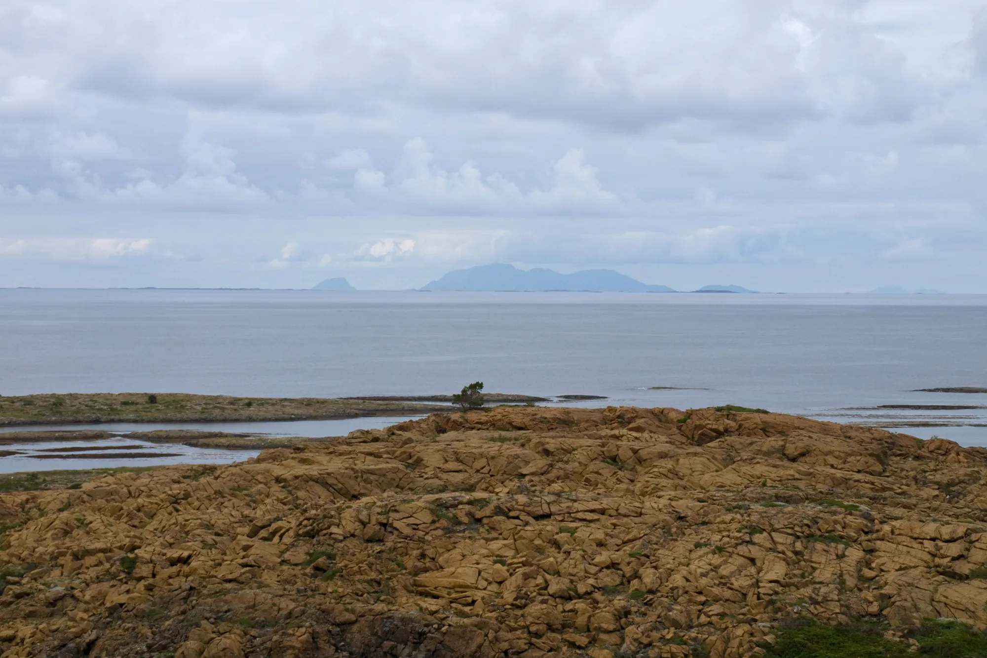
The first thing you notice is the colour. The rock is yellow, rust-red and grey, and little grows on the west side. The colour comes from the stone weathering in wind and rain, and the barren look from its lack of the elements that make good soil. Leka is old seabed: the ocean crust formed around 500 million years ago and was pushed onto land when the Caledonian mountains were raised, and here you can see it right down to the mantle. The island became Norway's geological national monument in 2010 and belongs to Trollfjell UNESCO Global Geopark. The legend explains the colour another way. The maiden Lekamøya was fleeing from Hestmannen, the horseman, south along the shipping lane. The whey butter she carried was lost here on the island, and that is what stained the rock red. When the sun came up, she and the other giants turned to stone. She still stands in the south of the island: a mountain that from the sea looks like a woman in a long dress.
Don't miss: Solsemhula, a cave with painted human figures from the end of the Stone Age or the Bronze Age. It can only be visited with a guide. Visit Leka mentions guided tours with Leka Opplevelser, but after a rockfall in 2020 there was no guiding in summer 2022, and we have not found out when the tours started again. Ask Leka Opplevelser before you plan around the cave.
Motorhome tip: The road round the island, the Fv 7132, is around 27 km. It is paved, but mostly only about four metres wide, and long stretches are narrower. Drive slowly and use the passing places. With a large motorhome you might rather cycle; Leka Brygge, just under five kilometres from the ferry, rents out bikes. Leka motell og camping lies around three kilometres from the ferry and is usually open for motorhomes from 1 May to 1 October, with 40 pitches with electricity and its own room for emptying toilet and grey water.
9. Holm — the ferry over to Helgeland
Back at Bogen you take the Fv 802 to the Fv 17 at Kjelleidet, and follow Kystriksveien around 20 km north to the ferry quay at Holm. Heilhornet, 1,058 metres high and shaped like a cone, rises east of the road. From Holm it is around 20 minutes across Bindalsfjorden to Vennesund, and then around 50 km on to Brønnøysund.
Motorhome tip: In the last 13 km before Holm you drive through the tunnels at Hestneset and Løvik, signed at 4.2 and 4.1 metres. Løvik is the lowest on the route. Holm Camping is just under two kilometres from the ferry quay. The 2026 season ran from 1 April to 30 September, and guests who stay overnight can empty grey water and toilets free of charge.
Practical info for motorhomes
Roads: The Fv 17, Fv 770, Fv 771, Fv 802 and the road round Leka are open to vehicles up to 19.5 metres long (Statens vegvesen's road database). The Fv 17 is mostly 6–7 metres wide, and the Fv 770 around 6 metres. The Fv 771 is narrower, mostly 5–6 metres and down to 4.2 at its narrowest. Round Leka the asphalt is mostly about four metres wide, and long stretches are narrower, down to 3.5 metres. The lowest signed height is 4.1 metres, in the Løvik tunnel on the Fv 17 just south of Holm. Rødhammertunnelen and the Hestneset tunnel are signed at 4.2 metres and Bergsviktunnelen at 4.4. In Rørvik, Strandgata passes under a building signed at 4.3 metres, but you can avoid it. There are no mountain passes, and the roads are open all year. Check vegvesen.no before you drive.
Parking: The centre of Namsos is small, and space is tight at the top of Klompen. In Rørvik, find a spot where motorhomes are allowed, and walk. Herlaugshaugen is less than a kilometre from the ferry quay at Skei. Never park in the passing places on Leka.
Overnight stays: The Outdoor Recreation Act lets you pitch a tent on uncultivated land, at least 150 metres from inhabited houses and cabins, for at most two days in the same place without the owner's consent. It gives you no right to park a motorhome wherever you like; signs and the landowner's rules apply. In Overhalla, Høylandet and on Leka much of the land along the road is farmland and farmyards. That is cultivated land, where you may not settle for the night. Use the campsites.
Campsites:
- Namsos Camping, Namsos — five minutes from the centre, electricity, some pitches with water and drainage
- Bjøra Camping, Overhalla — by the Fv 17 and the Bjøra
- Kleiva Camping, Vikna — at Evenstad, around ten minutes from Rørvik, 17 pitches with electricity
- Bogen Feriehus, Bindal — by the Fv 771 at Bogen, open all year
- Leka motell og camping, Leka — usually 1 May–1 October
- Holm Camping, Bindal — near the ferry quay, 2026 season 1 April–30 September
Fuel: The map (OpenStreetMap) shows fuel stations in Steinkjer, Namdalseid, Bangsund, Namsos, Overhalla, Høylandet, Foldereid, Kolvereid and Rørvik. We have not checked each of them with the chains, so fill up in good time. Between Kolvereid and Holm, along the Fv 771 and on Leka, we have not found any we can vouch for. Fill up in Kolvereid or Rørvik.
Waste disposal: Holm Camping lets guests who stay overnight empty grey water and toilets free of charge, and Leka motell og camping has its own room for emptying. Namsos Camping has pitches with water and drainage. The motorhome apps show more disposal points along the route, but we have not had them confirmed by whoever runs them. Empty whenever you get the chance.
Tolls: In the first 20 km of the Fv 17 north of Steinkjer you pass the toll stations at Dyrstad and Sprova (Vegamot). As of October 2026 they cost NOK 34 and NOK 57 for vehicles up to 3,500 kg without an agreement, and twice that for heavier vehicles. A motorhome over 3.5 tonnes pays the car rate only with an AutoPASS agreement and tag, and only if it is registered as M1 with the tag issuer. Without an agreement the bill goes to the owner, so agree with the owner how you will settle up.
Ferries:
- Skei–Gutvik (Leka) — about 20 min, all year, 8–14 departures a day. Free from September to May; from 1 June to 31 August a summer fare by length, paid with AutoPASS or FerryPay, otherwise invoiced to the owner. Timetables and prices at atb.no.
- Holm–Vennesund (Fv 17) — about 20 min, roughly every hour in the daytime all year. The ferry cannot be booked. You pay by vehicle length with AutoPASS, FerryPay or a card on board; otherwise the owner receives an invoice. Timetables at reisnordland.no.
If you are going straight from Namsos to Kolvereid or Rørvik, your satnav may suggest the ferry across Foldafjorden, Lund–Hofles–Geisnes (AtB, about 25 min, paid by vehicle length). This route instead goes over Høylandet and Foldereid, with no ferry.
Combine with
- Helgelandskysten — the continuation. From Vennesund it is around 50 km to Brønnøysund, where that route begins.
- Inderøy and the Golden Detour — the loop from Trondheim calls at Steinkjer, where this route starts.
- Fosen and Trøndelagskysten — the coast west of Trondheim, before you head north.
Weather
Out on the coast the winters are mild and the summers cool. At Rørvik airport the July normal is 14 degrees and February's around zero. In Namsos the summer is a little warmer and the winter colder, around 15 degrees in July and two degrees below zero in February. At Nordøyan lighthouse, out at sea west of Vikna, May is the driest month and November to January the wettest. Pack waterproofs whatever the month. Check yr.no for Namsos, Rørvik and Leka.
This route is part of Bobilvei's hand-picked motorhome routes in Norway. Every route is quality-checked with a focus on motorhome suitability, parking and local experiences.