- Route
- Haugesund – Haraldshaugen – Avaldsnes – Visnes – Åkrehamn – Sandve – Skudeneshavn – Kopervik – Haugesund (E134, Fv 547 and Fv 511), with a day trip to Utsira
- Length
- about 75 km around Karmøy, about 90 km with detours. To Haugesund: around 75 km from Stavanger and 115 km from Bergen, with one ferry.
- Driving time
- Around 2 hours without stops. Getting here: around 2 hours from Stavanger, 3–3.5 hours from Bergen.
- Recommended number of days
- 2–3, plus a day for Utsira
- Best season
- May–September. Roads are open all year, but Vikinggarden is open only in summer and several museums have shorter hours the rest of the year.
- Difficulty
- Easy. Short distances and good main roads. Watch the overhead braces on Karmsundbrua (signed at 4.0 metres), the island's narrow eastern side and the tight streets of old Skudeneshavn.
- Last checked
- October 2026
Why this route?
Karmøy faces the North Sea, halfway between Bergen and Stavanger. That makes it a good weekend trip from either city: collect the motorhome on Friday, take one ferry and arrive before evening.
In a few tens of kilometres you experience much of Norway's history. Kings ruled at Avaldsnes for over a thousand years, and Norway takes its name from the shipping route here, Nordvegen. Sandy beaches line the western side, and wooden Skudeneshavn awaits in the south. Coming from Stavanger, follow the loop in reverse: Karmøytunnelen takes you straight onto the island.
Stops along the route
1. Haugesund — the herring town beside Smedasundet
Haugesund grew through fishing and shipping. The centre runs along Smedasundet and Haugesjøen, with Risøy and Hasseløy across the water.
Don't miss: Dokken museum on Hasseløy, with a herring saltery, cooper's workshop and grocery shop from the period 1850–1950. It is open daily in summer.
Motorhome tip: Dokken P-plass beside the museum has 15 motorhome spaces. Pay hourly or daily, stay at most three days, with no reservations. The site has only bins; Haugesund Parkering refers visitors to Haraldshaugen Camping for more facilities. The centre is a quarter of an hour's walk away.
2. Haraldshaugen — the national monument
In 1872, a thousand years after the Battle of Hafrsfjord, a memorial was erected at Gard north of town: a 17-metre column on the remains of a burial mound, surrounded by 29 low stones, one for each county traditionally united by the king. Snorre writes that Harald Hårfagre was buried in a mound by Karmsund. Whether this was the exact spot is uncertain — many favour Avaldsnes instead.
Motorhome tip: Haraldshaugen Camping is nearby and welcomes motorhomes all year. Most pitches are 7 × 10 metres; if your motorhome exceeds ten metres, contact them first. Guests can empty cassettes at an automatic disposal station. Coming from Bergen, you pass it on the way into town.
3. Avaldsnes — Norway's oldest royal seat
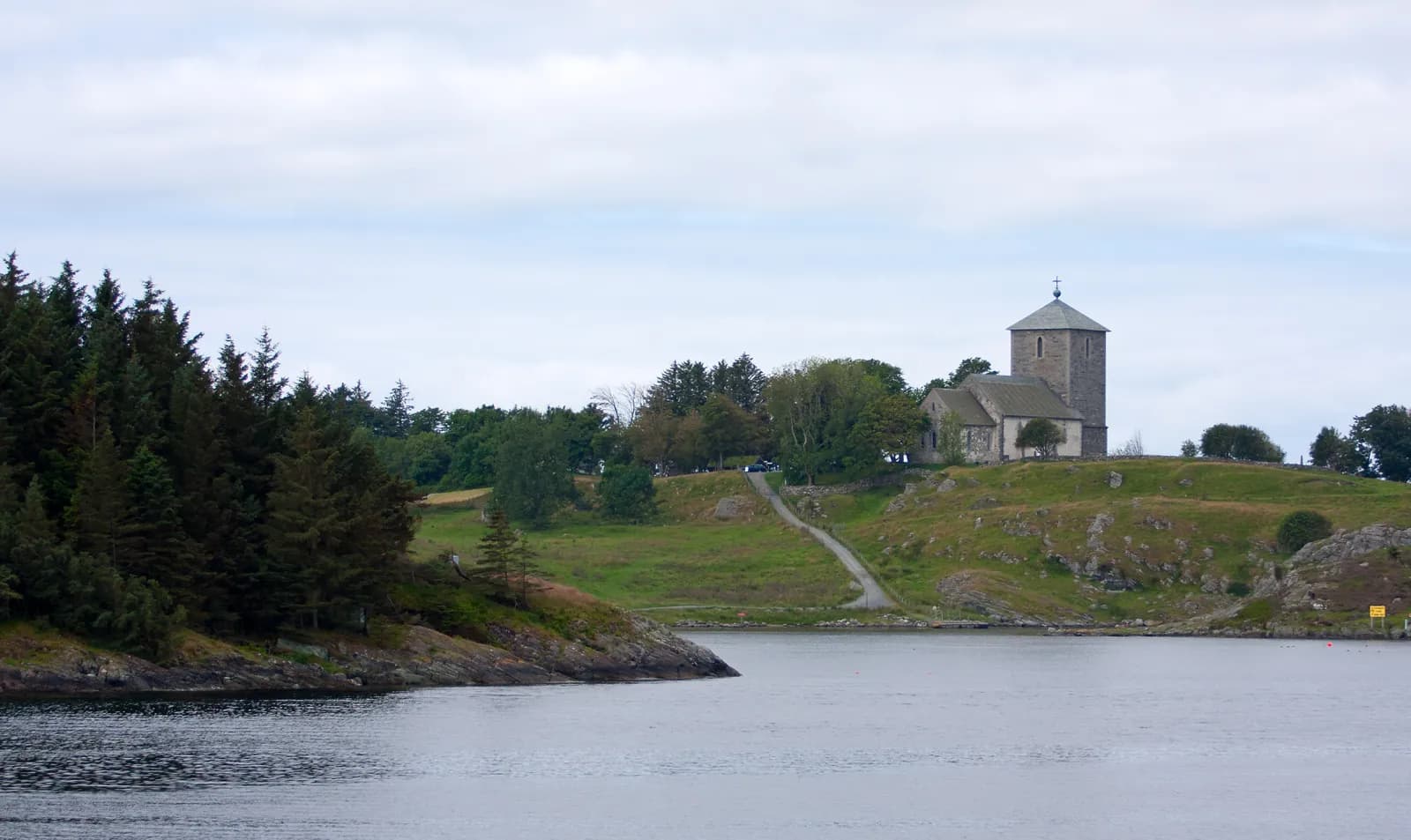
The E134 takes you over Karmsundbrua; a couple of kilometres later turn off to Avaldsnes. From here rulers controlled ships through Karmsundet, and kings resided here from around 200 to 1400. Olavskirken on the hill was probably built by Håkon Håkonsson around 1250. Legend says the world ends when Jomfru Marias synål touches the church wall. The standing stone is 6.5 metres high, Norway's tallest, and leans just clear of the northern wall.
Don't miss: Nordvegen historiesenter, built almost entirely underground so as not to compete with the church. In summer, mid-June to mid-August, Vikinggarden is also open. It lies on Bukkøy below the church, just over a kilometre's walk from the centre, with reconstructed longhouses, naval boathouses and roundhouses showing a Viking-age farm.
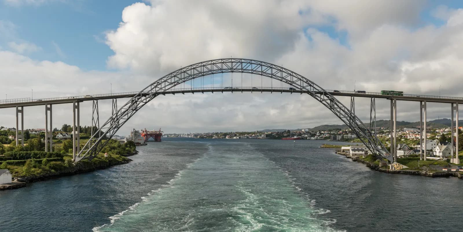
Motorhome tip: Karmsundbrua, built in 1955, is a steel arch with the central roadway suspended from it. Braces above the road are signed at 4.0 metres. Most motorhomes fit comfortably, but check yours — if taller, use Karmøytunnelen (stop 8), signed at 4.5 metres. The road up to the church is less than five metres wide.
4. Visnes — copper for the Statue of Liberty
Copper was discovered at Visnes, five kilometres from the church, in 1865, and the village became a mining community of over 3,000 residents. Mining continued until 1972. Copper from here is said to have gone to New York's Statue of Liberty, and a small replica stands by the sea.
Don't miss: The mining museum, open daily in summer. Walk to the smelting works ruins and up to the gazebo.
Motorhome tip: Visnesvegen (Fv 4818) is mostly 5–6 metres wide, with parking at the museum.
5. Åkrehamn and Åkrasanden
Fv 547 continues south along the western side, wide and straightforward. Åkrehamn is a fishing village with town status, its harbour sheltered by a string of islets. Just south of the centre begins Åkrasanden — several white sandy bays in succession rather than one beach. In 2015 it became Rogaland's first beach with Blue Flag environmental certification.
Don't miss: The glass artwork “Tid” by the beach, commemorating Moritz Rabinowitz, the Haugesund merchant who warned against Nazism and was killed in Sachsenhausen in 1942.
Motorhome tip: The municipality points to parking on Stongvegen, Strandavegen and by Vestre Karmøyveg. Use these for daytime visits and sleep at a campsite.
6. Sandvesanden — waves in the south
Further south lies Sandvesanden, with dunes and smooth rocks. This is the wave-surfing beach, in winter mostly for experienced surfers; windsurfing and kiting belong at Åkrasanden. Paths lead to Sandve harbour and neighbouring Mjølhussanden.
Motorhome tip: Parking is on Mjølhusvegen. A couple of kilometres north, Sandhåland Camping has motorhome pitches facing the sea — drop-in only, no toilet disposal.
7. Skudeneshavn — white wooden houses
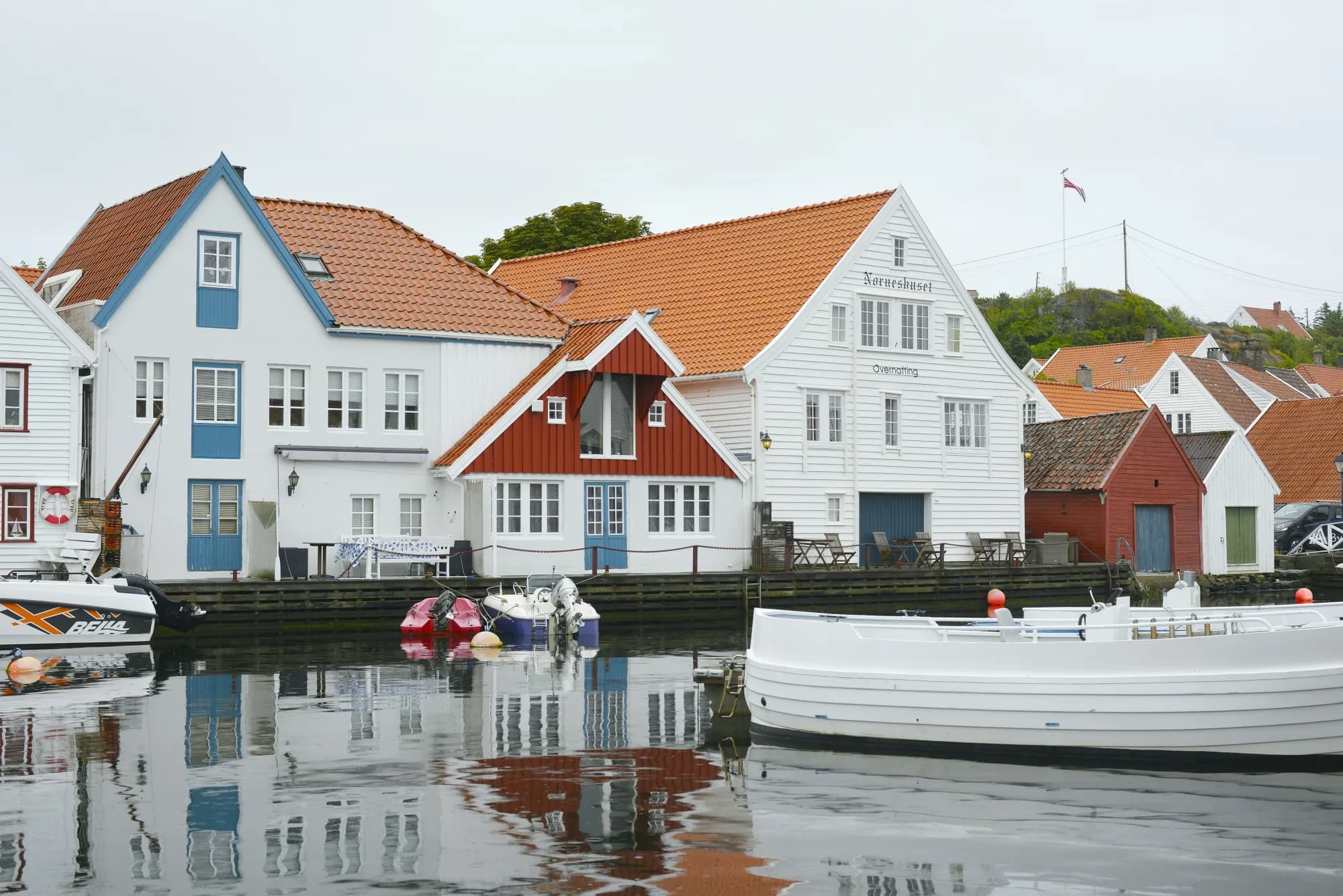
Skudeneshavn lies at the southern tip. The town flourished during 19th-century herring fishing, and most houses and waterfront warehouses from the middle of that century still stand. The cultural environment has been protected since 2018. Walk into Søragadå and along the harbour basin.
Don't miss: Skudeneshavn museum in Mælandsgården, open daily from around 20 June to early August.
Motorhome tip: Never drive into the old town; its narrow streets are made for pedestrians. Follow Fv 547, Postvegen and Kaigata to the old ferry quay, one of three free car parks near the centre. Older maps show a ferry from here to Mekjarvik near Stavanger — it no longer runs. Skudenes Camping is a short walk from the centre.
8. Karmøytunnelen — a roundabout inside the mountain
Return along the eastern side on Fv 511, past the municipal centre Kopervik. Just north, at Håvik, Karmøytunnelen passes beneath Karmsundet and Førresfjorden, descending to 139 metres below sea level. It opened in 2013. Inside the mountain, almost 60 metres below sea level, three tubes meet at a roundabout: one to Karmøy, one to the E39 towards Stavanger and one towards Haugesund.
Motorhome tip: Between five and ten kilometres north of Skudeneshavn, Fv 511 is only around four metres wide in places. Take care meeting large vehicles or return along the western side. The tunnel is signed at 4.5 metres and has around a 7 per cent gradient — use a lower gear downhill. It is free, but you pass a toll point towards Haugesund.
9. Utsira — a day at sea
Utsira lies 18 kilometres west of Karmøy and has fewer residents than any other Norwegian municipality. In spring and autumn migrating birds rest here, bringing many species to a small island. No lighthouse light in Norway stands higher above the sea than Utsira fyr from 1844.
Motorhome tip: Leave the motorhome at Dokken P-plass or your campsite. The ferry from Garpaskjær ferjekai in northern Risøy takes around 70 minutes and is free but runs only three–four times daily. Book at billetter.kolumbus.no, even without a car: weekends often fill up. Around two kilometres of road connect the island's harbours — walk or bring a bicycle.
Practical info for motorhomes
Roads: The E134, Fv 547 and Fv 553 through Karmøytunnelen allow vehicle combinations of 19.5 metres; Fv 547 is mostly 6–8 metres wide. The lowest signed height is 4.0 metres beneath Karmsundbrua's braces. Fv 511 on the eastern side is narrower. The E39 approaches through steep subsea tunnels — from Bergen via Bømlafjordtunnelen, 260 metres below sea level. Toll points around Haugesund charge automatically, including on the E134 just before Karmsundbrua. Check vegvesen.no before driving.
Parking: Dokken P-plass in Haugesund and the old ferry quay in Skudeneshavn. Beach car parks are for day visits.
Overnight stays: Use campsites or Dokken P-plass. The right to roam permits tents on uncultivated land at least 150 metres from inhabited houses, for at most two nights in one place without the landowner's consent. Motorhomes may stay only where parking is legal, and must never drive off-road into the terrain. Much of the land behind the beaches is cultivated land and improved pasture, where the right to roam does not permit setting up camp.
Campsites:
- Haraldshaugen Camping — Haugesund, by the national monument, open all year
- Skudenes Camping — Skudeneshavn, open all year, call first in winter
- Sandhåland Camping — Sandve, sea views, drop-in only
Fuel: Several stations in Haugesund, and on Karmøy at Avaldsnes, Åkrehamn, Kopervik and Skudeneshavn.
Waste disposal: Haraldshaugen Camping has automatic cassette disposal for guests, and Skudenes Camping has disposal. Dokken P-plass and Sandhåland Camping do not, so empty at one of those two campsites.
Ferries: None on the loop itself. Getting here:
- Mortavika–Arsvågen (E39, Fjord1) — from Stavanger, around 25 minutes. Nobody may remain in vehicles on the lower car deck. Rogfast, the tunnel replacing the ferry, is scheduled for completion in 2033.
- Halhjem–Sandvikvåg (E39, Torghatten for Skyss) — from Bergen, 45–50 minutes.
- Both run around the clock, frequently in daytime. With an AutoPASS tag payment is automatic and discounted; without it you pay full fare.
- Haugesund–Utsira (Rutebåten Utsira) — see stop 9.
Combine with
- Jæren — ferry across Boknafjorden towards Stavanger, then south beside the sandy beaches to Egersund.
- Ryfylke and Lysefjorden — the E134 east takes you around 140 km to Røldal, where that route ends. Follow it in reverse towards Stavanger.
- Hardanger — Odda is around 130 km along the E134 and Rv 13.
Weather
Karmøy is exposed to the North Sea, and wind is seldom far away. At Haugesund airport, August is warmest with a normal daily mean around 15 degrees, and February coldest at around two degrees above zero. Karmøy gets most rain in October, least in May. Check yr.no for Haugesund and Skudeneshavn — and the wind forecast.
This route is part of Bobilvei's hand-picked motorhome routes in Norway. Every route is quality-checked with a focus on motorhome suitability, parking and local experiences.