- Route
- Tromsø – Breivikeidet – Svensby – Lyngseidet – Olderdalen – Kåfjorden – Manndalen – Skibotn – Oteren – Nordkjosbotn – Tromsø (E8, Fv 91 with two ferries, E6), with a side trip to Steindalen
- Length
- about 260 km around the circuit, plus two ferry crossings. Around 295 km with the Steindalen detour. The first ferry leaves from Breivikeidet, around 55 km from central Tromsø.
- Driving time
- 4.5–5 hours on the road, plus an hour on the ferries and waiting time at the quay. Plan at least two days.
- Recommended number of days
- 2–4
- Best season
- June–September. Midnight sun from around 20 May into July. Ferries run all year, but avalanches can close roads in winter.
- Difficulty
- Easy. Good roads throughout, open to vehicle combinations of 19.5 metres, and no mountain passes. Two ferries that cannot be booked, and avalanche risk in winter.
- Last checked
- October 2026
Why this route?
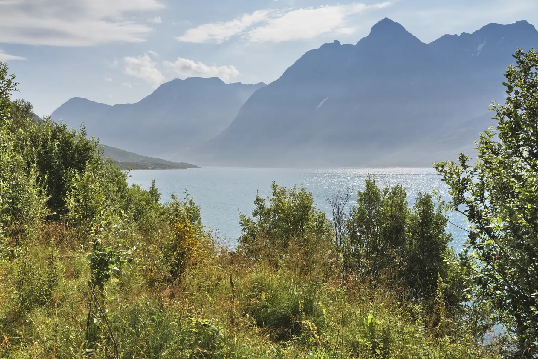
An hour from Tromsø you stand at the ferry quay looking at Lyngsalpene across the fjord. The peaks stretch almost eighty kilometres northwards, with around 140 glaciers between them. Jiehkkevárri, 1,834 metres, is the highest mountain in Troms.
The circuit takes you by ferry across Ullsfjorden and Lyngenfjorden and back along the eastern side of Lyngenfjorden. Along the way you encounter the Coastal Sámi in Manndalen and the old market at Skibotn, where Sámi, Kvens and Norwegians traded with one another for centuries. When the Germans withdrew in 1944–45, people in Kåfjord were forcibly evacuated and houses burnt or demolished — so most of what you see there was rebuilt after the war.
Two days are enough, but with a day for Steindalsbreen and an evening in Skibotn it soon becomes three or four.
Stops along the route
1. Tromsø — where the circuit starts and ends
Buy provisions and fill the tank before leaving. The next fuel station is at Lyngseidet, across Ullsfjorden.
Don't miss: Ishavskatedralen in Tromsdalen, just across the bridge from the centre. The church was completed in 1965, and its white façade resembles layers of ice floes.
Motorhome tip: Tromsø Lodge & Camping lies in Tromsdalen, just over a kilometre from the church, and is open all year. It has 51 pitches for motorhomes up to nine metres and three for twelve metres. Book in summer.
2. Breivikeidet — the ferry across Ullsfjorden
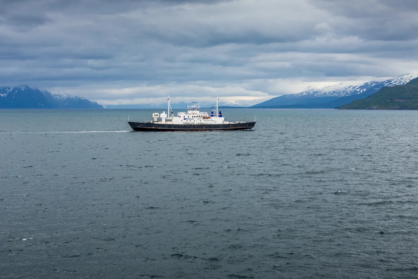
Leaving town, follow the E8 along Ramfjorden. At Fagernes, just over thirty kilometres from the centre, the Fv 91 branches across Breivikeidet, the valley between Ramfjorden and Ullsfjorden. Just over twenty kilometres later you reach the quay. The crossing to Svensby takes around 20 minutes, and the peaks grow bigger by the minute.
Motorhome tip: You cannot book a space for a motorhome — only coaches can reserve. The last sailing leaves earlier on Saturdays, so check the timetable.
3. Kjosen — the fjord between walls
From Svensby the Fv 91 follows Kjosen, a narrow arm of Ullsfjorden reaching towards Lyngseidet. Mountains rise straight from the water on both sides. In winter this is the exposed stretch: two avalanche galleries from 2006 and barriers along the road explain why.
Motorhome tip: Svensby Tursenter is 400 metres from the ferry quay, with electricity at pitches and a service building with shower, kitchen and sauna. Good for the first night if arriving late from Tromsø.
4. Lyngseidet — the church on the isthmus
In the middle of the village stands Lyngen kirke, a wooden cruciform church from 1782. Lyngseidet has been a trading place since 1789, on a four-kilometre-wide isthmus between Kjosen and Lyngenfjorden. Here also stands the largest wooden building in Northern Norway: Solhov, the old folk high school, completed in 1924.
Don't miss: The ferry across Lyngenfjorden to Olderdalen, around 40 minutes. On the eastern side you see Nordnesfjellet, where NVE monitors unstable mountain sections around the clock. In summer, usually from June to mid-August, an extra ferry runs here, with more frequent departures.
Motorhome tip: Fill the tank here. There is also a motorhome dump station in the centre. At the ferry quay a sign reminds you to shut off the motorhome's gas before driving aboard.
5. Kåfjorden — copper and a deep gorge
From Olderdalen the E6 runs around Kåfjorden, with Birtavarre at its head. From here a road goes up Kåfjorddalen. Copper was mined in the valley between 1898 and 1919, and the smelting works' ruins still stand at Ankerlia.
Don't miss: Gorsabrua, spanning a gorge 153 metres deep. In summer people bungee-jump from the bridge.
Motorhome tip: The Fv 7936 up the valley is paved for 7.5 km. It then becomes a narrow, potholed gravel road. The large Ankerlia car park is around 3 km along the gravel: stop there with your motorhome. Parking costs money (EasyPark). The path past the mine ruins to the bridge is around 3.5 km, and you can return via Fosseveien and the construction road, around 4.5 km. The gravel road continues to an upper car park 1.8 km from the bridge, but the road there is too poor to recommend for a large motorhome.
6. Manndalen — Coastal Sámi culture
In Manndalen (Olmmáivággi), grene weaving lives on, an ancient technique preserved by the Coastal Sámi. The woollen blankets, called grener, are handwoven on an upright loom, with stones keeping the threads taut. Work is now under way to have the technique added to UNESCO's list. Since 1991 the indigenous festival Riddu Riđđu has filled the valley in July.
Don't miss: Senter for nordlige folk, the Coastal Sámi museum and cultural centre at the foot of the valley. Exhibitions are open on weekdays. By the church lies Jan Baalsrud, the resistance fighter who hid in a cave here during the war.
Motorhome tip: Fuel by the E6 in Manndalen. It is the last station before Skibotn.
7. Skibotn — the market by the fjord
From Manndalen the E6 heads west through Nordnestunnelen, 5.7 km long and opened in 2018 as the last stage of a long effort to protect the E6 against landslides. The road then follows the shore south, with Lyngsalpene directly across the fjord. Markets were held in Skibotn for centuries, with written sources dating back to the 1500s. Sámi from the plateau and traders from Tornedalen came here to meet Kvens and Norwegians from the coast. Some market stalls survive.
Don't miss: The market place, where Nord-Troms Museum opens the stalls in summer.
Motorhome tip: Olderelv Camping and Strandbu Camping in Skibotn are both open all year. Olderelv has a separate waste-disposal building and accepts non-guests for a fee.
8. Steindalen — walk to Steindalsbreen (side trip)
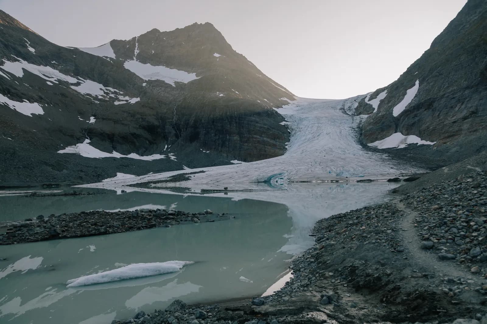
From Oteren, at the head of the fjord, follow the Fv 868 north on the western side. After around 16 km turn towards IMA Tursenter, where the trail starts. The first hour takes you to Steindalshytta, then continue over moraine ridges to the glacial lagoon. The return walk is around 12 km, a day trip. At the glacier, signs show former positions of its front.
Don't miss: The ice floes in the lagoon in front of the glacier. If you want to venture onto the ice itself, book a guide.
Motorhome tip: The IMA Tursenter car park is large and gravelled. The valley is in Lyngsalpan protected landscape: no drones, and dogs must be on a lead. Return via the E6 and E8 through Nordkjosbotn, just under a hundred kilometres from Oteren to Tromsø.
Practical info for motorhomes
Roads: All roads — E8, Fv 91, E6 and Fv 868 — are open to vehicle combinations of 19.5 metres (Statens vegvesen's road database), and the Fv 91 and Fv 868 are mostly over five metres wide. No tunnels on the circuit have a signed height limit, and the road database gives over 4.3 metres clearance everywhere. If you want to drive the western side from Lyngseidet instead of taking the ferry to Olderdalen, the Fv 868 to Oteren is 42 km, past Furuflaten and through Pollfjelltunnelen from 1983: 3.2 km long, signed at 4.0 metres and so narrow it has passing places inside. Use them when meeting large vehicles. However, you then miss Kåfjorden, Manndalen and Skibotn.
In winter roads sometimes close because of avalanche risk, particularly the Fv 91 over Breivikeidet and along Kjosen, the E8 in Lavangsdalen and the E6 along Lyngenfjorden. At Oteren signs indicate the diversion via the Fv 868 and ferry when the E6 is closed. Check vegvesen.no/trafikk or call 175.
Parking: Rest areas along the E6 and E8 are built for articulated vehicles, so there is space for large motorhomes. But they are for breaks on the journey: for the night Statens vegvesen refers travellers to campsites and other places intended for overnight stays. In Kåfjorddalen: go no further than Ankerlia with a large motorhome.
Overnight stays: Use campsites when you can. The Outdoor Recreation Act allows tents at least 150 metres from an inhabited house or cabin and no more than two nights at the same place without the landowner's consent. With a motorhome, stay only where parking is allowed, and never drive into the terrain.
Campsites:
- Tromsø Lodge & Camping — Tromsdalen, open all year, book in summer
- Svensby Tursenter — by the Svensby ferry quay, electricity at pitches
- Olderelv Camping — Skibotn, open all year, waste disposal also for non-guests
- Strandbu Camping — Skibotn, by the river mouth, open all year
Fuel: Fill up in Tromsø. Along the Fv 91 there is no station before Lyngseidet. Further on there are stations in Manndalen, Skibotn and Nordkjosbotn, and automated pumps in Birtavarre and at Hatteng.
Waste disposal: At campsites. Also in central Lyngseidet, at the Hatteng rest area by the E6 and in automated cassette-emptying machines at the rest area by Nordnestunnelen (E6) and in Lavangsdalen (E8). See bobilplassen.no.
Ferries:
- Breivikeidet–Svensby — around 20 minutes, across Ullsfjorden.
- Lyngseidet–Olderdalen — around 40 minutes, across Lyngenfjorden.
Norled operates both for Svipper, all year. Cars and motorhomes cannot reserve spaces. Payment is automatic: the number plate is photographed as you drive aboard, and the price follows the motorhome's length, including the bicycle rack. If renting, agree with the owner how ferry crossings will be settled. Timetables at svipper.no.
Combine with
- Senja — the ferry from Botnhamn goes to Brensholmen on Kvaløya, just under 60 km from central Tromsø.
- Kvaløya and Sommarøy — the island west of town, a natural leg before or after Lyngen.
- Nordkapp — from Olderdalen it is around 205 km along the E6 to Alta, where that route starts.
- Kilpisjärvi — the E8 runs from Skibotn up Skibotndalen to Finland. Kilpisjärvi is around 55 km away.
Weather
Lyngsalpene catches much of the weather from the sea, and the head of the fjord is drier than Tromsø. In Skibotn the July daily average is around 13–14 degrees and rainfall around 45 millimetres, compared with just over 12 degrees and over 70 millimetres in Tromsø. The weather can still turn quickly, and the wind on the ferry is cold. Polar night from late November to mid-January. Check yr.no for Lyngseidet, Skibotn and Tromsø.
This route is part of Bobilvei's hand-picked motorhome routes in Norway. Every route is quality-checked with a focus on motorhome suitability, parking and local experiences.