- Route
- Gryllefjord – Bergsbotn – Tungeneset – Mefjordvær – Botnhamn (National Tourist Route Senja, Fv86 and Fv862)
- Length
- about 80 km from Gryllefjord ferry quay to Botnhamn ferry quay, about 120 km including return side trips to Mefjordvær, Fjordgård and Husøy. Nasjonale turistveger gives 102 km for the whole tourist route, which also includes the side trips to Mefjordvær and Husøy.
- Driving time
- Around 2 hours without stops (3 with side trips), but plan at least two days
- Recommended number of days
- 2–4
- Best season
- June–August. Midnight sun from around 20 May into July. The summer ferry from Andenes usually runs from mid-May to late September.
- Difficulty
- Moderate. Narrow road with passing places and many tunnels, several old and tight. No mountain crossings and no length limit that stops a motorhome.
- Last checked
- October 2026
Why this route?
Senja is Norway's second-largest island outside Svalbard. The outer coast is the one you have seen in pictures: peaks rising straight from the sea, pale beaches at the heads of fjords and fishing villages facing the open ocean. National Tourist Route Senja follows this coast from Gryllefjord to Botnhamn.
The route is short but not fast: narrow road, many tunnels and small rest areas. That makes it a motorhome trip of short stages, with nights beside the sea and time for evening light. Arrive on the summer ferry from Andenes and continue towards Tromsø, and Senja becomes a natural part of a longer northern journey.
Stops along the route
1. Gryllefjord — ashore from Andøya
The village is squeezed between the fjord and Middagstinden, with a fish landing facility and ferry quay. This is where the summer ferry from Andenes docks and the tourist route begins.
Motorhome tip: Senja Fjordcamp in Torsken, just under seven kilometres away, has electricity, water and disposal for both cassettes and fixed tanks — good for the first night if the ferry arrives late.
2. Bergsbotn — the platform above the fjord
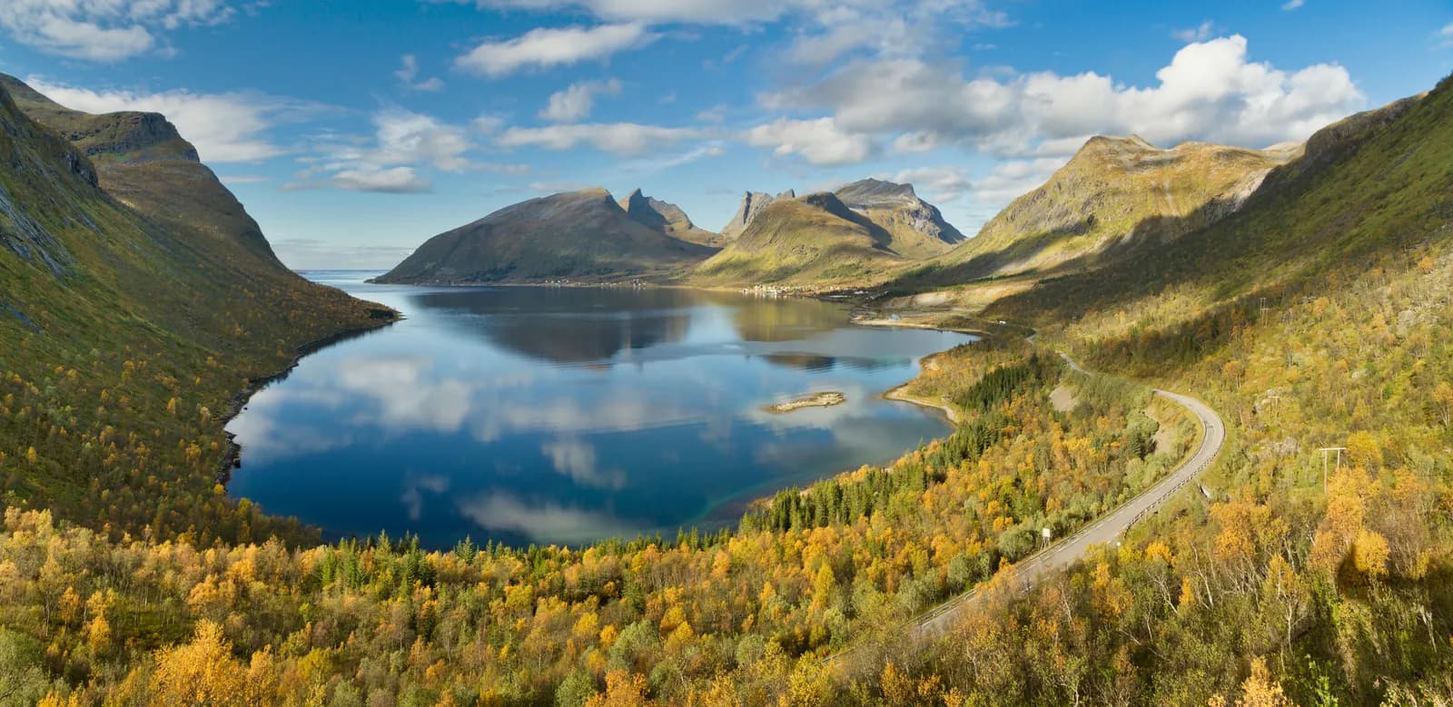
Along the way you pass the turn-off to Hamn, where the nickel works already had hydroelectric power in 1882 — among the first in the world. After Skalandtunnelen the road curves down towards the head of the fjord, and in a hairpin bend a 44-metre platform projects from the mountainside. Designed by Code arkitektur, it is wheelchair-accessible.
Motorhome tip: The rest area has spaces for five cars and one large vehicle — arrive early or late. A little further on is Skaland, with a shop and Skaland Camping.
3. Tungeneset — peaks above the sea
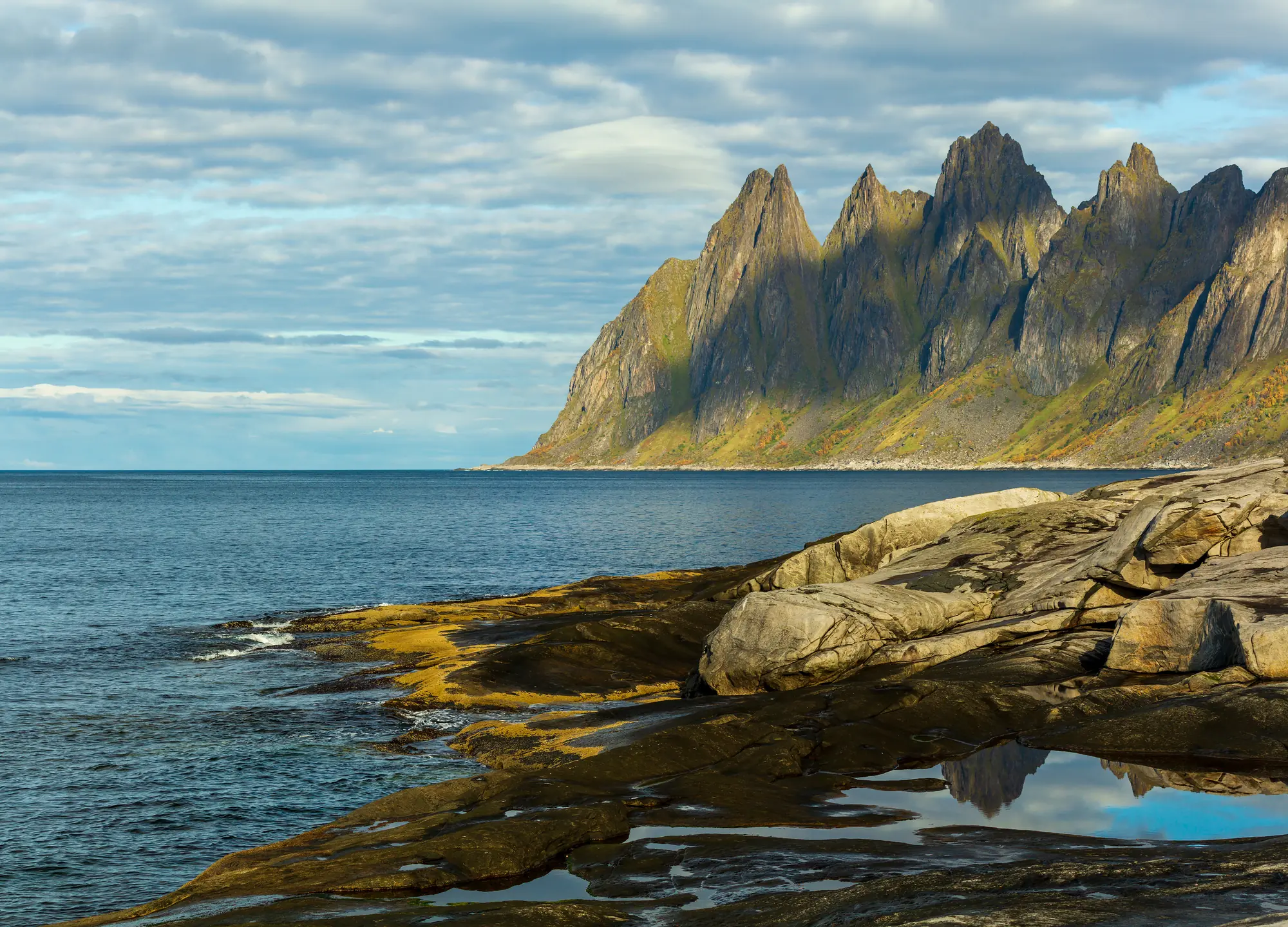
After Steinfjordtunnelen, follow Steinfjorden out to Tungeneset. From the car park, larch planks take you out onto the smooth rock, with the sea before you. Across Ersfjorden, Okshornan stands like a row of teeth against the sky.
Don't miss: Okshornan in evening sunlight.
Motorhome tip: Eight spaces for cars, none for large vehicles. If full, continue and return later. The toilet (early May–early October) is not for motorhome waste disposal.
4. Ersfjordstranda — pale sand and “Gulldassen”
The fjord ends at a pale sandy beach with mountains immediately behind. Many stop just as much for “Gulldassen”, a triangular gold-coloured toilet from 2014. Nearby stands a new service building from 2026, with toilets and a kiosk.
Motorhome tip: Parking has been expanded to around 60 spaces, but the municipality mentions no dedicated spaces for large vehicles. Do not park along the road, and never in passing places.
5. Mefjordvær — facing the open sea
A side trip of just under six kilometres from Senjahopen takes you out to the old fishing village. The rest area lies by the breakwater. Its toilet is open all year, and out on the breakwater you can sit on a bench looking along the fjord.
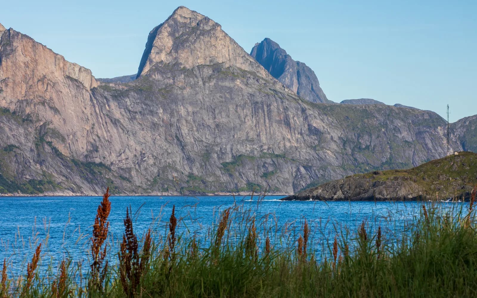
Don't miss: Segla seen across Mefjorden in evening light.
Motorhome tip: Motorhome dump station at the rest area. Camp Mefjord has eight pitches with electricity and waste disposal. The road out is narrow — take it slowly when meeting others.
6. Fjordgård and Segla — for strong legs
Segla (639 m above sea level) rises like a sail straight from Mefjorden. The trail starts in Fjordgård, and nearby Hesten (556 m above sea level) gives you the familiar photographed view towards Segla.
Motorhome tip: The road passes through two old, tight tunnels, including 2.3-km Fjordgårdtunnelen. The municipality's visitor strategy identifies the tunnel and parking as the hardest parts of a visit. Park in the paid area at the fishing harbour and keep to the trail.
7. Husøy — the village on the islet
The entire small island in Øyfjorden is one densely built village, and a 300-metre causeway connects it to Senja. Here you find a shop and chapel.
Motorhome tip: The side trip from Huselv is just under 12 km, with two tunnels from 1983. Park in the designated area and walk around.
8. Botnhamn — the ferry towards Tromsø
The tourist route ends at the ferry quay. From here the ferry to Brensholmen on Kvaløya runs all year, taking 35–45 minutes.
Motorhome tip: Toilet, shower and dump station at the marina. Cars have priority on the day's final departure, so preferably take an earlier ferry. Fjordbotn Camping is around 12 km away.
Practical info for motorhomes
Roads: According to Statens vegvesen's road database, the asphalt between Skaland and Mefjordbotn is mostly under five metres wide, so two motorhomes cannot pass everywhere. Use passing places and let those in a hurry pass. Roads are open to vehicles up to 19.5 metres, and there are no mountain crossings.
Tunnels: Around ten tunnels and avalanche galleries. The newest are spacious, but those from the 1970s — Steinfjord, Bratthesten, Svartholla and Breitind — are narrow. Signed height is 4.2–4.6 metres on the main route and 4.1–4.2 on side trips. Breitindtunnelen is lowest: signed at 4.2 metres, but the road database gives 3.8 metres calculated clearance. That is enough for an ordinary motorhome; if yours is over 3.5 metres, measure it before driving. Check vegvesen.no before driving.
Parking: Rest areas have few or no spaces for large vehicles. Parking in passing places is prohibited.
Overnight stays: Use campsites, particularly in July. On uncultivated land the Outdoor Recreation Act requires that you cause no damage or inconvenience, tents stand at least 150 metres from an inhabited house or cabin, and you stay no more than two nights at one place without consent from the owner or user. Do not drive into the terrain.
Campsites:
- Senja Fjordcamp, Torsken — near Gryllefjord
- Skaland Camping — midway along the route
- Camp Mefjord, Mefjordvær — by the sea
- Fjordbotn Camping, Stønesbotn — near Botnhamn
Fuel: Fill the tank before driving onto the outer coast: in Andenes before the ferry, in Tromsø if arriving from the north, or in Finnsnes. There are only a few small pumps along the tourist route.
Waste disposal: In Mefjordvær, Botnhamn and at campsites. See bobilplassen.no.
Ferries: Andenes–Gryllefjord usually runs from mid-May to late September, two–three times daily, taking around 1 hour and 40 minutes. Spaces cannot be booked, and during the main summer holiday period you often have to wait for the next departure. Botnhamn–Brensholmen runs all year, taking 35–45 minutes. Timetables at svipper.no.
Combine with
- Vesterålen and Andøya — the summer ferry from Gryllefjord goes to Andenes.
- Lofoten — continue south through Vesterålen.
- Nordkapp — take the ferry from Botnhamn towards Tromsø and continue north.
- Kvaløya and Sommarøy — Sommarøy lies around eight kilometres from Brensholmen ferry quay.
- Ånderdalen national park — coastal pine forest with trees up to 500 years old on the inner side.
Weather
Summer on the outer coast is cool and changeable. In summer 2026 the Botnhamn weather station recorded an average daytime temperature around 16 degrees, but rain and fog can roll in quickly from the sea. Strong winds can stop ferries. Northern lights may appear from late September. Check yr.no for Skaland, Senjahopen and Botnhamn.
This route is part of Bobilvei's hand-picked motorhome routes in Norway. Every route is quality-checked with a focus on motorhome suitability, parking and local experiences.