- Route
- Alta – Kløfta – Suolovuopmi – Masi (Máze) – Pikefossen – Kautokeino (Guovdageaidnu) – Gievdneguoika – Láhpoluoppal – Karasjok (Kárášjohka) (E45 and Rv 92)
- Length
- about 260 km from Alta to Karasjok. That includes 32 km back north on the E45 from Kautokeino to the junction where the Rv 92 turns off.
- Driving time
- Around 4 to 4.5 hours without stops
- Recommended number of days
- 2–3
- Best season
- June–September. The roads are open all year, but the toilets at the rest areas are closed from mid-October to May, and several of the sights have a summer season only.
- Difficulty
- Easy in summer. Good, quiet roads with no tunnels, ferries or toll stations. The challenge is the distances: 129 km without fuel between Kautokeino and Karasjok, and reindeer on the road.
- Last checked
- October 2026
Why this route?
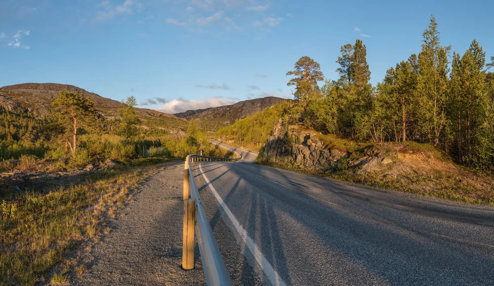
Most people driving through Finnmark stay by the coast. This route heads straight inland. Finnmarksvidda is Norway's largest mountain plateau, more than 22,000 square kilometres of dwarf birch, bog, rivers and lakes, mostly 300 to 500 metres above sea level. In winter it is the coldest part of the country. In summer it is light around the clock, and often a reindeer is the only thing that breaks the line of the horizon.
This is also the Sámi heartland. In Guovdageaidnu/Kautokeino and Kárášjohka/Karasjok most people are Sámi, and here you find the Sámi Parliament, the Sámi national theatre and much of what carries Sámi language and culture forward. You are driving through a part of Norway where Norwegian is not the only language on the signs. Take it as an invitation to learn a little, not as a backdrop.
The route starts in Alta, where the North Cape route also begins, and ends in Karasjok. From there the E6 leads north towards Lakselv and the North Cape, or east along the Tana river towards Varanger.
Stops along the route
1. Alta — fill up before the plateau
The rock carvings at Hjemmeluft are covered in the North Cape route, which starts here. If you have an hour to spare in the centre, walk past Alta church, known as the Northern Lights Cathedral. It was completed in 2013, designed by Link Arkitektur together with the Danish practice Schmidt Hammer Lassen. The facade is titanium, and the whole building is shaped as a spiral that ends in the tower.
Don't miss: A walk around the church. The titanium facade mirrors the light, so it looks different in evening sun and in grey weather.
Motorhome tip: Fill up with fuel, water and food in Alta, and empty the toilet. From here it is 132 km to Kautokeino, and the only filling point we have found on the way, a pump at the village shop in Masi, we have not been able to confirm. The E45 leaves the E6 at the Gakori junction, on the west side of Alta. Solvang Camping, described in the North Cape route, is open all year and has a waste disposal point. It lies east of the centre, the opposite way from the E45.
2. Kløfta and Suolovuopmi — up onto the plateau
For the first stretch the E45 follows the valley south from the fjord, through pine woods and past quiet stretches of river. After the rest area at Garajokka, around 20 km from Alta, the valley narrows. At Kløfta the road runs beneath steep rock walls, and slides happen here. Snow and slush avalanches closed the road several times in spring 2023, and in August that year it was shut for a night after a rockfall. Statens vegvesen, the Norwegian road authority, is to build a 4.2 km tunnel past the slide-prone stretch, and the first contract was awarded in January 2026. After Kløfta the road climbs steadily, and gradually the trees grow lower and fewer. Around 50 km from Alta you reach Suolovuopmi fjellstue, a mountain lodge. Travellers have found shelter here since the 1840s, first as a resting place on the postal route across the plateau. The old route still crosses the E45 by the lodge. The house you see is not the original: German soldiers destroyed the lodge in 1944, and the new one was finished in 1948. Today it is privately run.
Don't miss: A coffee at the lodge. You can drop in during the day or stay the night, and according to DNT's ut.no it is open all year. It has no website of its own, so check ut.no before you count on that coffee.
Motorhome tip: If you want to stop in the valley, do it at the Garajokka rest area and not beneath the rock walls at Kløfta. The roadworks at Kløfta may cause waits over the next few years, so check vegvesen.no before you set off. If the E45 is closed here, you can drive the route in reverse: the E6 via Lakselv to Karasjok, around 250 km. In winter there may then be convoy driving over Sennalandet on the E6. The old postal route is a gravel road: stay on the E45 in a motorhome.
3. Masi and Pikefossen — the village that was saved
Máze/Masi lies half a kilometre from the E45, by the Kautokeino river, roughly halfway to Kautokeino. It is a small North Sámi village with a long history as a church site. In 1968 the first plans to dam the Alta–Kautokeino watercourse appeared, and in them Masi was to be flooded. The village escaped: in 1973 it was left out of the plans and protected. The dispute over the watercourse went on until 1982, with demonstrations and hunger strikes, and became known as the Alta case. The dam was built further downstream, at Šávču/Sautso, but the case had lasting effects on Norway's Sámi policy.
Don't miss: Pikefossen, around 17 km south of Masi, where the Kautokeino river drops over a wide rock sill right by the road.
Motorhome tip: The rest area at Pikefossen is built for large vehicles, and so is the 6-mila rest area just north of Masi. Both have composting toilets that are closed from mid-October to 1 May. You cannot empty a motorhome toilet there.
4. Kautokeino — the church, the open-air museum and Easter
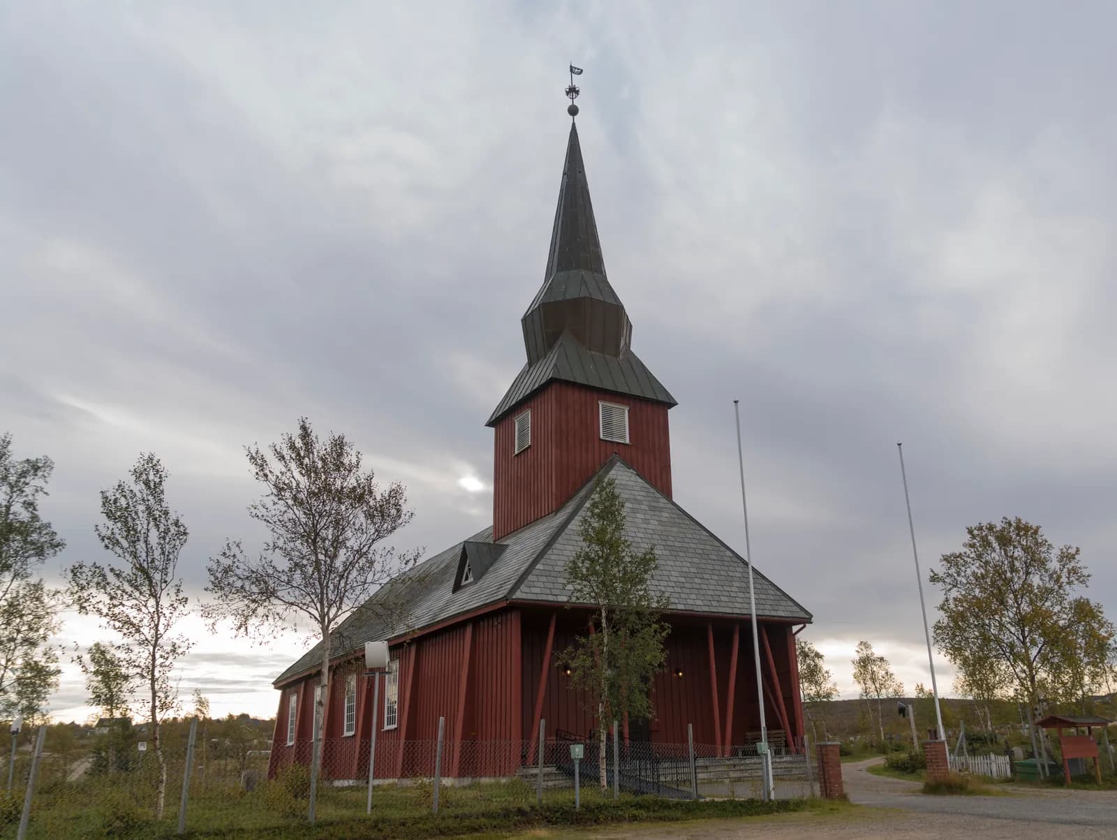
Guovdageaidnu/Kautokeino is Norway's largest municipality by area, and most people who live here are Sámi. Reindeer herding is still one of the most important livelihoods. The church you see today is a red-painted wooden church from 1958. The previous one, from 1701, was burned by the Germans in 1944. The village also has Kautokeino bygdetun, an open-air museum with a reindeer herders' farmstead, a smallholding and outfield buildings, run by RiddoDuottarMuseat.
Don't miss: The open-air museum. In autumn, winter and spring it opens Tuesday to Friday, and the summer hours are not on rdm.no, so phone or check before you come. If you come at Easter, the Sámi Easter festival, Sámi beassášmárkanat, held since 1971, has the world championship in reindeer racing, joik and the Sámi Grand Prix.
Motorhome tip: Arctic Motell & Kautokeino Camping has been running since 1968 and has motorhome pitches with and without electricity, a service building with showers and a shared kitchen. In summer they offer coffee by the fire in the lavvu. Fill the tank in Kautokeino, where Esso, Circle K and an unstaffed St1 pump are along the E45. It is 129 km to Karasjok without a single station. We have not found a public waste disposal point here that we can confirm. Ask at the campsite.
5. Juhls' and Beaivváš — silver and theatre
On a rise just outside the centre stands Juhls' Silver Gallery, Juhls' silversmithy. The house was extended in stages over several decades, and the architecture alone is a reason to go in. In the workshop under the same roof they still make the jewellery. It all began with a couple who settled in Kautokeino in the 1950s, Frank and Regine Juhls. They built up the silversmithy from nothing, and in 1959 it became the first in Finnmark. Since 2008 their daughter Sunniva has run it.
Kautokeino also has Čoarvemátta, a new building designed by Snøhetta and opened in 2024. This is where Beaivváš Sámi Našunálateáhter, the Sámi National Theatre, performs, sharing the house with the Sámi upper secondary school. The theatre grew out of the protest years around the Alta case, with its first production in 1981, and has been one of Norway's national stages since 1993. The stage language is Sámi, but you do not need to speak it: most productions have surtitles in Norwegian and English.
Don't miss: The guided tour at Juhls'. Both entry and the tour are free, and the gallery is open all year except from Christmas Eve to 3 January, 1 May and 17 May.
Motorhome tip: Juhls' is signposted from the Esso station. Beaivváš is a touring theatre and is often on the road, so check the programme at beaivvas.no before you plan around a performance.
6. Rv 92 — straight across the plateau
From Kautokeino you drive 32 km back north on the E45 to Gievdneguoika, where the Rv 92 turns off to the east. From there it is 97 km to Karasjok, with hardly any settlement. You pass the village of Láhpoluoppal, and later Jergul, where the Iešjohka flows past, one of the rivers that become the Tana watercourse. Over the last stretch the road descends from around 350 to 135 metres above sea level, through pine forest, towards Karasjok.
Don't miss: A break by one of the lakes on the plateau, far from every sound. The bogs of the plateau are known for cloudberries.
Motorhome tip: Choose the Lahppujavri or Liidnebeachanguolbba rest areas. They are built for lorries. The rest area at Gievdneguoika is small, designed for cars and closed all winter. Ássebákti, near Karasjok, is also designed for cars, but it has five spaces for large vehicles, and you can only enter it from one direction. The composting toilets along the Rv 92 are closed from mid-October to mid-May. Slow down when you see reindeer, and stop completely if a herd crosses the road.
7. Karasjok — the Sámi Parliament and Sápmi Park
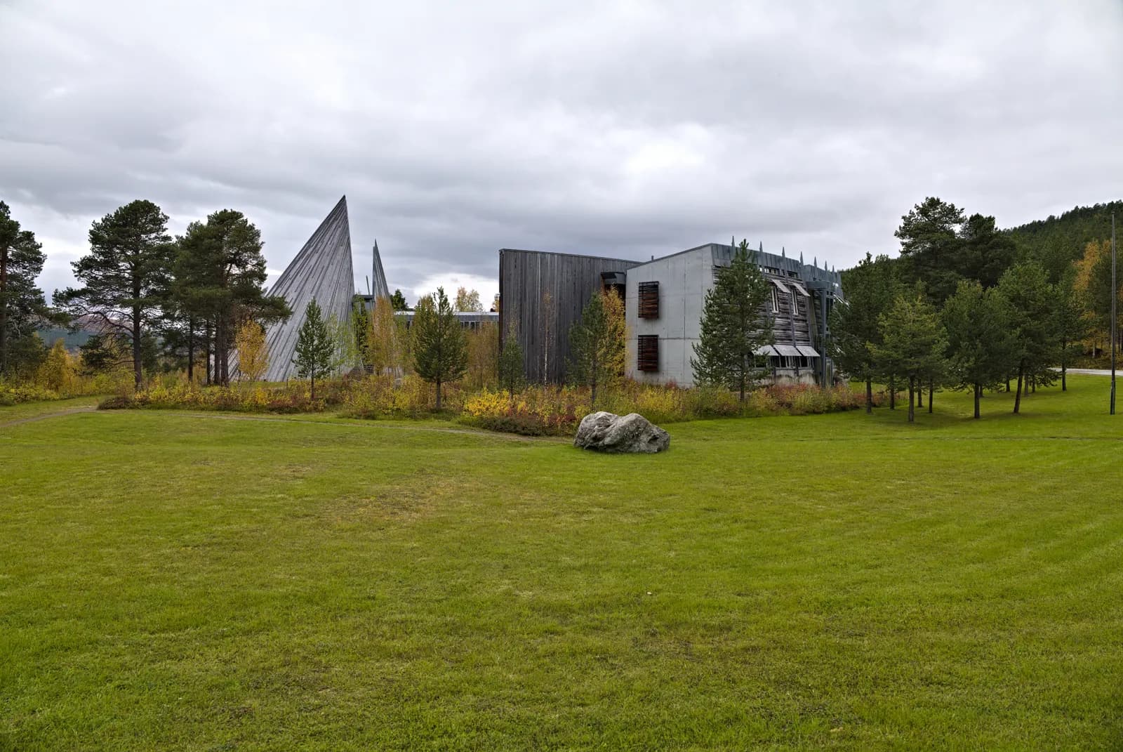
In Kárášjohka/Karasjok around 80 per cent of the inhabitants are Sámi, and many of the Sámi institutions are based here. The Sámi Parliament, Sámediggi, meets in a building by Stein Halvorsen and Christian Sundby, opened in 2000. The timber on the facade has turned grey, and above the assembly hall rises a tall, slanting cone that makes many people think of a lavvu. The cone is easy to see from the centre. Close to the E6 is Sápmi Park, a visitor centre about Sámi culture run by the Scandic hotel. In summer the park offers reindeer, joik, lasso throwing, a "magic theatre" and the Storgammen restaurant in turf huts. The whole park is open in summer, usually from early June to late August. The rest of the year only the shop is open. Check the dates for the year you travel.
Don't miss: The guided tour of the Sámi Parliament. It is free and needs no booking, and it usually runs on Tuesdays, Wednesdays and Thursdays at 1 pm. In high summer, from late June to mid-August, tours run at other times. Check sametinget.no for the year you travel. There are no tours in weeks with committee or plenary meetings, and the building is closed at weekends.
Motorhome tip: Min Ája (formerly Karasjok Camping) is next to the Sámi Parliament, with a view over the river, and has cabins and pitches for caravans and motorhomes. Just west of the centre there is a free waste disposal point by the Rv 92. According to users, the water tap was out of order in May 2026 and repaired in June. Carry enough water anyway. You can get fuel at Circle K and YX in the centre.
8. Karasjok old church — the one that was left standing
Down on the river plain stands Karasjok old church, completed in 1807 and built in the shape of a cross from local timber. When the Germans withdrew in the autumn of 1944, they burned Karasjok. The blast from the bridge they blew up smashed most of the windows, but the church itself was still standing when the village around it had burned. In 1945 it served for a short time both as a field hospital and as a place for the villagers to stay. Look for the reindeer carved above the door to the chancel. The altarpiece arrived in 1831 and shows Christ with the crown of thorns, painted after a picture by Van Dyck.
Don't miss: The churchyard around the church. If you want to see inside, ask Karasjok parish. Note too that the Sámi Collections, Sámiid Vuorká-Dávvirat, have closed the exhibitions in their main building for good. In 1972 the museum was the first Sámi institution of its kind in Norway. It is now waiting for a new building, and the collection is moving into temporary storage. Whether the open-air museum next door is open is shown on rdm.no.
Motorhome tip: To reach the church and the YX station you cross the bridge over the Kárášjohka on the Rv 92. It has braces above the carriageway, but the road authority's database gives 4.8 metres of clearance, a good margin for a motorhome. From Karasjok it is 75 km on the E6 to Lakselv and around 180 km along the Tana river to Tana bru.
Practical info for motorhomes
Roads: The E45 from Alta to Kautokeino (the Rv 93 until 2018) and the Rv 92 from Gievdneguoika to Karasjok are both open to vehicles up to 19.5 metres long (the road authority's database). The E45 is mostly 6 to 7 metres wide and hardly anywhere under 5.5. The Rv 92 is narrower, mostly 5.5 to 6.5 metres, but nowhere under 5 metres. There are no tunnels and no signed height limits on the route. The lowest calculated clearance is 4.8 metres, under the braces of the bridge over the Kárášjohka in Karasjok. The only long climb is up the valley from Alta: from under 100 metres at Garajokka to almost 300 metres ten kilometres further south, past Kløfta. The highest point is around 400 metres, north of Masi. Kløfta is prone to slides, and slides have closed the E45 there for hours, in summer too. A tunnel is to be built there over the coming years. Both roads are open all year and are not on the road authority's list of fixed convoy stretches in Finnmark, but in bad weather there may be convoy driving or closures at short notice. Check vegvesen.no/trafikk or call 175. No toll stations on the route.
Parking: Use the rest areas. Garajokka, 6-mila, Pikefossen, Lahppujavri and Liidnebeachanguolbba are built for lorries. Gievdneguoika and Ássebákti are designed for cars, but Ássebákti has five spaces for large vehicles.
Overnight stays: The right to roam lets you camp in a tent at least 150 metres from an inhabited house and for at most two nights in the same place without the landowner's consent. With a motorhome you park only where parking is allowed, and you never drive off the road into the terrain. The plateau is winter pasture for domesticated reindeer, and in spring and autumn the herds are moved between the plateau and the coast. Keep your distance from the reindeer and keep your dog on a lead. Where signs forbid camping or overnight stays, they apply.
Campsites:
- Solvang Camping og Leirsted, Alta — open all year, with a waste disposal point (see North Cape)
- Arctic Motell & Kautokeino Camping, Kautokeino — motorhome pitches with and without electricity
- Min Ája (formerly Karasjok Camping), Karasjok — right by the Sámi Parliament
Between Alta and Kautokeino and between Kautokeino and Karasjok we have not found campsites with their own website that we could check.
Fuel: Fill up in Alta. Between Alta and Kautokeino we have only found a pump at the village shop in Masi, and we have not been able to confirm it. Kautokeino has Esso, Circle K and an unstaffed St1 pump. Fill up again there: between Kautokeino and Karasjok there are 129 km without a station. Karasjok has Circle K and YX.
Waste disposal: Empty in Alta before you set off. In Kautokeino we have not found a public waste disposal point we can confirm, so ask at the campsite. In Karasjok there is a free waste disposal point by the Rv 92, just west of the centre. The toilets at the rest areas are composting toilets: never empty a motorhome toilet there.
Ferries: No ferries.
Reindeer and mosquitoes: In spring and autumn the reindeer herds are moved between the plateau and the coast, and then you may meet them on and beside the road. In summer, too, Statens vegvesen has said it receives reports almost every day of reindeer and sheep on the roads of Northern Norway. Slow down where it is signed, and stop if a herd is standing in the road. If you hit an animal, you must help it as best you can and notify the owner or the police if you cannot help enough. In July and early August the mosquitoes on the plateau can be a nuisance. Bring repellent and mosquito nets for the windows.
Combine with
- North Cape — also starts in Alta. From Karasjok it is 75 km on the E6 to Lakselv and then around 65 km along the Porsangerfjord to Olderfjord, where the North Cape route turns off towards Magerøya.
- Varanger — from Karasjok the E6 runs east along the Tana river, around 195 km to Varangerbotn, where the Varanger route begins.
- Finland — from Kautokeino the E45 continues south to the border at Kivilompolo, and from Karasjok the Rv 92 runs to the border at Karigasniemi.
Weather
Finnmarksvidda has an inland climate, and in winter it is the coldest area in the country. At Suolovuopmi July is the warmest month with a normal of around 12 degrees, and February the coldest at around minus 13. Most rain falls in August. The lowest temperature ever measured in Norway, minus 51.4 degrees, was recorded in Karasjok on 1 January 1886. The midnight sun stands over the plateau from around 20 May to around 23 July. Check yr.no for Kautokeino, Suolovuopmi and Karasjok.
This route is part of Bobilvei's hand-picked motorhome routes in Norway. Every route is quality-checked with a focus on motorhome suitability, parking and local experiences.